Home / Nevada / Cowboy Country / Metropolis
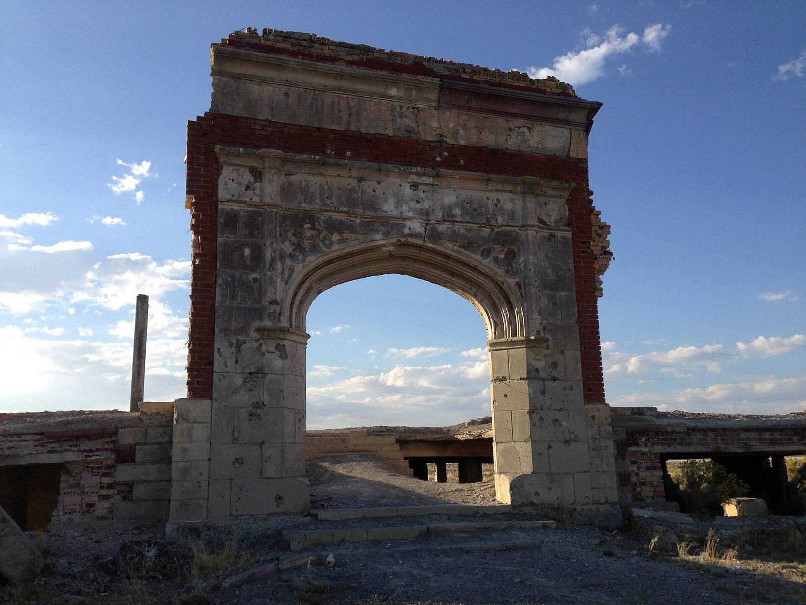
The brick and concrete arch of the ruined Lincoln School at Metropolis against a blue skyFamartin / CC BY-SA 4.0 via Wikimedia Commons
🏛️Historical

Metropolis

Part ofCowboy Country
On this driveU.S. 93: The Jackpot Crossing

A planned farm city with a brick hotel and street lights, undone by a lawsuit from farmers at the far end of the same river.

Off the Beaten PathPhotographyGhost TownsNo Cell ServiceFree
⏱
Duration
Half an hour at the ruins, plus the drive from Wells.
📅
Best Season
Late spring through fall, when the county road is dry.

The Story

Metropolis was named for what it was meant to become. In 1910 Harry Pierce's Pacific Reclamation Company, a New York land firm, bought some 40,000 acres of sagebrush near the head of the Humboldt and laid out a city on it: graded streets, cement sidewalks, fire hydrants and street lights, a four-block business district, and a Southern Pacific spur from Wells that opened in 1911. In December of that year a three-story brick hotel opened with private baths, electric light and an elevator. A dam on Bishop Creek, north of town, was to water the farms.

What the company had not done was secure the water. In a state where every drop of a river is claimed by someone downstream, it had built its dam without approval and without sufficient rights, and in 1913 farmers at Lovelock, near the far end of the Humboldt, took it to court. The ruling left Metropolis enough water for about 4,000 of its 40,000 acres. Drought, crickets and jackrabbits took much of the rest. The hotel had already closed in 1913; the company went bankrupt in 1920, the railroad pulled its track in the mid-1920s, and the hotel burned in 1936. The post office lasted until 1942, and the school held classes into the 1940s.

What stands now is the front arch of the brick Lincoln School, the hotel's foundations a quarter mile away, and the cemetery, with ranch land all around. The dam is still up the creek.

Metropolis is about twelve miles northwest of Wells by county road. There are no services, and the ruins are fragile; look and leave them standing.

Visitor Info

⏱
Time Needed
Half an hour at the ruins, plus the drive from Wells.
📅
Best Season
Late spring through fall, when the county road is dry.
🛣️
Highway
I-80

On the Map

Nearby

The closest stops worth working into your route

natural43 mi away
Lamoille Canyon & the Ruby Mountains
The great exception to Nevada's sagebrush monotony — a glacier-carved canyon and a wall of eleven-thousand-foot granite peaks an hour southeast of Elko, fairly called the state's Alps.
cultural46 mi away
Elko
The railroad built it, cattle made it, and gold keeps it — the working capital of northeast Nevada, a frontier cow town that never got around to becoming a relic.
historical49 mi away
Jarbidge
The end of the road, twice over — Nevada's most isolated town, deep in a canyon on the Idaho line, where the West's last gold rush and its last stagecoach robbery both played out.
cultural56 mi away
Jackpot
A casino town made by an Idaho law, a mile inside the Nevada line, that still keeps Idaho's clock.
historical56 mi away
California Trail Interpretive Center
A free, surprisingly ambitious BLM museum of the overland crossing — eight miles west of Elko, on the trail itself, where the California Trail met the Hastings Cutoff that doomed the Donner Party.
cultural58 mi away
Ruby Valley & Newe Sogobia
The valley where the Western Shoshone signed an 1863 treaty that ceded no land — and the heart of Newe Sogobia, a homeland the Newe say was never for sale.

Historical markers nearby

Roadside plaques and monuments within a short detour

Marker8.6 mi away
Humboldt Wells
Marker28 mi away
Fort Halleck Site 1867- 1886