Home / Colorado / The Central Rockies / Maroon Bells
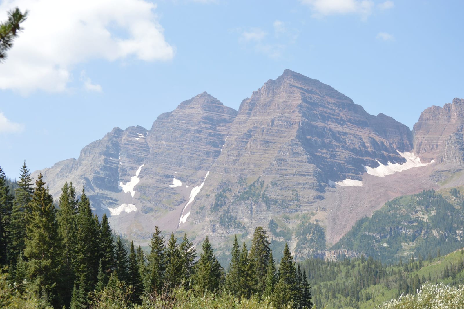
The banded red peaks of the Maroon Bells above spruce forest, seen from near Crater LakeWhyleesaa / CC BY-SA 4.0 via Wikimedia Commons
🌲Natural

Maroon Bells

Part ofThe Central Rockies
On this driveCO-82: Twin Lakes over Independence Pass to Glenwood Springs

Two fourteeners of crumbling red mudstone, called the Deadly Bells since eight people died on them in 1965, and reachable in summer only by reservation.

IconicPhotographySummerPaid EntryFallHiking
⏱
Duration
Half a day.
🎟
Admission
Reservation fee for the shuttle or parking.
📅
Best Season
Summer and fall; fall color in late September.

The Story

The Maroon Bells, Maroon Peak at about 14,160 feet and North Maroon Peak at 14,014, stand a third of a mile apart at the head of Maroon Creek, ten miles southwest of Aspen, with Maroon Lake in a glacier-cut basin at their feet. Their color is their rock: Maroon Formation mudstone, sediment shed off an ancient range and stained red by iron, harder than it looks from the lake and far weaker than the granite of most Colorado peaks.

That weakness gave them their other name. In 1965 eight climbers died on the Bells in five separate accidents, and a Forest Service sign at the trailhead still calls them the Deadly Bells and warns that the rock is loose, rotten and kills without warning. Fatal falls have continued; the standard routes are exposed scrambles where a handhold can come away.

The view from the lake is among the most photographed in the country, and the crowds that came for it shaped how anyone gets there. In 1977, to cut the traffic and fumes on the ten-mile road up Maroon Creek, a mandatory summer shuttle bus began running from Aspen; it still leaves from Aspen Highlands. Since 2020 both the shuttle and the few private-car parking slots at the lake have required reservations through the summer and fall, and in fall color season they sell out early. A flat mile-long loop circles Maroon Lake, and a trail of under two miles climbs to Crater Lake, directly beneath the peaks.

Visitor Info

⏱
Time Needed
Half a day.
🎟
Admission
Reservation fee for the shuttle or parking.
📅
Best Season
Summer and fall; fall color in late September.
🛣️
Highway
CO-82

On the Map

Nearby

The closest stops worth working into your route

historical20 mi away
Independence Pass
Crossed by prospectors on the Fourth of July 1879, opened as a toll road for the Aspen rush in 1881, and shut by snow half of every year since.
natural36 mi away
Glenwood Canyon
Interstate 70 threaded through on viaducts in 1992, buried by debris flows off a burn scar in 2021, with Hanging Lake on a permit above it.
historical51 mi away
South Park City Museum
A mining town assembled in the 1950s from buildings hauled out of South Park's dying camps, by a Colorado Springs lawyer who wanted no imitation town.
natural55 mi away
Black Canyon of the Gunnison National Park
Two men on a rubber air mattress floated through in 1901 to prove a tunnel could be built, past a cliff that drops some 2,250 feet to the river.
geological56 mi away
Grand Mesa
An old valley floor turned into a mountaintop by lava, holding more than three hundred lakes, with a road up its western cliffs built by veterans of the CCC.
cultural68 mi away
Ute Indian Museum
On the farm of Ouray and Chipeta: a spring the DAR roofed with a concrete tipi in 1924, Chipeta's grave of 1925, and a museum rebuilt with the three Ute tribes in 2017.