Home / Colorado / The San Juans & the Black Canyon / Black Canyon of the Gunnison National Park
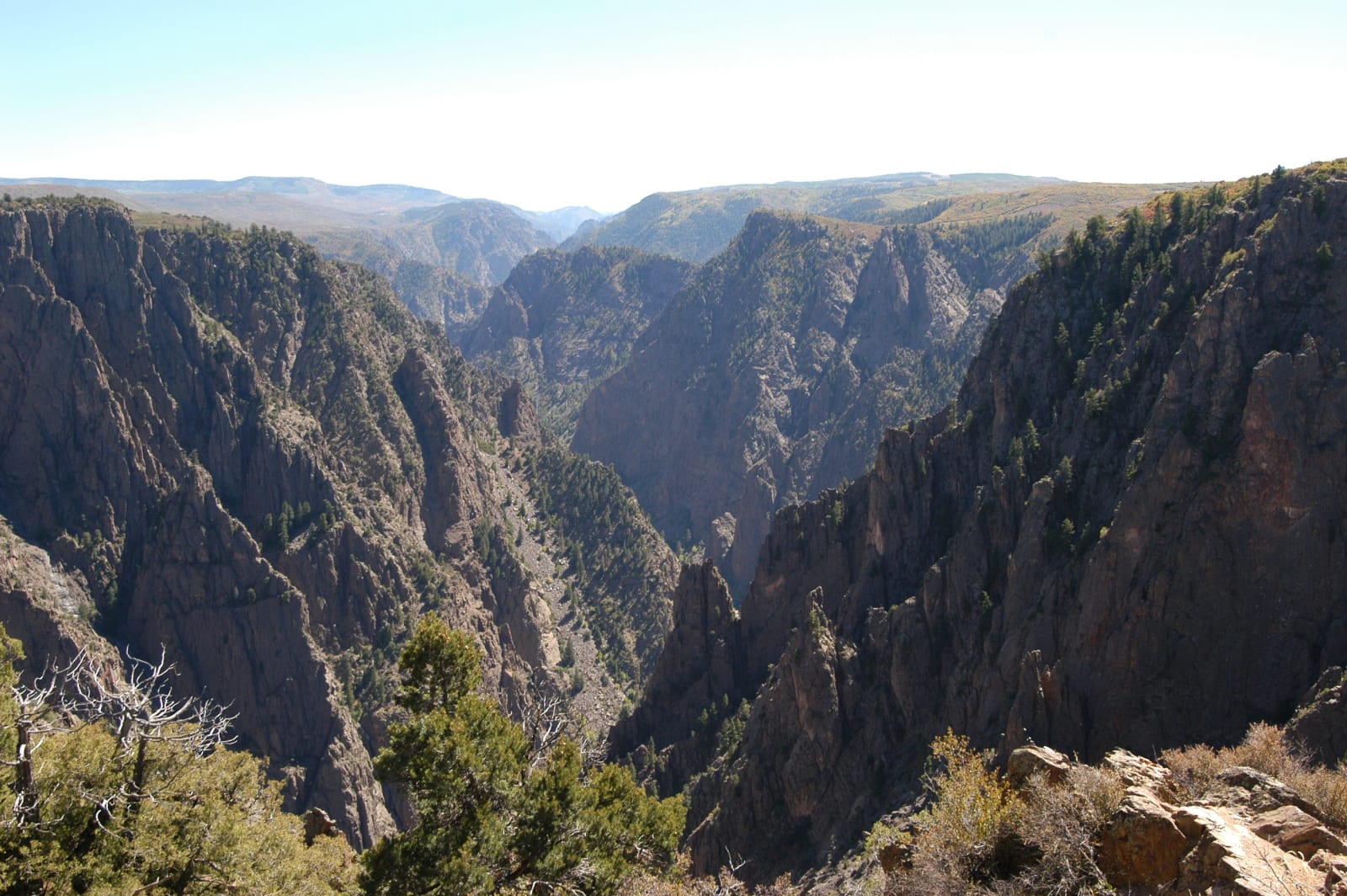
The dark walls of the Black Canyon of the Gunnison from Tomichi PointG. Edward Johnson / CC BY-SA 3.0 via Wikimedia Commons
🌲Natural

Black Canyon of the Gunnison National Park

Part ofThe San Juans & the Black Canyon

Two men on a rubber air mattress floated through in 1901 to prove a tunnel could be built, past a cliff that drops some 2,250 feet to the river.

IconicPhotographyDark SkySummerPaid EntryHiking
⏱
Duration
Half a day.
🎟
Admission
Entrance fee.
📅
Best Season
Late spring through fall; the South Rim Road is partly closed in winter.

The Story

An expedition tried in 1900 to work down the gorge in wooden boats to see whether the Gunnison could be tapped for the farms of the Uncompahgre Valley, and abandoned the attempt deep in the canyon. The next summer William Torrence, who had been on that trip, went back with Abraham Lincoln Fellows of the U.S. Geological Survey. They gave up boats and took a rubber air mattress for floating and rubber bags for their instruments, and on August 12, 1901, they started down from Cimarron.

The trip took about nine days. At the Narrows, where the floor squeezes to some forty feet across beneath walls 1,700 feet high, fallen boulders had jammed between the cliffs into bridges and tunnels, and the two men scrambled, swam and hauled each other up a quarter of a mile in a day. They came out below the Painted Wall convinced that a tunnel was possible. Fellows' surveyors worked the canyon for two more years, construction began in 1905, and the Gunnison Tunnel was holed through on July 6, 1909.

The Painted Wall, the tallest cliff in Colorado, rises about 2,250 feet from the river, its dark gneiss and schist striped with pale bands of pegmatite where molten rock once forced its way into cracks. The canyon became a national monument in March 1933. The South Rim Road runs about seven miles from the visitor center past Chasm View and the Painted Wall overlooks; the North Rim is reached by a separate gravel road, and the descents to the river are unmaintained routes for experienced hikers with a permit.

Visitor Info

⏱
Time Needed
Half a day.
🎟
Admission
Entrance fee.
📅
Best Season
Late spring through fall; the South Rim Road is partly closed in winter.
🛣️
Highway
US-50

On the Map

Nearby

The closest stops worth working into your route

cultural13 mi away
Ute Indian Museum
On the farm of Ouray and Chipeta: a spring the DAR roofed with a concrete tipi in 1924, Chipeta's grave of 1925, and a museum rebuilt with the three Ute tribes in 2017.
geological35 mi away
Grand Mesa
An old valley floor turned into a mountaintop by lava, holding more than three hundred lakes, with a road up its western cliffs built by veterans of the CCC.
historical46 mi away
Animas Forks
A silver camp at 11,200 feet where the Animas River's three forks meet, with the 1879 Duncan house and its bay window still standing on the Alpine Loop.
historical46 mi away
Red Mountain Mining District
Three iron-red peaks above Red Mountain Pass, the 1882 Yankee Girl and its headframe, and a boom town that went up in five weeks in 1883.
natural55 mi away
Maroon Bells
Two fourteeners of crumbling red mudstone, called the Deadly Bells since eight people died on them in 1965, and reachable in summer only by reservation.
historical65 mi away
Colorado National Monument
A homemade road of fifty-four switchbacks, then the CCC's Rim Rock Drive, nineteen years in the building and finished in 1950.