Home / Oregon / The Oregon High Desert / Malheur National Wildlife Refuge
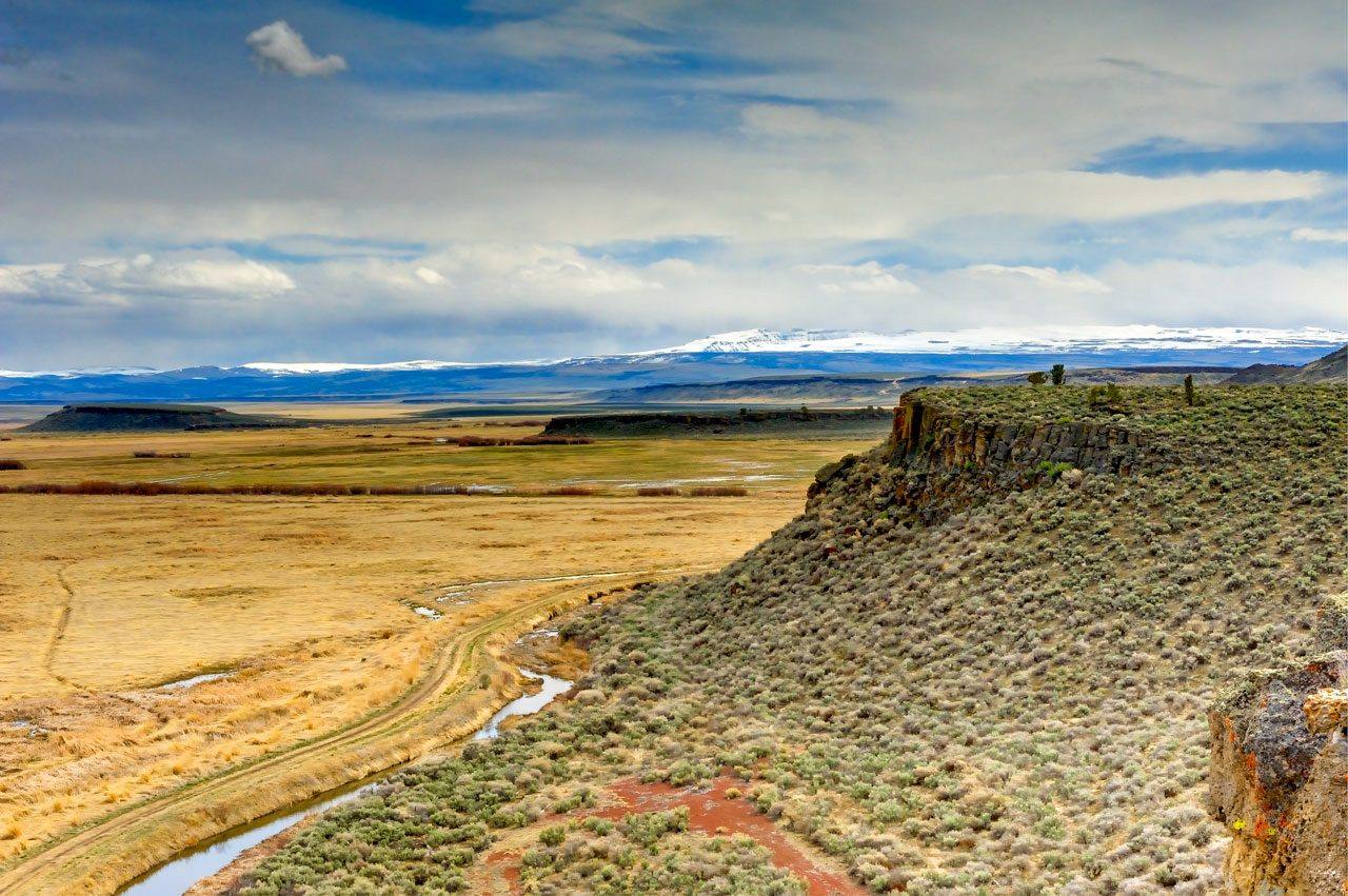
The Blitzen valley wetlands of Malheur National Wildlife Refuge from the Buena Vista overlook, Steens Mountain snowcapped beyondJeff Sorn, Oregon Department of Transportation / CC BY 2.0 via Wikimedia Commons
🌲Natural

Malheur National Wildlife Refuge

Part ofThe Oregon High Desert

A lake-and-marsh refuge set aside for its birds in 1908 that had to buy a river's water to keep them, and now fights the carp that have eaten away its marshes.

Off the Beaten PathPhotographySpringFall
⏱
Duration
Half a day for the headquarters and a drive through the refuge.
📅
Best Season
April and May for the spring migration; fall for cranes and waterfowl.

The Story

In 1908 the wildlife photographers William Finley and Herman Bohlman, working with the Audubon Society of Portland, persuaded Theodore Roosevelt to set aside Malheur, Mud and Harney lakes as a preserve and breeding ground for native birds; their photographs of the lake's grebes, ibis, pelicans and gulls from that year survive. The reservation protected the birds but not their water. The Donner und Blitzen River that fed Malheur Lake ran through private ranchland upstream, and as the lake dwindled, Finley and Portland Audubon understood that the refuge needed the river's water rights. In 1935 the government bought the old P Ranch and the Blitzen valley with them and folded the land into the refuge.

The newest threat is under the water. Common carp, not native here, root up the lake bottom, cloud the water and destroy the plants and insects the birds depend on; refuge research has found that they have cut migratory bird productivity on Malheur Lake by more than ninety percent. Beginning in the 1990s the Burns Paiute Tribe, whose ancestors' homeland this is, ranchers, environmental groups, county officials and federal agencies began working together on how the refuge is managed, and the fight against the carp is a central part of that work.

Spring is the season to come. Millions of birds stop here on migration, sandhill cranes and white-faced ibis, swans, ducks and shorebirds among them, and the Harney County Migratory Bird Festival brings birders to the basin each April. The refuge headquarters is on Sod House Lane south of Malheur Lake, near the old Sod House Ranch where this pin sits.

Visitor Info

⏱
Time Needed
Half a day for the headquarters and a drive through the refuge.
📅
Best Season
April and May for the spring migration; fall for cranes and waterfowl.
🛣️
Highway
OR-205

On the Map

Nearby

The closest stops worth working into your route

historical14 mi away
Pete French Round Barn
A round barn from the 1880s, built for breaking and training stock, the best-known relic of a cattle empire that ended when its owner was shot dead by a homesteader.
geological41 mi away
Steens Mountain
A single tilted block of the earth's crust thirty miles long that rises gently from the west and drops a mile on the east, its top carved by glaciers into gorges two thousand feet deep.
natural54 mi away
Alvord Desert
A twelve-mile playa in the rain shadow of Steens Mountain where, in December 1976, a deaf stuntwoman drove a rocket car to a women's land speed record she was not allowed to push past.
historical80 mi away
Kam Wah Chung
A stone store in John Day where a Chinese herbalist practiced for sixty years and died leaving $23,000 in patients' checks he had never cashed.
historical109 mi away
Silver City
An Owyhee silver camp that faded but never quite emptied, still lit by twelve-volt bulbs.
geological111 mi away
Fort Rock
A ring of volcanic rock standing alone on a dry lakebed, born when rising magma hit water and later carved by the waves of a lake that surrounded it as an island.

Historical markers nearby

Roadside plaques and monuments within a short detour

Marker5.5 mi away
American Indian Seasonal Round
Marker25 mi away
The Terrible Trail
Marker29 mi away
Homeland of the Burns Paiute
Marker29 mi away
Great Basin