Home / Missouri / The Missouri River: Rhineland to Boonslick / Katy Trail State Park
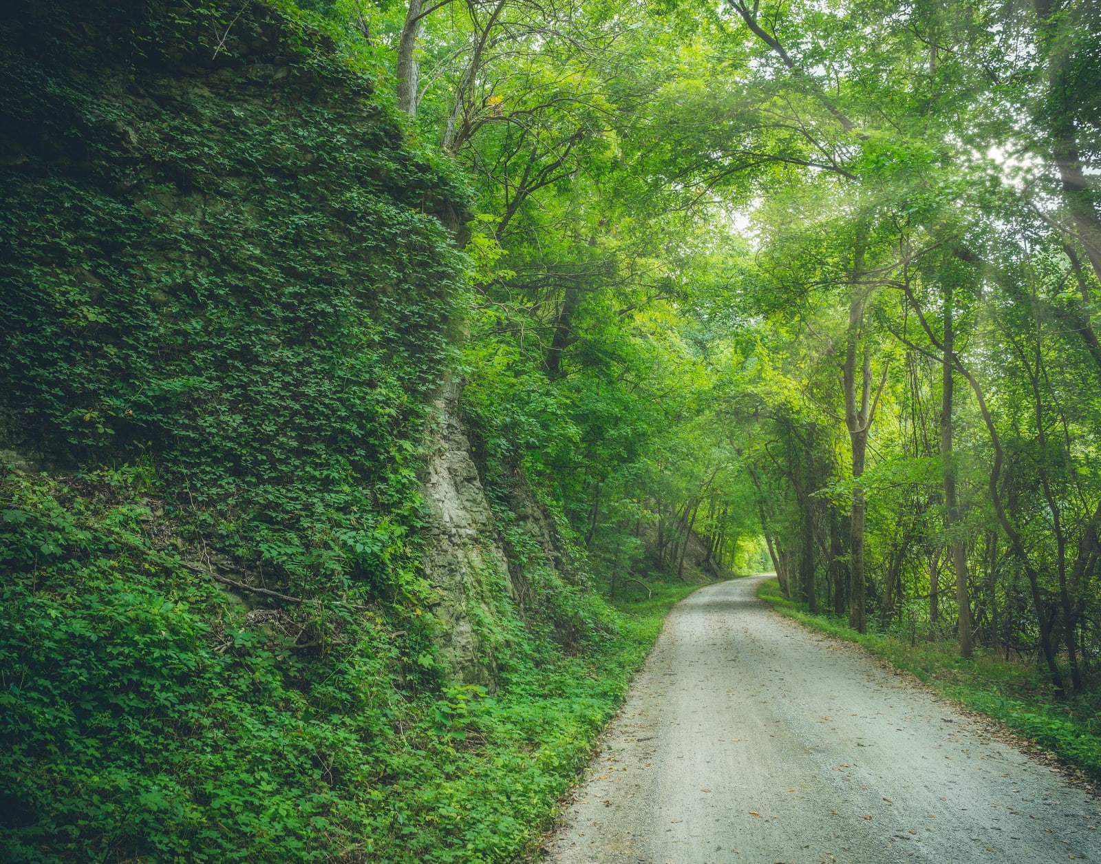
The gravel Katy Trail running under a green tree canopy beside an ivy-covered bluff.Heath Cajandig / CC BY 2.0 via Wikimedia Commons
🏕️Recreational

Katy Trail State Park

Part ofThe Missouri River: Rhineland to Boonslick
On this driveMO-94 and the Katy Trail: St. Charles to Arrow Rock

Two hundred forty miles of the old Missouri-Kansas-Texas rail bed between Machens and Clinton, mostly along the Missouri River, first opened in 1990 at Rocheport, where it runs through the railroad's stone tunnel.

⏱
Duration
An hour for a walk from Rocheport through the tunnel; days for the full 240 miles.
🎟
Admission
Free.
📅
Best Season
Spring for dogwood and redbud, fall for color; open sunrise to sunset year round. Water and flush restrooms at the trailheads are shut off from November 1 through March 31, and parts of the trail flood when the river is high.

The Story

The Missouri-Kansas-Texas Railroad, the Katy, ran trains up the Missouri valley until 1986, when it gave up the line from Machens in St. Charles County to Sedalia. An amendment to the National Trails System Act let corridors no longer needed for trains be banked for future rail use and opened as trails in the meantime, and Missouri State Parks took the right-of-way that way. Edward D. "Ted" Jones Jr., of the Edward Jones brokerage, had ridden a rail-trail in Wisconsin and lobbied the legislature for this one, and he and his wife Pat gave $2.2 million to buy the corridor.

Construction began in 1987, and the first section opened at Rocheport on April 28, 1990, six months before Ted Jones died. In 1991 the Union Pacific donated 33 miles from Sedalia to east of Clinton, and purchases and gifts filled in the rest. The finished trail is 240 miles long, with 26 trailheads and four restored depots. From Cooper County to St. Charles it is an official segment of the Lewis and Clark National Historic Trail.

Rocheport is a good place to start. The trail passes through the railroad's stone tunnel there, and for long stretches it runs with the river on one side and bluffs on the other. Telegraph poles, truss bridges and old depot towns line the way, and dogwood and redbud bloom in spring. Since 2010 the Katy Land Trust has worked with landowners to protect farms and woods along the corridor.

Visitor Info

⏱
Time Needed
An hour for a walk from Rocheport through the tunnel; days for the full 240 miles.
🎟
Admission
Free.
📅
Best Season
Spring for dogwood and redbud, fall for color; open sunrise to sunset year round. Water and flush restrooms at the trailheads are shut off from November 1 through March 31, and parts of the trail flood when the river is high.
🛣️
Highway
I-70

On the Map

Nearby

The closest stops worth working into your route

geological15 mi away
Rock Bridge Memorial State Park
Karst on the edge of Columbia: a boardwalk through a natural rock tunnel to the Devil's Icebox sinkholes, over a cave that is the only known home of the pink planarian.
historical18 mi away
Boone's Lick State Historic Site
The salt spring in the Howard County woods that Daniel Boone's sons worked from 1805, whose name spread to a road, a country and the first American settlement of central Missouri.
historical22 mi away
Arrow Rock State Historic Site
A Boonslick river town of more than 1,000 that the river and railroads left behind, built and worked by enslaved people, now a village of fifty and a National Historic Landmark.
cultural34 mi away
America's National Churchill Museum
The Westminster College campus where Churchill gave the Iron Curtain speech in 1946, with a bombed Wren church from London rebuilt stone by stone above his museum.
architectural35 mi away
Missouri State Capitol
The 1917 capitol on the Jefferson City bluff, built after lightning burned its predecessor, with the State Museum downstairs and Thomas Hart Benton's mural of Missouri in the House Lounge.
historical35 mi away
Lincoln University and the Soldiers' Memorial
The school that Black soldiers of the 62nd and 65th U.S. Colored Infantry paid for out of army wages in 1866, now a land-grant university on its Jefferson City hill.

Historical markers nearby

Roadside plaques and monuments within a short detour

Marker8.6 mi away
Boonville
Marker11 mi away
Boonville/Franklin
Marker13 mi away
Fayette
Marker14 mi away
Columbia
Marker22 mi away
Arrow Rock
Marker23 mi away
Glasgow