Home / Missouri / The Missouri River: Rhineland to Boonslick / Boone's Lick State Historic Site
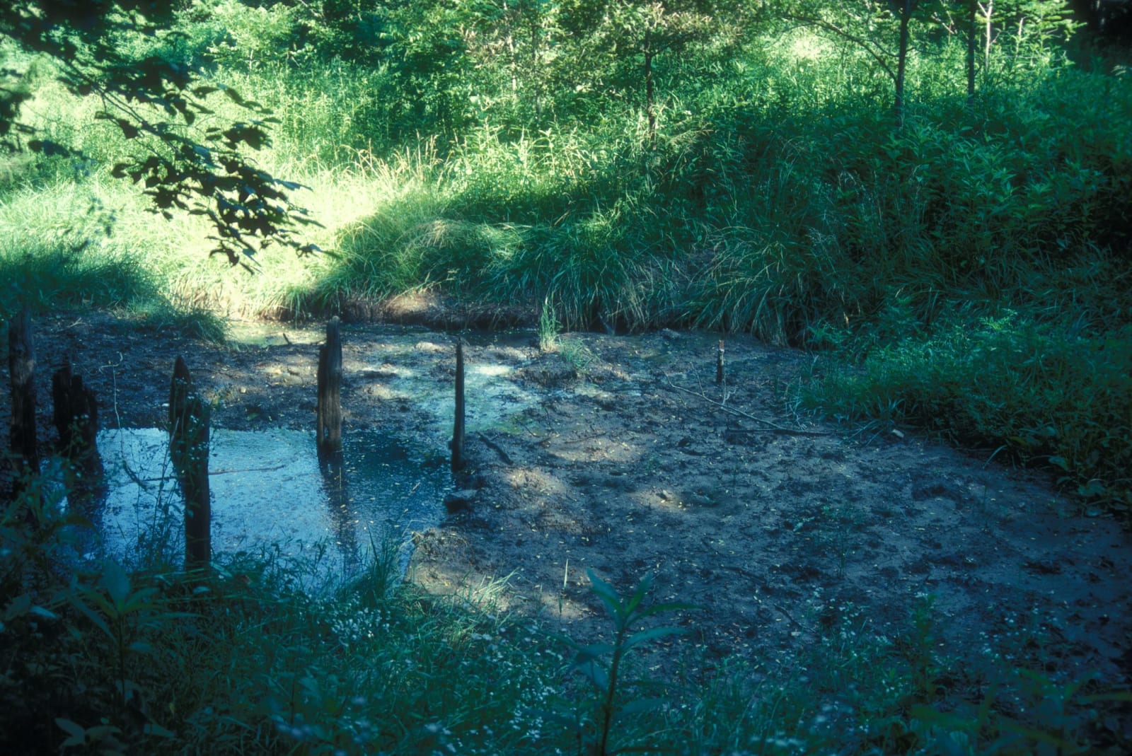
The shallow salt spring at Boones Lick seeping through green woods.Jerrye and Roy Klotz MD / CC BY-SA 3.0 via Wikimedia Commons
🏛️Historical

Boone's Lick State Historic Site

Part ofThe Missouri River: Rhineland to Boonslick
On this driveMO-94 and the Katy Trail: St. Charles to Arrow Rock

The salt spring in the Howard County woods that Daniel Boone's sons worked from 1805, whose name spread to a road, a country and the first American settlement of central Missouri.

⏱
Duration
Under an hour, including the short walk to the springs.
🎟
Admission
Free.
📅
Best Season
Year round, sunrise to sunset; the grounds may close during heavy snow or ice.

The Story

Lewis and Clark noted many saltwater springs along this part of the Missouri. Late in 1804 Nathan Boone and his brother-in-law Mathias Van Bibber came on one in what is now Howard County. James Mackay already held it, a reward from the Spanish for leading an expedition up the Missouri, so Nathan and his brother Daniel Morgan Boone bought the right to make salt from him. In the spring of 1805 they began boiling the brine down until the salt crystallized, and sent it downriver by boat to sell in St. Louis. The works grew to about twenty men.

Their trips home to the Femme Osage valley needed an overland route, and the spring gave its name to everything around it. In 1808 Nathan guided William Clark's dragoons west to build Fort Osage along what became the Boone's Lick Road, and in 1814 he surveyed it from St. Charles to Franklin. After the War of 1812 settlers poured along it from the upper South, many bringing enslaved people, as the Boones themselves did, and the Boone's Lick Country became the first major American settlement in central Missouri. The brothers had sold the works in 1810, when attacks by Native people defending their country made the spring unsafe.

A short trail leads to the springs and the remnants of the works, and outdoor exhibits explain how salt was made and why it mattered.

Visitor Info

⏱
Time Needed
Under an hour, including the short walk to the springs.
🎟
Admission
Free.
📅
Best Season
Year round, sunrise to sunset; the grounds may close during heavy snow or ice.
🛣️
Highway
MO-187

On the Map

Nearby

The closest stops worth working into your route

historical3.8 mi away
Arrow Rock State Historic Site
A Boonslick river town of more than 1,000 that the river and railroads left behind, built and worked by enslaved people, now a village of fifty and a National Historic Landmark.
recreational18 mi away
Katy Trail State Park
Two hundred forty miles of the old Missouri-Kansas-Texas rail bed between Machens and Clinton, mostly along the Missouri River, first opened in 1990 at Rocheport, where it runs through the railroad's stone tunnel.
historical24 mi away
Annie and Abel Van Meter State Park
The homeland of the Missouria, the Nutachi, on the loess ridges at the Great Bend, where Marquette's 1673 map placed their town and a cultural center tells their history.
geological33 mi away
Rock Bridge Memorial State Park
Karst on the edge of Columbia: a boardwalk through a natural rock tunnel to the Devil's Icebox sinkholes, over a cave that is the only known home of the pink planarian.
cultural44 mi away
Walt Disney Hometown Museum
A museum in Marceline's old Santa Fe depot, built on the collection of Walt Disney's sister Ruth, about the five years the Disney family farmed outside this railroad town.
architectural48 mi away
Union Covered Bridge State Historic Site
An 1871 oak bridge over the Elk Fork of the Salt River on the old Paris to Fayette road, the last Burr-arch covered bridge in Missouri, mended after a century of floods.

Historical markers nearby

Roadside plaques and monuments within a short detour

Marker3.7 mi away
Arrow Rock
Marker9.2 mi away
Boonville/Franklin
Marker10 mi away
Glasgow
Marker11 mi away
Fayette
Marker12 mi away
Boonville
Marker25 mi away
Keytesville