Home / Missouri / The Missouri River: Rhineland to Boonslick / Arrow Rock State Historic Site
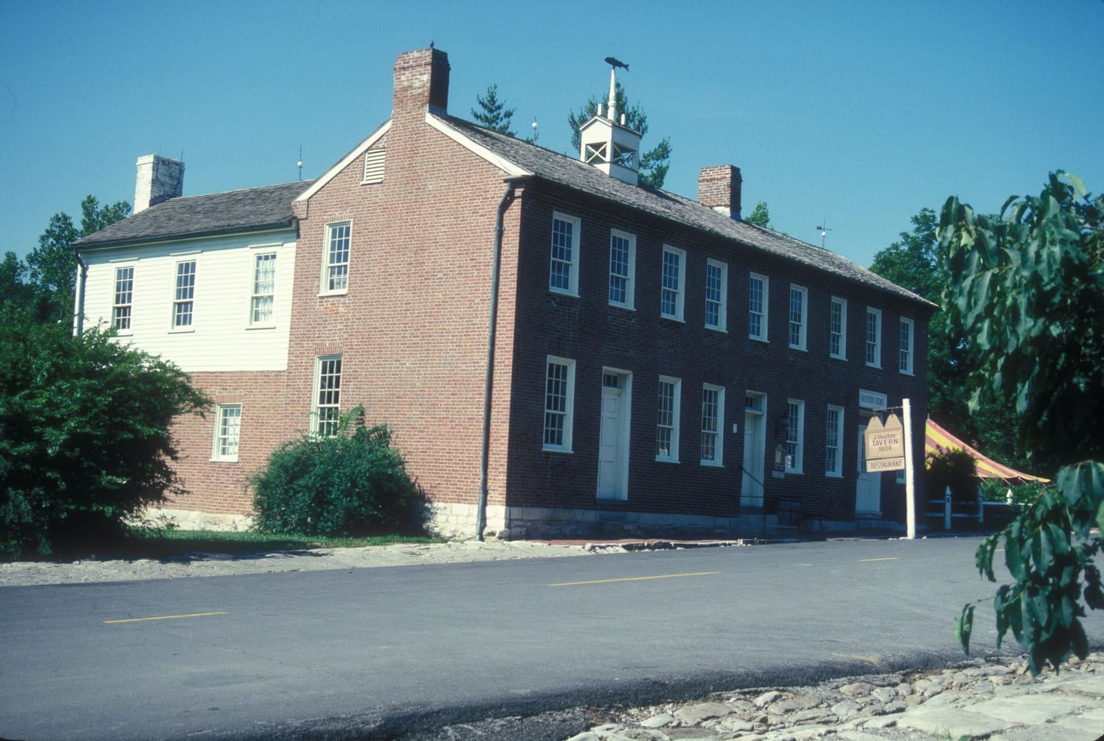
The two-story brick Arrow Rock Tavern with its rooftop bell on the main street of Arrow Rock.Jerrye and Roy Klotz MD / CC BY-SA 3.0 via Wikimedia Commons
๐Ÿ›๏ธHistorical

Arrow Rock State Historic Site

Part ofThe Missouri River: Rhineland to Boonslick
On this driveMO-94 and the Katy Trail: St. Charles to Arrow Rock

A Boonslick river town of more than 1,000 that the river and railroads left behind, built and worked by enslaved people, now a village of fifty and a National Historic Landmark.

โฑ
Duration
Half a day.
๐ŸŽŸ
Admission
Village and grounds open to walk; building and tram tour terms through the site and the Friends of Arrow Rock.
๐Ÿ“…
Best Season
March through November, when the visitor center is open daily; Friday to Sunday in winter.

The Story

The bluff here appears on a French map of 1732 as pierre a fleche, the rock of arrows, and an 1819 account explained that Native people came to it for the stone they used to point their arrows. By 1815 a ferry crossed from the foot of the bluff to the boom town of Franklin on the north bank, and in the 1820s some of the first traders bound for Santa Fe crossed on it; local tradition says caravans filled their water barrels at the Big Spring, which still runs below the tavern. Platted as New Philadelphia in 1829 and renamed for the bluff in 1833, the town grew past 1,000 people and became one of the busiest landings between Kansas City and St. Louis. The painter George Caleb Bingham lived here, and the site keeps his house.

The wealth of the Boonslick rested on hemp and tobacco, crops raised by enslaved people, who also built much of the town. By 1880 Black residents were more than half of Arrow Rock's population. In 1856 Dr. John Sappington, a pioneer of quinine against malaria, set aside a cemetery for the people he enslaved, and most of its 350 or so burials are unmarked.

After the Civil War the river trade ebbed and the railroads went elsewhere; about fifty people live here now. The whole town became a National Historic Landmark in 1964. Joseph Huston's tavern of 1834 still serves meals, and tram tours run with the Friends of Arrow Rock take in the old courthouse and the stone calaboose.

Visitor Info

โฑ
Time Needed
Half a day.
๐ŸŽŸ
Admission
Village and grounds open to walk; building and tram tour terms through the site and the Friends of Arrow Rock.
๐Ÿ“…
Best Season
March through November, when the visitor center is open daily; Friday to Sunday in winter.
๐Ÿ›ฃ๏ธ
Highway
MO-41

On the Map

Stories

A story featuring this place

Go deeper into the history and character of this stop

Nature
The Chutes at Lisbon Bottom
Open Road Guide ยท 3 min read

Nearby

The closest stops worth working into your route

historical3.8 mi away
Boone's Lick State Historic Site
The salt spring in the Howard County woods that Daniel Boone's sons worked from 1805, whose name spread to a road, a country and the first American settlement of central Missouri.
historical21 mi away
Annie and Abel Van Meter State Park
The homeland of the Missouria, the Nutachi, on the loess ridges at the Great Bend, where Marquette's 1673 map placed their town and a cultural center tells their history.
recreational22 mi away
Katy Trail State Park
Two hundred forty miles of the old Missouri-Kansas-Texas rail bed between Machens and Clinton, mostly along the Missouri River, first opened in 1990 at Rocheport, where it runs through the railroad's stone tunnel.
geological36 mi away
Rock Bridge Memorial State Park
Karst on the edge of Columbia: a boardwalk through a natural rock tunnel to the Devil's Icebox sinkholes, over a cave that is the only known home of the pink planarian.
cultural45 mi away
Walt Disney Hometown Museum
A museum in Marceline's old Santa Fe depot, built on the collection of Walt Disney's sister Ruth, about the five years the Disney family farmed outside this railroad town.
historical51 mi away
Battle of Lexington State Historic Site
The Anderson House and the Missouri River bluff at Lexington, where the Missouri State Guard rolled river-soaked hemp bales toward the Union lines in September 1861.

Historical markers nearby

Roadside plaques and monuments within a short detour

Marker0.1 mi away
Arrow Rock
Marker12 mi away
Boonville/Franklin
Marker13 mi away
Glasgow
Marker14 mi away
Boonville
Marker15 mi away
Fayette
Marker25 mi away
Keytesville