Home / Oklahoma / No Man's Land & the Northwest / Gloss Mountain State Park
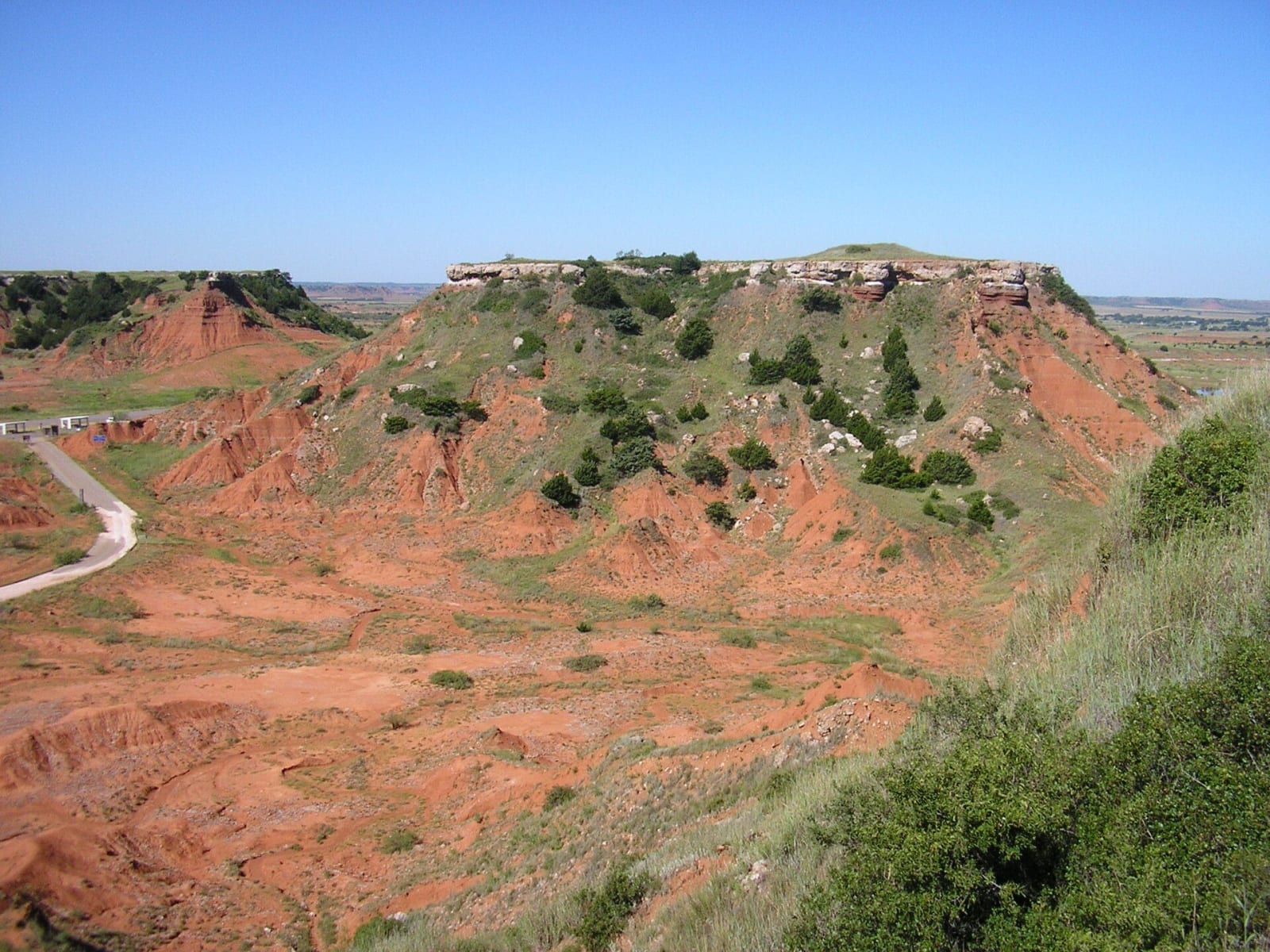
Red buttes capped with pale gypsum in the Gloss Mountains, seen from a mesa top.Okiefromokla / public domain via Wikimedia Commons
🏜️Geological

Gloss Mountain State Park

Part ofNo Man's Land & the Northwest

Red buttes of the Blaine Escarpment beside US-412, capped with gypsum whose selenite flashes in the sun, with a trail up Cathedral Mountain and a park kept by its neighbours.

⏱
Duration
One to two hours.
📅
Best Season
Spring and fall.

The Story

The Glass Mountains, or Gloss Mountains, are not mountains. They are mesas and buttes of the Blaine Escarpment, a line of high ground that crosses northwestern Oklahoma, standing 150 to 200 feet above the flat land of Major County. A sea that once covered the region left layers of red shale and siltstone with a cap of gypsum on top, and as streams cut down, the caprock kept the buttes standing while the land around them washed away. The gypsum is full of selenite, which throws back the sunlight like glass and gave the hills both their names. The first Americans known to explore them, in 1821, called them the Shining Mountains.

In 1977 the state put up $125,000, matched by the federal Land and Water Conservation Fund, to buy 640 acres along US-412 for a park, then could not pay to finish it and leased the land for grazing for twenty years. In 1997 people from nearby Fairview formed a conservancy to run it. The state provides the land, the residents keep up the restroom, pavilions and picnic grounds, and the conservancy pays a gatekeeper to open and lock the park.

There is no camping. The trail climbs from the parking lot to the top of Cathedral Mountain and runs across the mesa, with the valley floor below and Lone Peak Mountain beyond. Cars may enter from 7:30 a.m. to 5 p.m.; hikers may stay from sunrise to sunset.

Visitor Info

⏱
Time Needed
One to two hours.
📅
Best Season
Spring and fall.
🛣️
Highway
US-412

On the Map

Nearby

The closest stops worth working into your route

architectural11 mi away
Sod House Museum
Marshal McCully's two-room soddy of 1894 near Aline, the one sod house left in Oklahoma that a homesteader built, under a protective cover where it has always stood.
geological20 mi away
Little Sahara State Park
More than 1,600 acres of bare, moving dunes south of Waynoka, blown from the Cimarron's Ice Age terraces, begun as a park with two circus camels in 1958.
geological29 mi away
Salt Plains National Wildlife Refuge
About twelve thousand acres of salt flat near Jet where visitors dig hourglass selenite crystals in season, and where the Cherokee Outlet treaty kept the salt open to every tribe.
natural31 mi away
Roman Nose State Park
A canyon of gypsum cliffs and three springs north of Watonga, one of Oklahoma's first seven state parks, named for Henry Roman Nose, a Cheyenne chief who survived Fort Marion.
geological39 mi away
Alabaster Caverns State Park
A three-quarter-mile gypsum cave under Cedar Canyon near Freedom, with selenite, rare black alabaster, five kinds of bats and a past as a 1950s fallout shelter.
historical39 mi away
Cherokee Strip Regional Heritage Center
The Oklahoma Historical Society's Enid museum of the September 1893 run into the Cherokee Outlet, with the town's original land office among the old buildings out back.

Historical markers nearby

Roadside plaques and monuments within a short detour

Marker11 mi away
Sod House
Marker22 mi away
Cantonment