Home / Washington / The Olympic Peninsula & the Coast / Glines Canyon Spillway Overlook
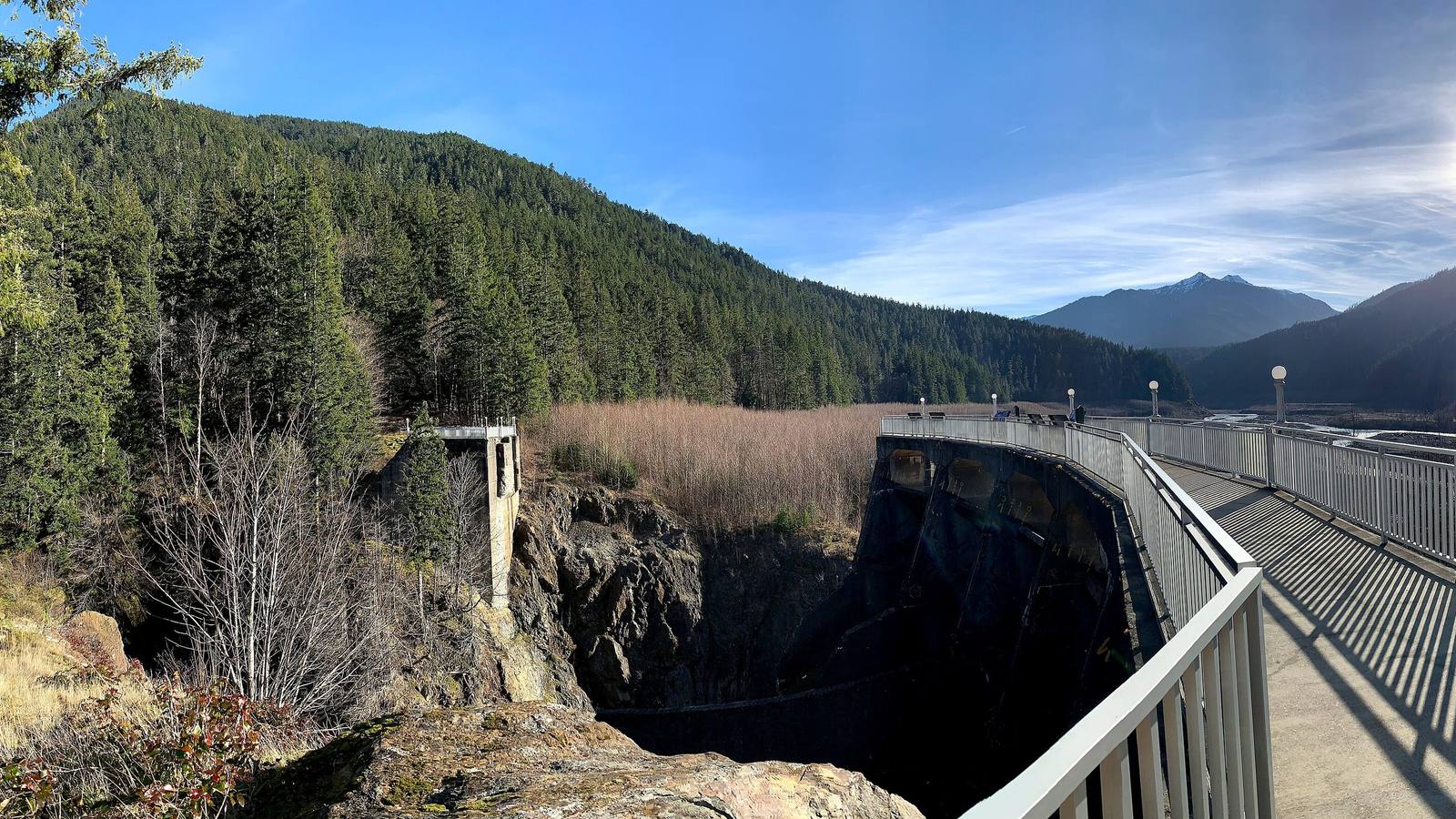
The walkway along the old spillway of Glines Canyon Dam, its railing curving above the dark rock slot where the dam stood, with the tan, regrowing bed of the old reservoir and forested ridges beyondAndrew Kvalheim / CC BY-SA 4.0 via Wikimedia Commons
🏛️Historical

Glines Canyon Spillway Overlook

Part ofThe Olympic Peninsula & the Coast
On this driveUS-101: The Olympic Peninsula Loop

A viewpoint built on the spillway of a 210-foot dam that is no longer there, above a valley that was a reservoir for most of a century.

Native American HeritagePaid EntryHiking
⏱
Duration
Half a day, with the walk in from Madison Falls.
📅
Best Season
Late spring through fall.

The Story

Glines Canyon Dam stood 210 feet high in a slot of rock eight miles above the lower dam on the Elwha. It was finished in 1927 to power the mills at Port Angeles, and when the park grew around it the dam and its reservoir, Lake Mills, ended up inside Olympic National Park. Its demolition was finished in 2014, and the park left part of the concrete spillway in place and made it a viewpoint. From the rail you look down into the canyon where the dam stood and up a valley that was under water for most of a century, now a braided river running through young alder and replanted conifers on what was lakebed.

The dam's lake had trapped millions of cubic yards of sand and gravel. With the dam gone the river has been carrying that sediment down to the Strait, rebuilding the beaches at the river mouth that had been starving for a hundred years.

Downstream, the lower dam's reservoir drained first. In the summer of 2012, park archaeologists told the Lower Elwha Klallam Tribe that their creation site had come back into the open: a rock with two deep hollows, named in Klallam for the coiled baskets they resemble, where by the tribe's teaching the Creator bathed and blessed the Klallam people. No one in the tribe had seen it since the water rose behind Elwha Dam in 1913. Within days tribal members walked down and stood on it.

Getting here now takes some effort. Floods washed out Olympic Hot Springs Road below the overlook, and the valley beyond Madison Falls is open only to walkers and cyclists.

Visitor Info

⏱
Time Needed
Half a day, with the walk in from Madison Falls.
📅
Best Season
Late spring through fall.
🛣️
Highway
US-101

On the Map

Nearby

The closest stops worth working into your route

natural18 mi away
Hoh Rain Forest
Twelve to fourteen feet of rain a year, spruce standing in rows on the logs that nursed them, and the elk Theodore Roosevelt set the first park lands aside for.
historical42 mi away
Ebey's Landing
A bluff trail above the beach where, in August 1857, a Kake raiding party came ashore to answer the shelling of their camp at Port Gamble the year before.
natural43 mi away
Ruby Beach
Driftwood, sea stacks and a short walk down from US-101, with Destruction Island offshore and two names on the chart that tell only the sailors' side.
historical45 mi away
English Camp
Twelve years of a British garrison on a Coast Salish shell midden, with a formal garden, a blockhouse that outlived the empire's claim, and a cemetery on the hill.
historical52 mi away
Old Man House Park
An acre of beach on Agate Passage where the largest winter house on the coast stood until the government burned it in 1870.
natural52 mi away
Deception Pass
A tide race between Whidbey and Fidalgo islands that fooled George Vancouver, and the 1935 bridge that finally tied Whidbey to the mainland.

Historical markers nearby

Roadside plaques and monuments within a short detour

Marker7.4 mi away
Juan de Fuca
Marker14 mi away
Spanish Explorers