Home / Washington / North Sound & the San Juan Islands / Deception Pass
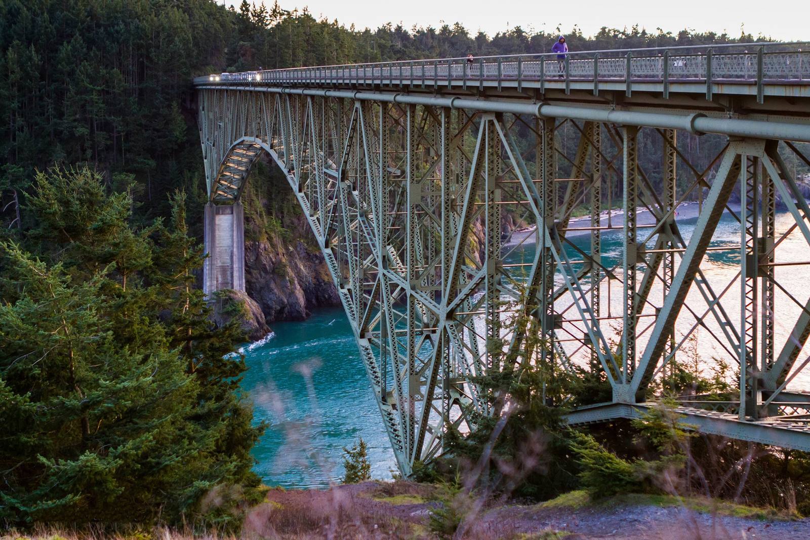
The steel arch of the Deception Pass Bridge spanning the narrow green channel between Whidbey and Fidalgo islands, forest on both sidesPascal Walschots / CC BY 2.0 via Wikimedia Commons
🌲Natural

Deception Pass

Part ofNorth Sound & the San Juan Islands

A tide race between Whidbey and Fidalgo islands that fooled George Vancouver, and the 1935 bridge that finally tied Whidbey to the mainland.

Year-RoundScenic DrivingNative American HeritagePaid Entry
⏱
Duration
Half an hour for the bridge; a day in the park.
📅
Best Season
Year-round.

The Story

In the spring of 1792 George Vancouver took the long island south of here for a peninsula of the mainland. On June 7 his sailing master, Joseph Whidbey, worked a small boat into what looked like a bay and found a narrow, violent channel cutting all the way through to Skagit Bay. Vancouver named the island for Whidbey and the channel Deception Passage, for having been deceived.

The pass is a tide race. Twice a day the water of Skagit Bay and Saratoga Passage drains through a gap of rock a few hundred feet wide, and the current can run at nine knots, with whirlpools and standing waves at the turn of the tide. The Samish and Swinomish summered here and had villages around the pass, and their name for it meant dangerous. At Rosario Beach on the Fidalgo side, a Samish story pole tells of the Maiden of Deception Pass, a young woman who married into the sea.

For most of a century Whidbey was reached only by boat. The bridge, two spans hopping across tiny Pass Island, was built in eleven months and dedicated at noon on July 31, 1935, with young men of the Civilian Conservation Corps working on its approaches and the park around it. It stands 180 feet over the water, and its walkways are the best place to watch the current run.

Visitor Info

⏱
Time Needed
Half an hour for the bridge; a day in the park.
📅
Best Season
Year-round.
🛣️
Highway
SR-20

On the Map

Nearby

The closest stops worth working into your route

historical15 mi away
Ebey's Landing
A bluff trail above the beach where, in August 1857, a Kake raiding party came ashore to answer the shelling of their camp at Port Gamble the year before.
historical26 mi away
English Camp
Twelve years of a British garrison on a Coast Salish shell midden, with a formal garden, a blockhouse that outlived the empire's claim, and a cemetery on the hill.
historical47 mi away
Old Man House Park
An acre of beach on Agate Passage where the largest winter house on the coast stood until the government burned it in 1870.
historical52 mi away
Glines Canyon Spillway Overlook
A viewpoint built on the spillway of a 210-foot dam that is no longer there, above a valley that was a reservoir for most of a century.
natural53 mi away
Artist Point
The end of the Mount Baker Highway, a ridge between Baker and Shuksan below the ski area that holds the world record for snow in a single season.
historical55 mi away
Bainbridge Island Japanese American Exclusion Memorial
A cedar wall running down to the dock where the first Japanese Americans were taken, and the story of the island newspaper that wanted them back.

Historical markers nearby

Roadside plaques and monuments within a short detour

Marker0.1 mi away
Deception Pass
Marker17 mi away
Chuckanut Drive
Marker27 mi away
Big Cedar Stump / Smokey Point
Marker28 mi away
Discovery Bay