Home / Washington / North Sound & the San Juan Islands / English Camp
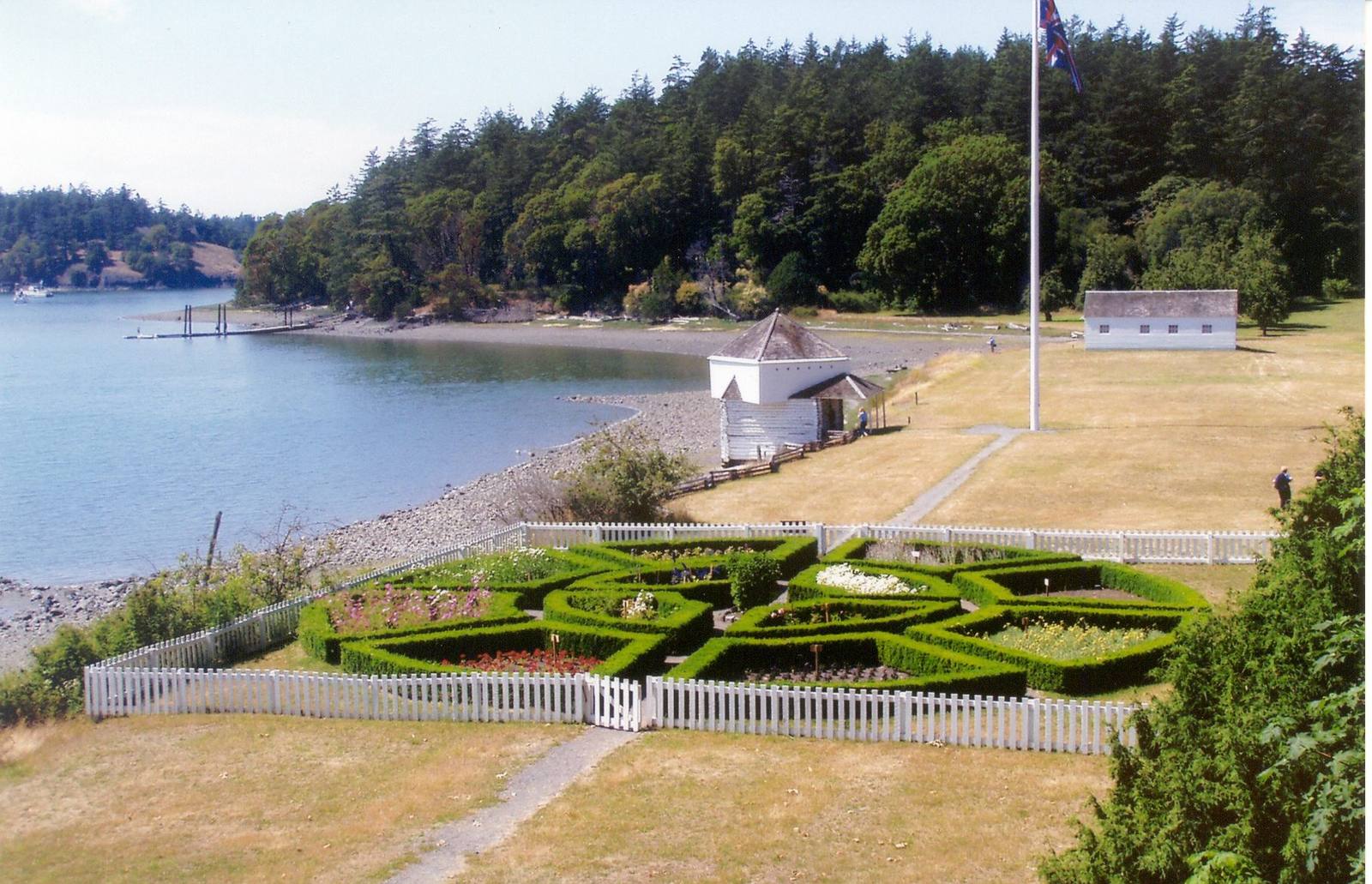
The formal garden at English Camp behind a white picket fence, with the blockhouse on the shore of Garrison Bay and the parade ground beyondChris Light / CC BY-SA 4.0 via Wikimedia Commons
🏛️Historical

English Camp

Part ofNorth Sound & the San Juan Islands

Twelve years of a British garrison on a Coast Salish shell midden, with a formal garden, a blockhouse that outlived the empire's claim, and a cemetery on the hill.

Year-RoundNative American HeritageFreeHiking
⏱
Duration
One hour; two with the climb up Young Hill.
📅
Best Season
Year-round; buildings staffed in summer.

The Story

The Royal Marines came ashore on Garrison Bay on March 23, 1860, to hold the British end of San Juan Island while London and Washington argued over the boundary. The navy surveyors who chose the spot remembered it from an earlier survey, when one of their officers had noted abandoned plank houses standing among a vast shell midden on the shore. The bay had been a Coast Salish winter village for centuries. The marines cleared the trees, and the parade ground they laid out sits on that midden, which they described as shell banked ten feet high and a hundred and twenty yards long.

Where the Americans at the other end of the island built for use, the British built to remind themselves of home. The second commander, Captain Delacombe, had a formal flower garden laid out at the foot of the hill below the officers' quarters, and the camp grew to more than two dozen buildings, with a hospital, a commissary and a small blockhouse on the water's edge. Relations with the American garrison were friendly from the start, and for twelve years the two camps shared the island without a shot fired.

The marines left in November 1872. An American survey that winter called the blockhouse old and worthless, but the Crook family, who farmed the site for nearly a century, kept it standing, and for years the British government paid them to tend the marines' cemetery on Young Hill. The barracks, commissary, blockhouse and garden have been restored, and a steep trail climbs to the cemetery and on to views across Haro Strait to Vancouver Island.

Visitor Info

⏱
Time Needed
One hour; two with the climb up Young Hill.
📅
Best Season
Year-round; buildings staffed in summer.
🛣️
Highway
West Valley Road

On the Map

Nearby

The closest stops worth working into your route

natural26 mi away
Deception Pass
A tide race between Whidbey and Fidalgo islands that fooled George Vancouver, and the 1935 bridge that finally tied Whidbey to the mainland.
historical33 mi away
Ebey's Landing
A bluff trail above the beach where, in August 1857, a Kake raiding party came ashore to answer the shelling of their camp at Port Gamble the year before.
historical45 mi away
Glines Canyon Spillway Overlook
A viewpoint built on the spillway of a 210-foot dam that is no longer there, above a valley that was a reservoir for most of a century.
natural62 mi away
Hoh Rain Forest
Twelve to fourteen feet of rain a year, spruce standing in rows on the logs that nursed them, and the elk Theodore Roosevelt set the first park lands aside for.
historical66 mi away
Old Man House Park
An acre of beach on Agate Passage where the largest winter house on the coast stood until the government burned it in 1870.
cultural68 mi away
Makah Cultural and Research Center
The tribe's own museum at the end of the road, built around the whale hunt and the treaty that is the only one the United States ever signed naming a right to whale.

Historical markers nearby

Roadside plaques and monuments within a short detour

Marker26 mi away
Deception Pass