Home / Washington / Coulee Country / Dry Falls Vista House
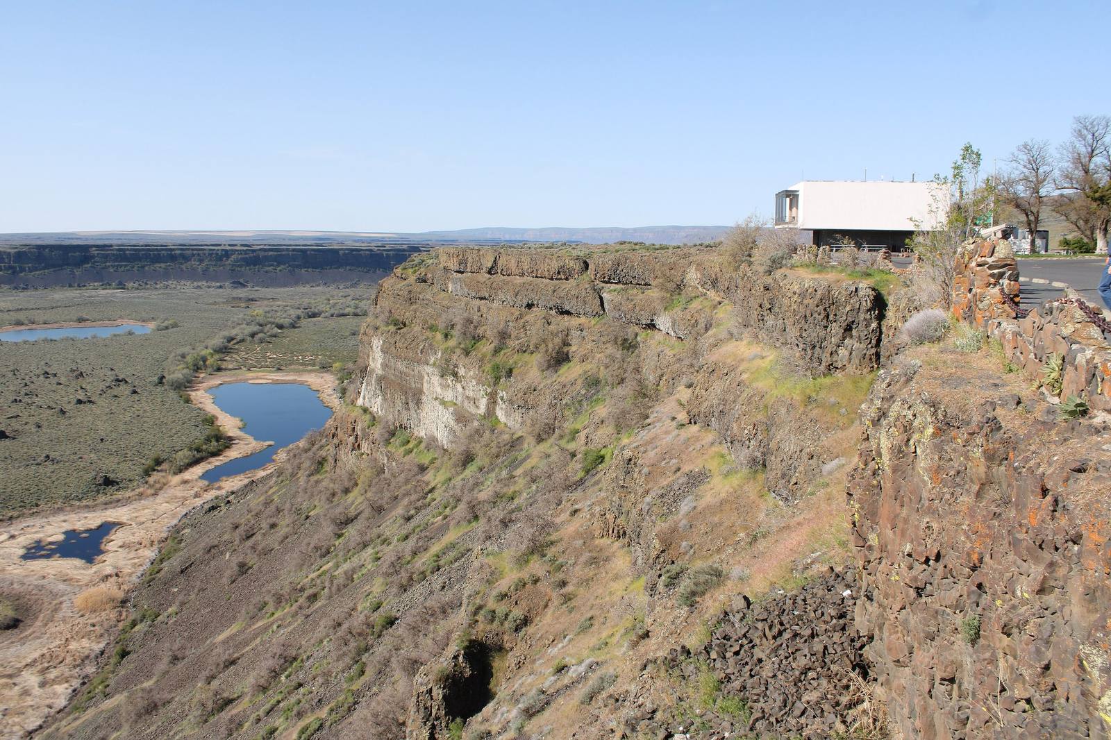
The Dry Falls visitor center perched on the rim of the basalt cliffs, the old falls' floor and its pothole lakes spreading belowChris Light / CC BY-SA 4.0 via Wikimedia Commons
🏛️Historical

Dry Falls Vista House

Part ofCoulee Country

The viewpoint a Coulee City grocer talked the state into in 1925, with a stone Vista House on the rim from 1928 and a glass-walled interpretive center from 1966.

Family-FriendlyFree
⏱
Duration
One hour.
📅
Best Season
Spring through fall; the visitor center keeps seasonal hours.

The Story

Dry Falls became a park because a grocer kept asking. In 1925 Frank McCann of Coulee City took the idea to the state parks committee, and three years later the state built a stone Vista House on the rim, dedicated on July 25, 1928. The six-sided building still stands at the edge of the cliff.

The Depression did the next round of work. In 1934 the state parks superintendent, William Weigle, found his laborers in the camps that had filled with men looking for work on Grand Coulee Dam, and they extended the stone wall along the rim and built a caretaker's house. The caretaker, Charles Geizentanner, hired in 1935, lectured visitors at the wall and wrote a pamphlet calling the falls the Wonder of Wonders and the Mystery of Mysteries.

After the war the parks chairman, Lieutenant Governor Vic Meyers, bought the homesteads below the cliff and built a resort park around the lakes, with a golf course, stables and cabins. In 1947 critics said nearly two thirds of the state parks budget had gone into it and called it Vic's Folly. It became one of the most popular parks in the state anyway. The lakes at the foot of the cliff are the old plunge pools, now fed by groundwater.

The Dry Falls Interpretive Center was dedicated on May 15, 1966, a modernist building by the Spokane architect Kenneth Brooks with a wall of glass facing the cataract. In 1994 the state dedicated it to J Harlen Bretz, thirteen years after his death.

Visitor Info

⏱
Time Needed
One hour.
📅
Best Season
Spring through fall; the visitor center keeps seasonal hours.
🛣️
Highway
SR-17

On the Map

Nearby

The closest stops worth working into your route

cultural8.6 mi away
Lake Lenore Caves
Shallow shelters in a coulee wall that people used for thousands of years, where the archaeologists who arrived in 1958 found that collectors had dug them over first.
natural16 mi away
Soap Lake
A mineral lake at the foot of the Grand Coulee that drew health seekers by the thousand, and whose older name, Smokiam, the town declined to give back.
geological21 mi away
Steamboat Rock
An 800-foot basalt butte that geologists read as the remains of a waterfall twice the height of Dry Falls, now almost an island in a reservoir pumped up from the Columbia.
historical22 mi away
Northrup Canyon
A side canyon of the Grand Coulee with a forest in it, springs, a homestead orchard, and a killing over the orchard trees in 1903.
industrial30 mi away
Grand Coulee Dam
An idea a newspaper buried on page seven in 1918, built as a Depression jobs program by twelve thousand workers, seventy-two of whom died on it.
historical43 mi away
Chief Joseph's Grave
The Nez Perce cemetery at Nespelem, on the Colville Reservation, where Hin-mah-too-yah-lat-kekt was buried in 1904 and buried again under a historical society's marble shaft in 1905.

Historical markers nearby

Roadside plaques and monuments within a short detour

Marker0 mi away
Story of Dry Falls
Marker8.7 mi away
Lake Lenore Caves