Home / Washington / Coulee Country / Steamboat Rock
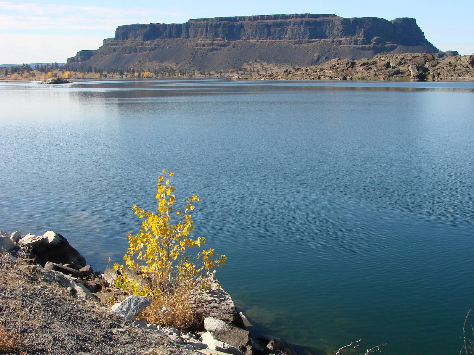
Steamboat Rock's flat-topped basalt mass rising across the still water of Banks Lake, a yellow-leaved shrub on the rocks in the foregroundAdam Jones / CC BY-SA 2.0 via Wikimedia Commons
🏜️Geological

Steamboat Rock

Part ofCoulee Country

An 800-foot basalt butte that geologists read as the remains of a waterfall twice the height of Dry Falls, now almost an island in a reservoir pumped up from the Columbia.

SwimmingSummerPaid EntryHiking
⏱
Duration
Half a day with the summit hike.
📅
Best Season
Spring and fall for the climb; summer for the lake.

The Story

Steamboat Rock rises 800 feet out of Banks Lake, flat-topped and some 600 acres across, a block of columnar basalt that the floods went around and over. Geologists read it as what remains of the upper falls of the Grand Coulee, a twin cataract about twice the height of Dry Falls, which lies some twenty miles downstream. Here the water cut all the way through the basalt layers to the granite underneath. The rock and the country around it figure in the stories of Coyote and the Eagle family that the people of the coulee have told for generations.

For some thirteen thousand years after the floods the rock stood in a dry canyon. Then the Columbia Basin Project closed both ends of the upper coulee with earthen dams and filled the trough between them with water pumped up from behind Grand Coulee Dam. The reservoir, twenty-seven miles long and finished in 1953, was named Banks Lake for Frank Banks, the construction supervisor at the dam, and it left the rock standing at the end of a peninsula with water on nearly every side.

The state park was dedicated on June 20, 1964. A trail climbs about 650 feet to the top, where the walking is flat and the views run up and down the coulee and north to the mountains of the Okanogan. Below, the park keeps lawns, a swimming beach and boat launches on the lake.

Visitor Info

⏱
Time Needed
Half a day with the summit hike.
📅
Best Season
Spring and fall for the climb; summer for the lake.
🛣️
Highway
SR-155

On the Map

Nearby

The closest stops worth working into your route

historical2.4 mi away
Northrup Canyon
A side canyon of the Grand Coulee with a forest in it, springs, a homestead orchard, and a killing over the orchard trees in 1903.
industrial9.3 mi away
Grand Coulee Dam
An idea a newspaper buried on page seven in 1918, built as a Depression jobs program by twelve thousand workers, seventy-two of whom died on it.
historical21 mi away
Dry Falls Vista House
The viewpoint a Coulee City grocer talked the state into in 1925, with a stone Vista House on the rim from 1928 and a glass-walled interpretive center from 1966.
historical22 mi away
Chief Joseph's Grave
The Nez Perce cemetery at Nespelem, on the Colville Reservation, where Hin-mah-too-yah-lat-kekt was buried in 1904 and buried again under a historical society's marble shaft in 1905.
cultural29 mi away
Lake Lenore Caves
Shallow shelters in a coulee wall that people used for thousands of years, where the archaeologists who arrived in 1958 found that collectors had dug them over first.
natural37 mi away
Soap Lake
A mineral lake at the foot of the Grand Coulee that drew health seekers by the thousand, and whose older name, Smokiam, the town declined to give back.

Historical markers nearby

Roadside plaques and monuments within a short detour

Marker21 mi away
Story of Dry Falls
Marker29 mi away
Lake Lenore Caves