Home / Missouri / Mark Twain Country & Little Dixie / Union Covered Bridge State Historic Site
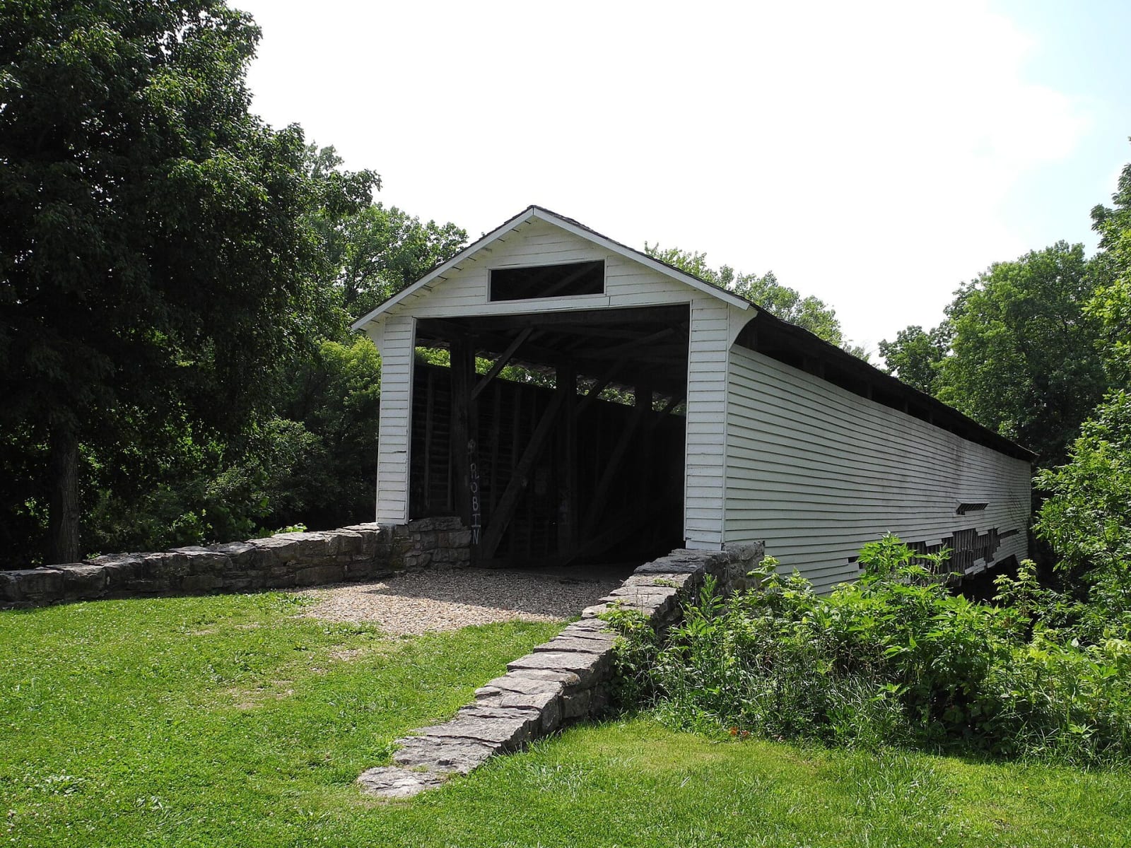
The white Union Covered Bridge on its stone abutment among summer trees.Kbh3rd / CC BY-SA 3.0 via Wikimedia Commons
🏗️Architectural

Union Covered Bridge State Historic Site

Part ofMark Twain Country & Little Dixie

An 1871 oak bridge over the Elk Fork of the Salt River on the old Paris to Fayette road, the last Burr-arch covered bridge in Missouri, mended after a century of floods.

⏱
Duration
Twenty to thirty minutes.
🎟
Admission
Free.
📅
Best Season
Year round, sunrise to sunset daily; the creek is prettiest in spring and fall.

The Story

Monroe County gave permission on April 8, 1870, for a bridge over the Elk Fork of the Salt River, after two earlier bridges at the crossing had failed. Joseph Elliott built it of local oak for $5,500 on the road between Paris in Monroe County and Fayette in Howard County, two towns of the hemp and tobacco country later called Little Dixie, and it opened on September 17, 1871. It took its name from Union Church nearby.

It is a Burr-arch truss, the only one among Missouri's four surviving covered bridges; the other three are Howe trusses. Two arches on each side work with a row of king posts to carry the deck, the parts are pinned with wooden treenails and a few iron fasteners, and the bridge bows slightly upstream to steady it in floods. Under its board siding and shingle roof it looks like a barn, and local legend says that is why livestock would walk through it.

It was nearly lost to neglect in the 1960s. In 1967 the legislature brought the state's covered bridges into the park system, and that same year a flood tore away siding, so the 1968 repairs used timbers from the Mexico Covered Bridge, which the flood had destroyed. It closed to cars in 1970, the year it was listed on the National Register, survived the Great Flood of 1993, and was damaged again in 2008. Repairs were finished in 2019.

Visitor Info

⏱
Time Needed
Twenty to thirty minutes.
🎟
Admission
Free.
📅
Best Season
Year round, sunrise to sunset daily; the creek is prettiest in spring and fall.
🛣️
Highway
MO-C

On the Map

Nearby

The closest stops worth working into your route

recreational40 mi away
Katy Trail State Park
Two hundred forty miles of the old Missouri-Kansas-Texas rail bed between Machens and Clinton, mostly along the Missouri River, first opened in 1990 at Rocheport, where it runs through the railroad's stone tunnel.
geological41 mi away
Rock Bridge Memorial State Park
Karst on the edge of Columbia: a boardwalk through a natural rock tunnel to the Devil's Icebox sinkholes, over a cave that is the only known home of the pink planarian.
cultural41 mi away
America's National Churchill Museum
The Westminster College campus where Churchill gave the Iron Curtain speech in 1946, with a bombed Wren church from London rebuilt stone by stone above his museum.
historical44 mi away
Jim's Journey: The Huck Finn Freedom Center
Hannibal's first African American history museum, built around Daniel Quarles, the enslaved man Clemens named as his model for Jim, and the Black town around him.
cultural44 mi away
Mark Twain Boyhood Home & Museum
The Hill Street house where Samuel Clemens lived from 1844 to 1853, and the blocks of Hannibal the town has spent more than a century arranging around his books.
historical48 mi away
Boone's Lick State Historic Site
The salt spring in the Howard County woods that Daniel Boone's sons worked from 1805, whose name spread to a road, a country and the first American settlement of central Missouri.

Historical markers nearby

Roadside plaques and monuments within a short detour

Marker17 mi away
Mark Twain
Marker18 mi away
Moberly
Marker22 mi away
Mexico