Home / Oregon / The North Oregon Coast / Astoria Column
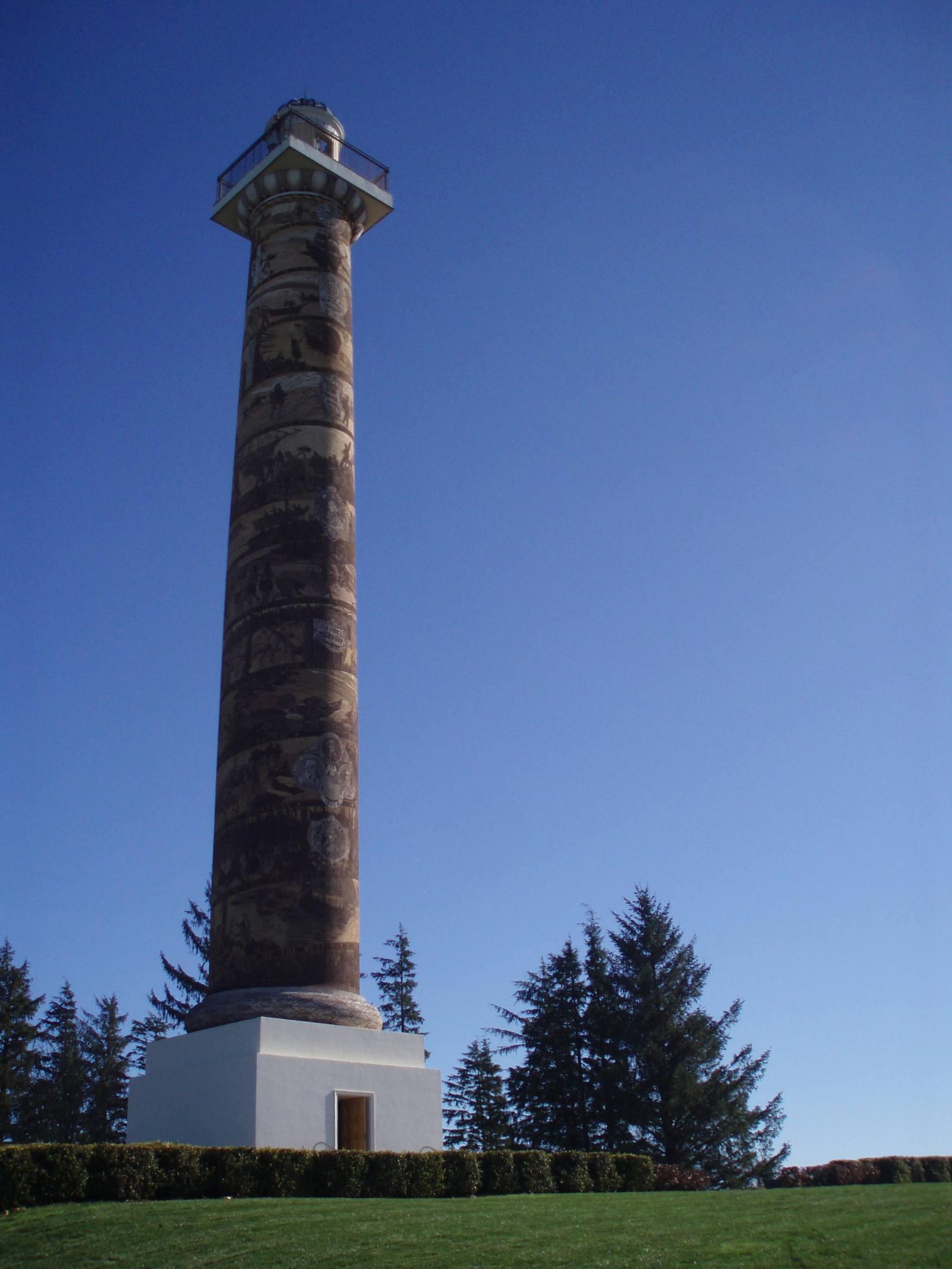
The Astoria Column on Coxcomb Hill, its spiral frieze rising from a white base above the firsHedwigg / CC BY-SA 3.0 via Wikimedia Commons
🏗️Architectural

Astoria Column

Part ofThe North Oregon Coast
On this driveUS-101 on the North Coast: Astoria to Newport

A railroad's 1926 monument to its own route, wrapped in a 525-foot spiral of Oregon history that ends with the train pulling into Astoria.

Photography
⏱
Duration
Half an hour, longer if you read the frieze band by band.
📅
Best Season
Any clear day; the view is the point, and the coast gives fewer of them in winter.

The Story

Coxcomb Hill rises about 600 feet behind Astoria, and the column on top adds 125 more, with 164 steps inside to a deck over the mouth of the Columbia, Youngs Bay, the bridge to Washington and, on a clear day, the Cascade volcanoes. It looks like a civic memorial and was a railroad's idea. Ralph Budd, president of the Great Northern, put up a dozen historical markers along his line between St. Paul and the Pacific in 1925 and 1926, and this was the last and largest. Vincent Astor, great-grandson of the fur merchant the city is named for, gave $20,000 of its $27,133.96 cost, and it was dedicated on July 22, 1926, during the city's founders' celebration.

The New York architect Electus Litchfield modeled it on Trajan's Column in Rome, and the Italian-born artist Attilio Pusterla covered it in sgraffito, cutting the design through layers of tinted plaster from a scaffold hung off the viewing platform. Only three of the fourteen bands were done on dedication day; the rest were finished that October. Read from the bottom up, the frieze begins with Robert Gray's ship entering the river in May 1792 and his first meeting with the Chinook and Clatsop, and climbs through Lewis and Clark and Astor's traders to the arrival of the railroad in 1893. A history paid for by a railroad ends, naturally enough, with the railroad.

Coastal weather wore the plaster down for decades, and a restoration was unveiled in November 1995. The gift shop sells balsa gliders, and launching one from the top is the local custom.

Visitor Info

⏱
Time Needed
Half an hour, longer if you read the frieze band by band.
📅
Best Season
Any clear day; the view is the point, and the coast gives fewer of them in winter.
📍
Location
1 Coxcomb Drive, Astoria, OR 97103
🛣️
Highway
US-30

On the Map

Nearby

The closest stops worth working into your route

historical4.4 mi away
Fort Clatsop
The log post the Corps of Discovery named for its neighbors, and left to the Clatsop headman Coboway five days after stealing one of his people's canoes.
geological22 mi away
Haystack Rock
A 235-foot sea stack made of lava that ran down the Columbia from the far side of the state, now a nesting rock for tufted puffins.
culinary48 mi away
Tillamook Creamery
A farmer-owned cheese plant that exists because Tillamook Bay had no good way out, and whose logo is the schooner the settlers built to make one.
historical67 mi away
Vanport
Briefly Oregon's second-largest city, built in about 110 days for Kaiser's shipyard workers, washed away in an afternoon in 1948, and later renamed out of existence.
historical78 mi away
Champoeg
The river-bend meadow where settlers voted for a government in 1843, and where the Willamette took the entire town but one warehouse eighteen years later.
natural81 mi away
Willamette Falls
A horseshoe of basalt across the Willamette, ringed by a century of mills, that is still one of the last places in the Columbia basin where tribes gather lamprey by hand.

Historical markers nearby

Roadside plaques and monuments within a short detour

Marker7.3 mi away
Fort Stevens State Park
Marker14 mi away
Tsunami - Seaside
Marker18 mi away
"Captain" John West and Westport, Oregon
Marker20 mi away
Ecola
Marker26 mi away
Cannons on the Beach