Home / Oregon / The North Oregon Coast / Haystack Rock
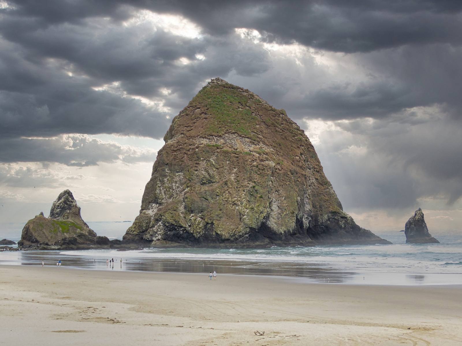
Haystack Rock and the Needles off Cannon Beach under a storm sky, the tide out across the sandEuthman / CC BY 4.0 via Wikimedia Commons
🏜️Geological

Haystack Rock

Part ofThe North Oregon Coast
On this driveUS-101 on the North Coast: Astoria to Newport

A 235-foot sea stack made of lava that ran down the Columbia from the far side of the state, now a nesting rock for tufted puffins.

IconicPhotography
⏱
Duration
An hour at low tide; longer with a scope and the volunteers.
📅
Best Season
April through August for puffins; a minus tide any time of year for the pools.

The Story

The rock looks as if it grew out of the coast, and in a sense it came from hundreds of miles inland. Between about fifteen and seventeen million years ago the Columbia River flood basalts poured out of fissures in what is now eastern Oregon and Washington, and some of the flows followed the old course of the Columbia all the way to the sea, burrowing into the soft marine sediments along the shore. The lava hardened underground. Uplift and the waves stripped the sediment away and left the hard basalt standing; Haystack Rock, Tillamook Head, Arch Cape and Saddle Mountain are all pieces of the same flows.

At low tide you can walk to its base across one of Oregon's marine gardens, where tide pools fill the rocks and climbing and collecting are banned. Everything above the high-tide line belongs to the Oregon Islands National Wildlife Refuge. From April into August tufted puffins nest in burrows on the grassy upper slopes, one of the few places on this coast to see them from shore, alongside murres, guillemots and cormorants. Volunteers of the Haystack Rock Awareness Program, begun in 1985, the last summer cars were allowed to drive the beach, set up at low tide from February into October.

The town's name came in from the sea too. The Navy schooner Shark wrecked on the Columbia bar in September 1846, and that fall Tillamook people sent word to its officers that part of the hull, with guns on it, had come ashore south of Tillamook Head. One of the guns, buried and uncovered by the sand for decades, named the beach, and the town of Elk Creek took the name in 1922 at the Post Office's insistence. The gun is in the Cannon Beach History Center and Museum; two more turned up at Arch Cape in 2008.

Visitor Info

⏱
Time Needed
An hour at low tide; longer with a scope and the volunteers.
📅
Best Season
April through August for puffins; a minus tide any time of year for the pools.
🛣️
Highway
US-101

On the Map

Nearby

The closest stops worth working into your route

historical18 mi away
Fort Clatsop
The log post the Corps of Discovery named for its neighbors, and left to the Clatsop headman Coboway five days after stealing one of his people's canoes.
architectural22 mi away
Astoria Column
A railroad's 1926 monument to its own route, wrapped in a 525-foot spiral of Oregon history that ends with the train pulling into Astoria.
culinary28 mi away
Tillamook Creamery
A farmer-owned cheese plant that exists because Tillamook Bay had no good way out, and whose logo is the schooner the settlers built to make one.
historical64 mi away
Vanport
Briefly Oregon's second-largest city, built in about 110 days for Kaiser's shipyard workers, washed away in an afternoon in 1948, and later renamed out of existence.
historical68 mi away
Champoeg
The river-bend meadow where settlers voted for a government in 1843, and where the Willamette took the entire town but one warehouse eighteen years later.
natural74 mi away
Depoe Bay
A six-acre harbor reached through a crack in the basalt, on land allotted in 1894 to a Tututni man the agency knew as Depot Charley.

Historical markers nearby

Roadside plaques and monuments within a short detour

Marker2.1 mi away
Ecola
Marker4.5 mi away
Cannons on the Beach
Marker7.7 mi away
Tsunami - Seaside
Marker22 mi away
Fort Stevens State Park
Marker25 mi away
41st Infantry Division
Marker25 mi away
The Tillamook Burn