Home / Missouri / Kansas City & the Western Border / Battle of Lexington State Historic Site
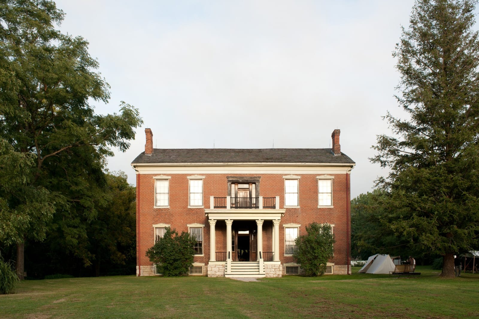
The red brick Anderson House on its lawn at the Battle of Lexington State Historic Site.Missouri State Parks / public domain via Wikimedia Commons
🏛️Historical

Battle of Lexington State Historic Site

Part ofKansas City & the Western Border

The Anderson House and the Missouri River bluff at Lexington, where the Missouri State Guard rolled river-soaked hemp bales toward the Union lines in September 1861.

⏱
Duration
Two hours for the visitor center and both guided tours.
🎟
Admission
Grounds open to all; Anderson House and battlefield tours are guided and can be reserved online or at the site (660-259-4654), which gives current fees.
📅
Best Season
April to July tours Tuesday to Sunday; August to October Wednesday to Sunday; November to March by appointment only. Visitor center 9 a.m. to 5 p.m. Tuesday to Saturday and 10 a.m. to 5 p.m. Sunday in season, 10 a.m. to 5 p.m. Wednesday to Sunday in winter.

The Story

Lexington was a hemp town before it was a battlefield. Hemp for rope, with tobacco, coal, cattle and river trade, made its money, and enslaved people were about a third of Lafayette County's population. William B. Waddell, later a partner in the Pony Express, built a brick store and a hemp warehouse here, and in 1855 more than two hundred slaveholders gathered in Lexington to denounce the antislavery settlers moving into Kansas.

In September 1861 Colonel James A. Mulligan held the town for the Union with about 3,500 men dug in around the Masonic College on the bluff. Sterling Price's Missouri State Guard, about 15,000 strong, surrounded him and cut him off from water. On the evening of September 19, General Thomas Harris's men took hemp bales from the warehouses and soaked them in the river overnight so heated shot could not set them alight. On the 20th they pushed the bales forward as a moving breastwork, and that afternoon Mulligan surrendered his garrison. Oliver Anderson's Greek Revival house, beside the Union works and in use as a Union hospital, changed hands three times during the fight, and bullet holes and cannon damage are still in its walls.

The win raised State Guard hopes that the war could be won and made Missouri Unionists doubt they could hold the state. The visitor center tells the battle, and guides take visitors through the Anderson House and over the battlefield, now quiet ground of orchards and gardens close to I-70.

Visitor Info

⏱
Time Needed
Two hours for the visitor center and both guided tours.
🎟
Admission
Grounds open to all; Anderson House and battlefield tours are guided and can be reserved online or at the site (660-259-4654), which gives current fees.
📅
Best Season
April to July tours Tuesday to Sunday; August to October Wednesday to Sunday; November to March by appointment only. Visitor center 9 a.m. to 5 p.m. Tuesday to Saturday and 10 a.m. to 5 p.m. Sunday in season, 10 a.m. to 5 p.m. Wednesday to Sunday in winter.
🛣️
Highway
US-24

On the Map

Nearby

The closest stops worth working into your route

historical17 mi away
Fort Osage National Historic Landmark
A reconstructed 1808 fort and government trading house on a Missouri River bluff at Sibley, where Osage leaders signed the treaty that gave up most of present Missouri.
industrial25 mi away
Watkins Woolen Mill State Historic Site
A three-story 1860 woolen mill in the Clay County hills that still holds nearly all its original machinery, at the center of the 3,660-acre Watkins farm called Bethany.
historical29 mi away
Harry S Truman National Historic Site
The Independence house Harry Truman lived in for half a century without owning it until 1953, kept as Bess Truman left it and seen only on small ranger tours.
historical30 mi away
National Frontier Trails Museum
The City of Independence museum of the Santa Fe, Oregon and California trails, told from travelers' journals, with a research library of more than 2,300 trail diaries, letters and recollections.
historical33 mi away
Annie and Abel Van Meter State Park
The homeland of the Missouria, the Nutachi, on the loess ridges at the Great Bend, where Marquette's 1673 map placed their town and a cultural center tells their history.
cultural37 mi away
Negro Leagues Baseball Museum
The national museum of Black professional baseball in Kansas City's 18th & Vine Jazz District, two blocks from the YMCA where the Negro National League was founded in 1920.

Historical markers nearby

Roadside plaques and monuments within a short detour

Marker8 mi away
Richmond
Marker17 mi away
Fort Osage
Marker29 mi away
Liberty