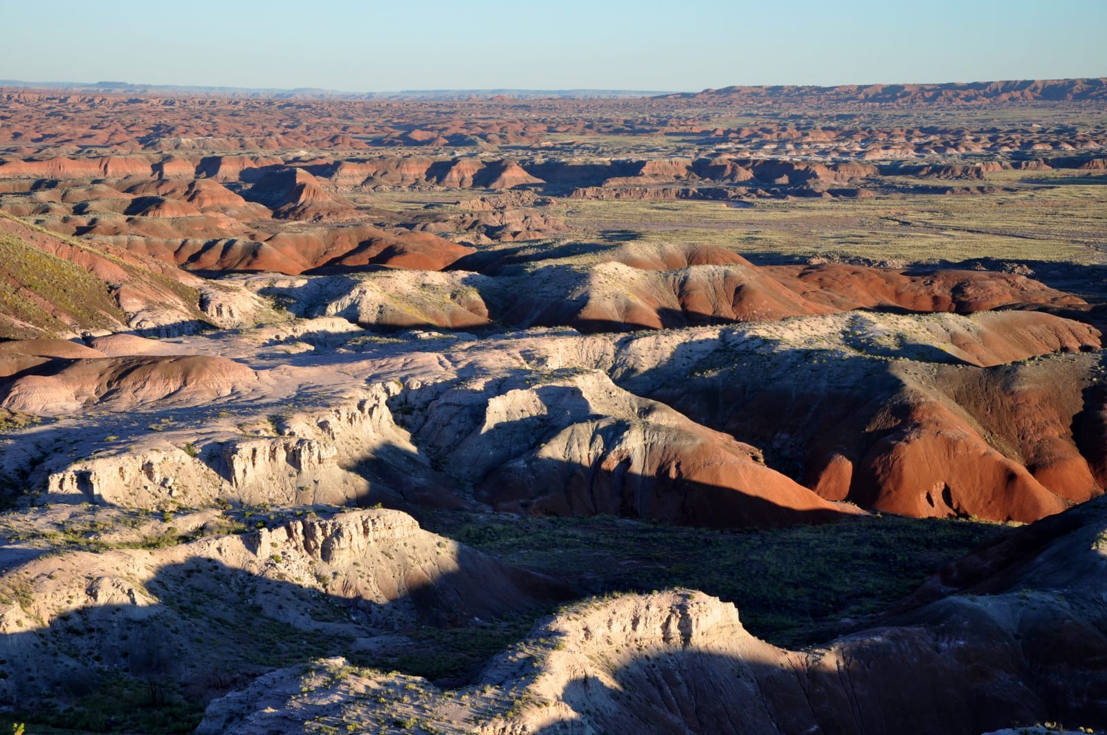
The longest surviving run of the Mother Road — east to west across Arizona, from the New Mexico line to the Colorado River, through petrified logs and Wigwam motels, the town that talked itself back to life, and the wild burros of Oatman.
4 days · 380 miles · best in spring & fall
Lupton, AZ (New Mexico line) → Topock, AZ (Colorado River / California line)
Arizona holds the longest surviving stretch of Route 66 in the country, and 2026 is the year to drive it — the Mother Road turned a hundred, and the towns that outlived the interstate spent the spring throwing it a birthday. This is the crossing east to west, from the New Mexico line at Lupton to the Colorado River at Topock: the painted badlands and stone logs of the Petrified Forest, the concrete tepees at Holbrook, a corner in Winslow, the ponderosa climb to Flagstaff, and then the long western half where the old alignment survives almost unbroken — Seligman, the caverns, Hackberry, Kingman, and the burros of Oatman. Four days is the honest length: enough to get off I-40 and onto the two-lane wherever it still runs, which out here is most of the way. The interstate made the road obsolete and the road refused to die. Slow down enough, and you can see why.
The drive, day by day
Press play to run the whole route, drag to any mile, or jump straight to a day. Every stop links to its own page.
Day 1 · Into Arizona: Painted Desert to Wigwam Village
Setting out from Lupton, AZ (New Mexico line) · first stop Petrified Forest National Park
0 / 380
miles
1
Day 1
Into Arizona: Painted Desert to Wigwam Village
90 mi · about 2 hrs driving · overnight in Holbrook
Cross the line at Lupton, and the first real stop is Petrified Forest National Park — the only national park Historic Route 66 runs straight through. The banded Painted Desert badlands sit in the north, the great stone log jams in the south, and a 28-mile road ties them together. Give it the morning; the gates close near sunset and there is no staying late. Then drop into Holbrook for the night, where the thing to do is sleep in a concrete tepee at the Wigwam Village, one of only three left in the country. The old town is small and worth a slow walk before dark.
2
Day 2
The Corner and the Climb: Winslow to Flagstaff
95 mi · about 2 hrs driving · overnight in Flagstaff
Winslow is a two-line town and worth every minute of it — the Standin' on the Corner park for the Eagles lyric, and La Posada, the last of the great Harvey House railroad hotels, restored and still taking guests. From there the road climbs: the country greens up, the ponderosa closes in, and just short of town the cliff dwellings of Walnut Canyon hang in a limestone gorge a short loop off the interstate. Flagstaff tops the day at nearly 7,000 feet, a railroad-and-university town where Route 66 is still the name of the street through downtown. Stay the night up high.
3
Day 3
The Road the Interstate Couldn't Kill: Williams to Kingman
150 mi · about 3.5 hrs driving · overnight in Kingman
Williams was the last Route 66 town anywhere bypassed by the interstate — I-40 did not reach it until 1984 — and it trades on that now, with the Grand Canyon Railway steaming north from its restored depot. (The Grand Canyon's South Rim is a 60-mile detour up SR-64 from here, worth a whole extra day if you have one.) West of Ash Fork the old alignment leaves the interstate for good and the best of the drive begins: Seligman, where the barber Angel Delgadillo — now in his late nineties, retired from the chair since 2022 but still turning up at the family gift shop — organized the businesses that talked Arizona into naming Historic Route 66; Grand Canyon Caverns, a Hualapai-owned elevator ride 21 stories down into the largest dry cavern in the country; Peach Springs, the Hualapai capital and the trailhead town for the long walk down to Havasupai; and the Hackberry General Store, a rust-and-neon shrine to the road. Sleep in Kingman.
4
Day 4
Over the Black Mountains: Oatman to the River
52 mi · about 2 hrs driving · overnight in Topock (cross into California)
The last leg is the slowest and the best preserved. Out of Kingman the Oatman Highway leaves the flats and climbs the Black Mountains in a series of switchbacks over Sitgreaves Pass, a genuine white-knuckle two-lane with drop-offs and, in places, no guardrail. It delivers you into Oatman, a gold-mining camp that refused to become a ghost town and reinvented itself around the wild burros that work its one street for hay pellets — descendants of the miners' pack animals, and now the closest thing the town has to landlords. Below Oatman the road runs down to Topock, meets the Colorado River, and crosses into California. That is the Arizona Mother Road, end to end.
The drives this trip follows
Each one is traced end to end on its own page, with every stop worth making along the way.