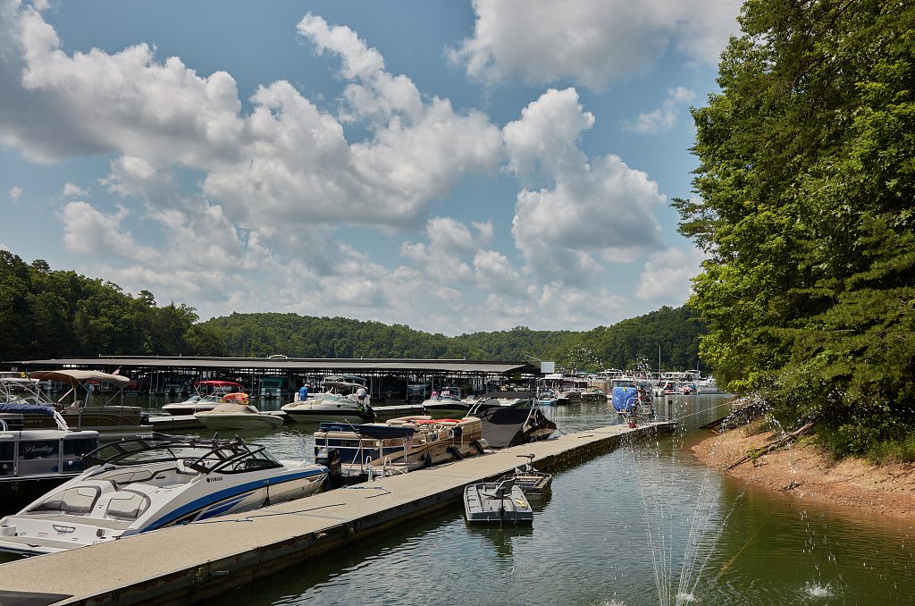
Boats tied along the docks of Grove Marina on Laurel River Lake near Corbin, with wooded shores and summer clouds over the Daniel Boone National Forest.
Carol M. Highsmith / public domain via Library of Congress
Kentucky · Region

Lake Cumberland & the Daniel Boone Country

Cumberland Falls and its moonbow, Lake Cumberland, Blue Heron's coal camp on the Big South Fork, Mill Springs battlefield, Boone's Trace at London and Renfro Valley.

10 places to explore

Shawnee, Cherokee and Chickasaw people knew this plateau long before Thomas Walker's party built a cabin near Barbourville in 1750, on Native land a Virginia company had been granted. The Warriors' Path ran north past Flat Lick, and Boone's Trace and the Wilderness Road followed it; at Levi Jackson Wilderness Road Park near London you can walk both, past the graves of the McNitt party, killed there in 1786.

The Cumberland River ties the rest together. It drops 68 feet at Cumberland Falls, saved from a power plan in 1930 and known for its moonbow, then backs up behind Wolf Creek Dam as Lake Cumberland, which pushed Burnside to higher ground. Above its banks Union troops won at Mill Springs in January 1862, and the 1877 Mill Springs Mill still grinds corn at the old Confederate crossing.

Down the Big South Fork, Stearns was the hub of a company that ran 18 coal and lumber camps, and at Blue Heron the people of Mine 18 tell their camp's story in their own recorded voices. Up the old US-25 corridor, Harland Sanders worked out his chicken at a roadside cafe in Corbin, and John Lair's Renfro Valley, home of the Coon Creek Girls, has put country music on the air since 1939, with the Kentucky Music Hall of Fame in his old stable.

What to See in Lake Cumberland & the Daniel Boone Country

10 places across the region, grouped by what they are.

Natural Areas
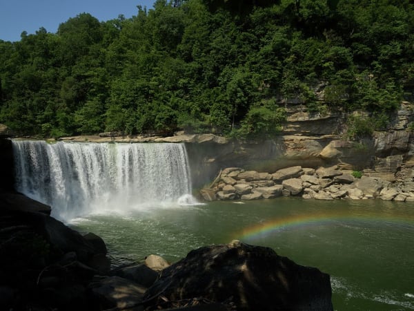
Cumberland Falls pouring over a wide sandstone ledge into a green pool, with a rainbow in the spray and wooded cliffs behind.

Cumberland Falls State Resort Park

Corbin

The 68-foot falls of the Cumberland River southwest of Corbin, saved from a power plan in 1930 and known for the moonbow that shows in its mist on clear full-moon nights.

View details →

Hikes & Trails

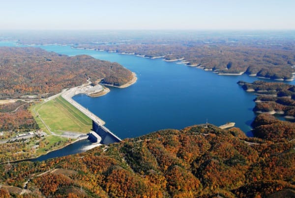
An aerial view of Wolf Creek Dam and Lake Cumberland in autumn, the long earthen and concrete dam holding back blue water between wooded ridges.

Lake Cumberland State Resort Park

Jamestown

A state park on the north shore of Lake Cumberland near Jamestown, on the reservoir Wolf Creek Dam made of the Cumberland River in the 1950s.

View details →

Historic Sites

Dr. Thomas Walker State Historic Site

Barbourville

A small state site south of Barbourville with a replica of the cabin Thomas Walker's party built in 1750, the first house built by settlers in what became Kentucky.

View details →
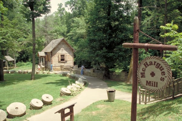
Old millstones line a path to the log McHargue's Mill in the woods of Levi Jackson Wilderness Road Park.

Levi Jackson Wilderness Road Park

London

A park south of London where walkable stretches of Boone's Trace and the Wilderness Road meet the 1786 McNitt Defeat burial ground, a pioneer museum and McHargue's Mill.

View details →
A split-rail fence along the crest of a grassy rise on the Mill Springs battlefield under a deep blue sky.

Mill Springs Battlefield National Monument

Nancy

The January 1862 battlefield at Nancy, west of Somerset, where Union troops under George Thomas broke the eastern end of the Confederate line across Kentucky.

View details →
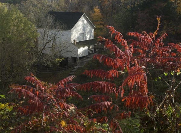
The white frame Mill Springs Mill on a wooded hillside above Lake Cumberland, seen past red autumn sumac.

Mill Springs Mill

Monticello

An 1877 gristmill with a 40-foot overshot wheel on the south shore of Lake Cumberland in Wayne County, beside the Confederate ferry landing of the Mill Springs campaign.

View details →

Towns & Gateways

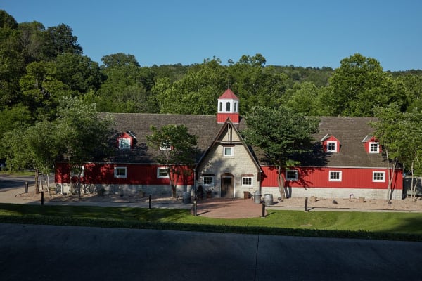
The Kentucky Music Hall of Fame in Renfro Valley, a long red former stable with a stone gabled entrance and a white cupola, under wooded hills.

Renfro Valley and the Kentucky Music Hall of Fame

Mount Vernon

John Lair's barn-dance valley off I-75 at Mount Vernon, broadcasting country music since 1939, with the Kentucky Music Hall of Fame in his old riding stable.

View details →

Industry & Mining

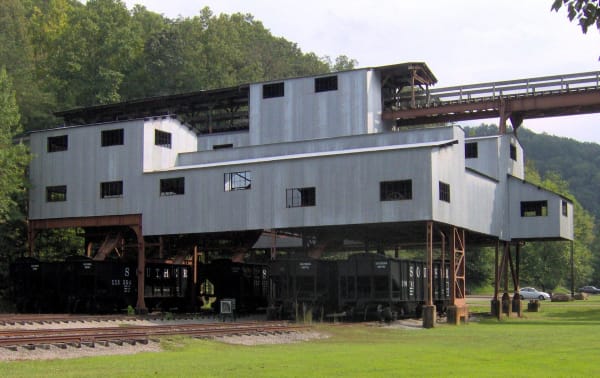
The restored metal coal tipple at Blue Heron stands over a row of hopper cars against wooded hills.

Blue Heron Mining Community

Stearns

Stearns Coal and Lumber's Mine 18 on the Big South Fork, a coal camp from 1937 to 1962 told through open 'ghost structures' and the recorded voices of the people who lived there.

View details →
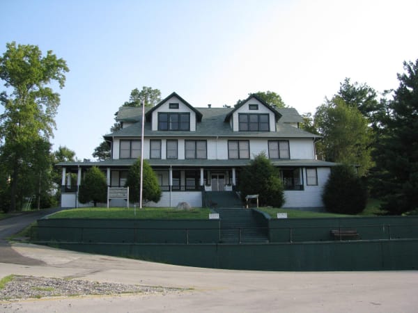
The white two-story former Stearns Coal and Lumber Company office, now the McCreary County Museum, above a terraced lawn and steps.

Stearns and the McCreary County Museum

Stearns

The Stearns Coal and Lumber Company's town on US-27, with its 1907 headquarters now the county museum and the depot where the Big South Fork Scenic Railway leaves for Blue Heron.

View details →

Food & Drink

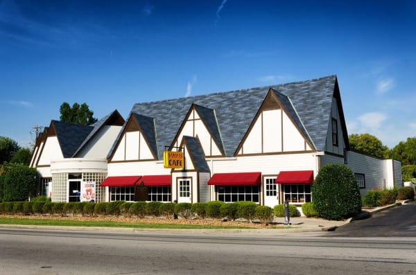
The white Sanders Cafe in North Corbin, with steep gabled rooflines, red awnings and a yellow Sanders Cafe sign beside the road.

Harland Sanders Cafe and Museum

Corbin

The 1940 roadside cafe and motel on old US-25 in North Corbin where Harland Sanders worked out his fried chicken, now a museum with a working KFC attached.

View details →

Lake Cumberland & the Daniel Boone Country rewards the unhurried. Pick a base, fan out, and let the country between the headline stops surprise you.

← Explore more of Open Road Guide