Home / Kentucky / Lake Cumberland & the Daniel Boone Country / Stearns and the McCreary County Museum
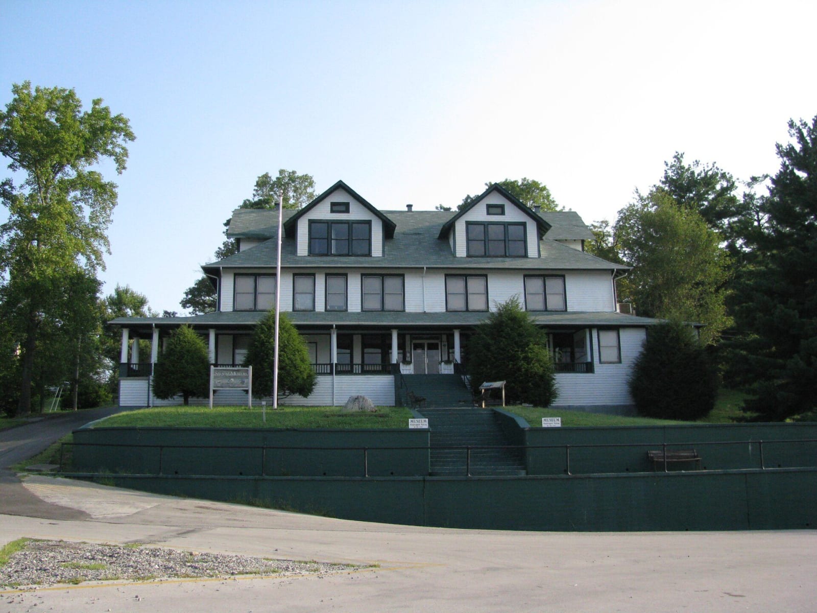
The white two-story former Stearns Coal and Lumber Company office, now the McCreary County Museum, above a terraced lawn and steps.Kybluegrass / CC BY-SA 3.0 via Wikimedia Commons
🏭Industrial

Stearns and the McCreary County Museum

Part ofLake Cumberland & the Daniel Boone Country

The Stearns Coal and Lumber Company's town on US-27, with its 1907 headquarters now the county museum and the depot where the Big South Fork Scenic Railway leaves for Blue Heron.

⏱
Duration
One hour for the museum; three hours with the train to Blue Heron and back.
🎟
Admission
The museum and the railway charge admission; see their sites for current rates.
📅
Best Season
Spring through fall, when the train runs.

The Story

In 1902 Justus S. Stearns, a lumberman from Ludington, Michigan, bought about 30,000 acres of uncut forest in southern Kentucky. Coal turned up soon after, and the Stearns Coal and Lumber Company built this town as the hub of an operation that came to control more than 200 square miles. At its height the company employed more than 2,200 people in 18 coal and lumber camps, and its own short line, the Kentucky and Tennessee Railway, ran more than 25 miles down into the Big South Fork valley with a dozen steam engines.

Stearns was a company town in full. The business district was painted the company's sage green with white trim, and company houses got water, electricity and steam heat; the company also built a golf course, tennis courts and a ball field. The headquarters, finished in 1907, now holds the McCreary County Museum, with the company president's office kept as it was, exhibits on logging, mining and moonshine, and a room for Wilburn K. Ross, the Medal of Honor recipient whose name the highway through town carries. The commercial district is on the National Register.

The company closed several mines in the 1950s and sold its last mining operations to Blue Diamond in the mid-1970s, and coal mining along the K and T ended in 1987. Much of the land went to the national forest and the Big South Fork. The Big South Fork Scenic Railway leaves from the depot beside the museum for a 45-minute ride down to Blue Heron.

Visitor Info

⏱
Time Needed
One hour for the museum; three hours with the train to Blue Heron and back.
🎟
Admission
The museum and the railway charge admission; see their sites for current rates.
📅
Best Season
Spring through fall, when the train runs.
🛣️
Highway
US-27

On the Map

Nearby

The closest stops worth working into your route

industrial4.4 mi away
Blue Heron Mining Community
Stearns Coal and Lumber's Mine 18 on the Big South Fork, a coal camp from 1937 to 1962 told through open 'ghost structures' and the recorded voices of the people who lived there.
natural12 mi away
Cumberland Falls State Resort Park
The 68-foot falls of the Cumberland River southwest of Corbin, saved from a power plan in 1930 and known for the moonbow that shows in its mist on clear full-moon nights.
natural19 mi away
Big South Fork National River and Recreation Area at Bandy Creek
The Tennessee gateway to a 125,000-acre Cumberland Plateau river gorge, from the Bandy Creek Visitor Center near Oneida, with Twin Arches and the old No Business country.
natural20 mi away
Pickett CCC Memorial State Park
A Civilian Conservation Corps park of sandstone buildings, natural bridges and rock shelters beside the Big South Fork, and an International Dark Sky Park.
historical23 mi away
Mill Springs Mill
An 1877 gristmill with a 40-foot overshot wheel on the south shore of Lake Cumberland in Wayne County, beside the Confederate ferry landing of the Mill Springs campaign.
culinary28 mi away
Harland Sanders Cafe and Museum
The 1940 roadside cafe and motel on old US-25 in North Corbin where Harland Sanders worked out his fried chicken, now a museum with a working KFC attached.

Historical markers nearby

Roadside plaques and monuments within a short detour

Marker1.9 mi away
First Kentucky Oil Well
Whitley City
Marker1.9 mi away
McCreary County, 1912
Whitley City
Marker3.3 mi away
Edward "Eddie" Ward
Pine Knot
Marker17 mi away
Cumberland College
Williamsburg
Marker17 mi away
Roy Martis Chappell
Williamsburg
Marker18 mi away
Gillespie Hall
Williamsburg