Home / Kentucky / Lake Cumberland & the Daniel Boone Country / Blue Heron Mining Community
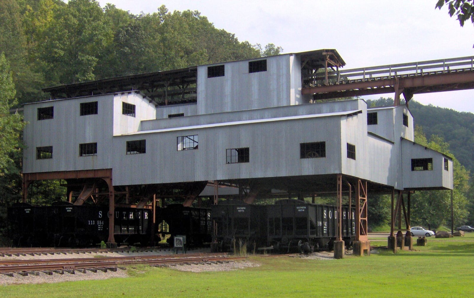
The restored metal coal tipple at Blue Heron stands over a row of hopper cars against wooded hills.Brian Stansberry / CC BY 3.0 via Wikimedia Commons
🏭Industrial

Blue Heron Mining Community

Part ofLake Cumberland & the Daniel Boone Country

Stearns Coal and Lumber's Mine 18 on the Big South Fork, a coal camp from 1937 to 1962 told through open 'ghost structures' and the recorded voices of the people who lived there.

⏱
Duration
One to two hours; half a day with the train.
🎟
Admission
Free (NPS).
📅
Best Season
Year round for the outdoor exhibits; the interpretive center and the train from Stearns run from late May through October.

The Story

Blue Heron sits at the bottom of the Big South Fork gorge in McCreary County, at the end of a winding road from Stearns. It was the Stearns Coal and Lumber Company's Mine 18, and from 1937 until December 1962 hundreds of people lived and worked here beside the river, in a camp of some 22 houses with a church, a school, a company store and a bathhouse. When the mine stopped paying, the company closed it and the buildings were hauled off or left to rot.

When the National Park Service took on the site for the Big South Fork National River and Recreation Area, nothing stood but the steel tipple and its bridge over the river. Rather than rebuild a town that was never meant to last, the park put up open metal frames, the ghost structures, on the old footprints in the 1980s. Each one takes a theme, the school, the church, courtship and marriage, women's work, moving away, and holds photographs, everyday objects and recordings.

The recordings are the reason to come. Former residents, the Slavens, Waterses, Davises, Ledbetters, Wrights and others, talk about the mine, the company store, women's work, courtship, church and school, and leaving when the mine shut. Start at the depot, which has a model of the camp in the 1950s, then walk the tipple bridge. The Big South Fork Scenic Railway runs down from Stearns in season and waits about an hour before it climbs back.

Visitor Info

⏱
Time Needed
One to two hours; half a day with the train.
🎟
Admission
Free (NPS).
📅
Best Season
Year round for the outdoor exhibits; the interpretive center and the train from Stearns run from late May through October.
🛣️
Highway
KY-742

On the Map

Nearby

The closest stops worth working into your route

industrial4.4 mi away
Stearns and the McCreary County Museum
The Stearns Coal and Lumber Company's town on US-27, with its 1907 headquarters now the county museum and the depot where the Big South Fork Scenic Railway leaves for Blue Heron.
natural15 mi away
Big South Fork National River and Recreation Area at Bandy Creek
The Tennessee gateway to a 125,000-acre Cumberland Plateau river gorge, from the Bandy Creek Visitor Center near Oneida, with Twin Arches and the old No Business country.
natural16 mi away
Cumberland Falls State Resort Park
The 68-foot falls of the Cumberland River southwest of Corbin, saved from a power plan in 1930 and known for the moonbow that shows in its mist on clear full-moon nights.
natural16 mi away
Pickett CCC Memorial State Park
A Civilian Conservation Corps park of sandstone buildings, natural bridges and rock shelters beside the Big South Fork, and an International Dark Sky Park.
historical22 mi away
Mill Springs Mill
An 1877 gristmill with a 40-foot overshot wheel on the south shore of Lake Cumberland in Wayne County, beside the Confederate ferry landing of the Mill Springs campaign.
historical25 mi away
Sgt. Alvin C. York State Historic Park
The Wolf River valley farm, gristmill and grave of Alvin York, the conscientious objector turned Medal of Honor soldier, now a National Historic Landmark district.

Historical markers nearby

Roadside plaques and monuments within a short detour

Marker5.7 mi away
First Kentucky Oil Well
Whitley City
Marker5.7 mi away
McCreary County, 1912
Whitley City
Marker6 mi away
Edward "Eddie" Ward
Pine Knot
Marker18 mi away
Divided Loyalties: Scott County in the Civil War
Huntsville, Tennessee
Marker18 mi away
Independent State of Scott
Huntsville, Tennessee
Marker21 mi away
Price's Meadow
Monticello