Home / Kentucky / Lake Cumberland & the Daniel Boone Country / Mill Springs Mill
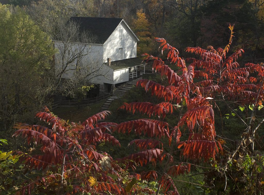
The white frame Mill Springs Mill on a wooded hillside above Lake Cumberland, seen past red autumn sumac.U.S. Army Corps of Engineers Nashville District / CC BY-SA 2.0 via Flickr
🏛️Historical

Mill Springs Mill

Part ofLake Cumberland & the Daniel Boone Country

An 1877 gristmill with a 40-foot overshot wheel on the south shore of Lake Cumberland in Wayne County, beside the Confederate ferry landing of the Mill Springs campaign.

⏱
Duration
Thirty minutes to an hour.
🎟
Admission
Free; cornmeal is sold when the mill runs.
📅
Best Season
Late spring through October, when the mill grinds on weekends.

The Story

Thirteen springs come out of the hillside here above the Cumberland, and they have turned millstones at this spot since the early 1800s. The present mill dates from 1877: three stories of frame on a stone basement, 40 feet square, set into the slope above the river. It started with a 28-foot wooden wheel. After the mill was sold in 1907 the owners put in the wheel that stands now, 40 feet high and three feet across.

The springs also explain why armies came. In November 1861 Felix Zollicoffer made this landing the southern anchor of his winter position, fortified it, and used a ferry to move men and supplies across to his camp at Beech Grove on the north bank. The nearby Brown-Lanier House served as a Confederate headquarters, and the West-Metcalfe House was a supply depot and then a field hospital. After the defeat of January 19, 1862, the army crossed back to the south bank by night, abandoning its camp, and went on into Tennessee.

The river became Lake Cumberland in the 1950s, and the U.S. Army Corps of Engineers restored the mill in 1976 as the centerpiece of its Mill Springs Park. The mill is on the National Register, and the landing and mill site are now part of Mill Springs Battlefield National Monument. On weekends in season the wheel turns again and the mill grinds corn.

Visitor Info

⏱
Time Needed
Thirty minutes to an hour.
🎟
Admission
Free; cornmeal is sold when the mill runs.
📅
Best Season
Late spring through October, when the mill grinds on weekends.
🛣️
Highway
KY-1275

On the Map

Nearby

The closest stops worth working into your route

historical9.5 mi away
Mill Springs Battlefield National Monument
The January 1862 battlefield at Nancy, west of Somerset, where Union troops under George Thomas broke the eastern end of the Confederate line across Kentucky.
recreational14 mi away
Lake Cumberland State Resort Park
A state park on the north shore of Lake Cumberland near Jamestown, on the reservoir Wolf Creek Dam made of the Cumberland River in the 1950s.
industrial22 mi away
Blue Heron Mining Community
Stearns Coal and Lumber's Mine 18 on the Big South Fork, a coal camp from 1937 to 1962 told through open 'ghost structures' and the recorded voices of the people who lived there.
industrial23 mi away
Stearns and the McCreary County Museum
The Stearns Coal and Lumber Company's town on US-27, with its 1907 headquarters now the county museum and the depot where the Big South Fork Scenic Railway leaves for Blue Heron.
natural25 mi away
Cumberland Falls State Resort Park
The 68-foot falls of the Cumberland River southwest of Corbin, saved from a power plan in 1930 and known for the moonbow that shows in its mist on clear full-moon nights.
natural26 mi away
Pickett CCC Memorial State Park
A Civilian Conservation Corps park of sandstone buildings, natural bridges and rock shelters beside the Big South Fork, and an International Dark Sky Park.

Historical markers nearby

Roadside plaques and monuments within a short detour

Marker1.2 mi away
West-Metcalfe House
Mill Springs
Marker1.3 mi away
Price's Meadow
Monticello
Marker10 mi away
Burnside
Burnside
Marker10 mi away
Harriette Simpson Arnow
Burnside
Marker14 mi away
Town Spring
Somerset
Marker15 mi away
Morgan's First Raid
Somerset