Home / Texas / Georgetown, Corsicana & the Blackland Prairie / The Round Rock
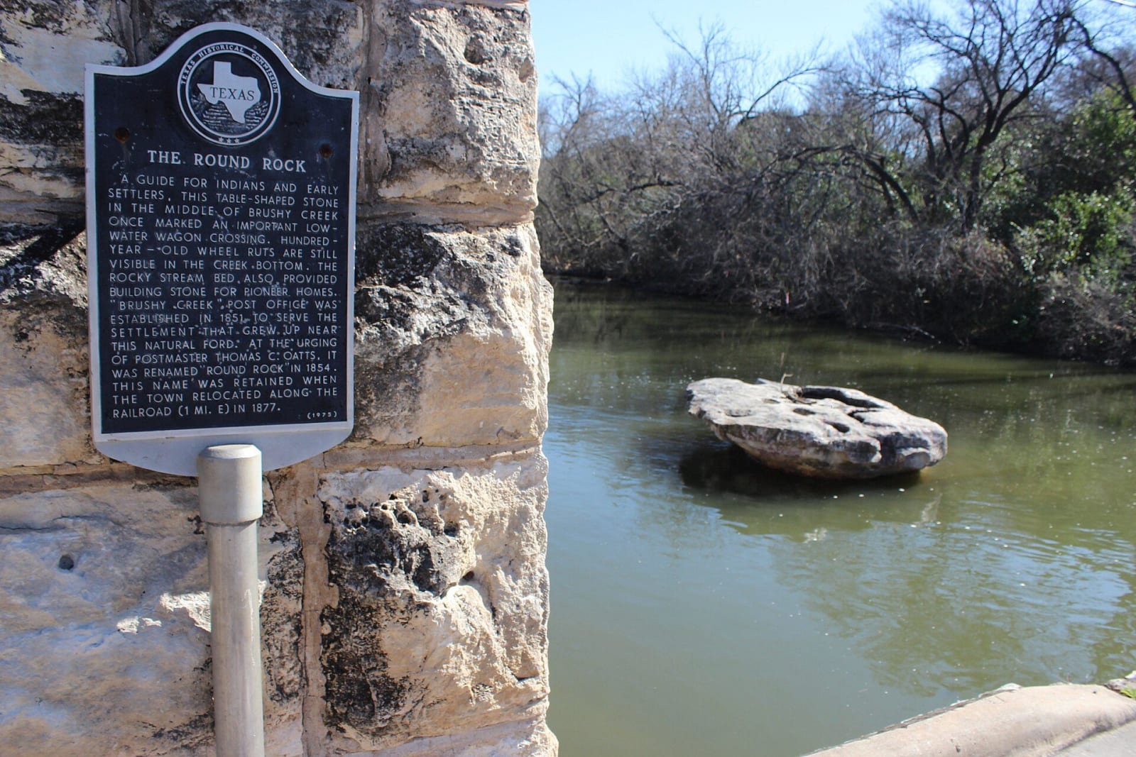
The flat limestone Round Rock sitting in the green water of Brushy Creek, beside the stone bridge pier carrying the Texas Historical Commission marker.Darrylpearson / CC BY-SA 4.0 via Wikimedia Commons
🏛️Historical

The Round Rock

Part ofGeorgetown, Corsicana & the Blackland Prairie

A table-shaped stone in Brushy Creek gave Round Rock its name in 1854; the Chisholm Trail crossed the creek near it, and Old Town stayed behind when the railroad pulled the town east.

⏱
Duration
About 30 minutes.
🎟
Admission
None; the marker is not on private property, per the Texas Historical Commission.
📅
Best Season
Year round. Brushy Creek can run high after heavy rain.

The Story

The rock is a table-shaped stone in the middle of Brushy Creek. The Texas Historical Commission marker, put up in 1975, says it identified a low-water wagon crossing, with wheel ruts in the creek bed, and that the rocky streambed supplied building stone for pioneer homes. A post office called Brushy Creek opened in 1851. Thomas C. Oatts urged the name Round Rock in 1854, and the Handbook gives August 24, 1854, for the change.

The Handbook says Oatts and Jacob Harrell, who opened a blacksmith shop in 1848, suggested the name because they often fished from a large anvil-shaped limestone rock in the creek. Cattle drivers bound for Kansas followed the Chisholm Trail across Brushy Creek near the rock, and the street through Old Town was later renamed Chisholm Trail. The marker sits on a limestone bridge support on that road.

The railroad arrived in 1876, and the town moved about a mile east along it by 1877. Old Town's early buildings included the Harris Stagecoach Inn of 1848 and Oatts's store and post office of 1851. Sam Bass was shot in Round Rock on July 19, 1878, died July 21 and was buried in the Round Rock Cemetery; our marker for Ranger R. C. Dick Ware tells that shooting.

Visitor Info

⏱
Time Needed
About 30 minutes.
🎟
Admission
None; the marker is not on private property, per the Texas Historical Commission.
📅
Best Season
Year round. Brushy Creek can run high after heavy rain.
🛣️
Highway
RM 620 / Chisholm Trail Road

On the Map

Nearby

The closest stops worth working into your route

geological6.5 mi away
Inner Space Cavern
A Georgetown cave found in 1963 when highway engineers drilled test holes, holding Pleistocene fossils and 72-degree rooms that visitors reach by an artificial tunnel.
architectural8.6 mi away
Williamson County Courthouse
The fifth Williamson County courthouse, a Beaux Arts building by C. H. Page, rises over a Georgetown square of more than 50 Victorian-era buildings.
natural14 mi away
Mount Bonnell
Austin's old lookout over the Colorado, named by an 1838 traveler, picnicked on by George and Libbie Custer, and reached by a 1939 flight of about 100 limestone steps.
historical16 mi away
LBJ Presidential Library
A ten-story travertine archive on the University of Texas campus holding 45 million pages from a presidency of civil rights laws, the War on Poverty and Vietnam.
cultural16 mi away
Harry Ransom Center
The University of Texas archive where a Gutenberg Bible and the earliest surviving camera photograph are always on view, free, beside the papers of Watergate and the movies.
historical16 mi away
Bullock Texas State History Museum
The state's history museum at the head of Congress Avenue, built around the hull of La Salle's ship La Belle, raised from Matagorda Bay with 1.8 million artifacts.

Historical markers nearby

Roadside plaques and monuments within a short detour

Marker0 mi away
The Round Rock
Round Rock
Marker0.5 mi away
Education in Round Rock
Round Rock
Marker0.5 mi away
In Memory of The Pioneer Builders
Round Rock
Marker0.5 mi away
Round Rock Cemetery
Round Rock
Marker0.6 mi away
Slave Burial Ground in Old Round Rock Cemetery
Round Rock
Marker0.7 mi away
Sam Bass' Death Site
Round Rock