Home / California / San Fernando & Santa Clarita Valleys / St. Francis Dam Disaster Site
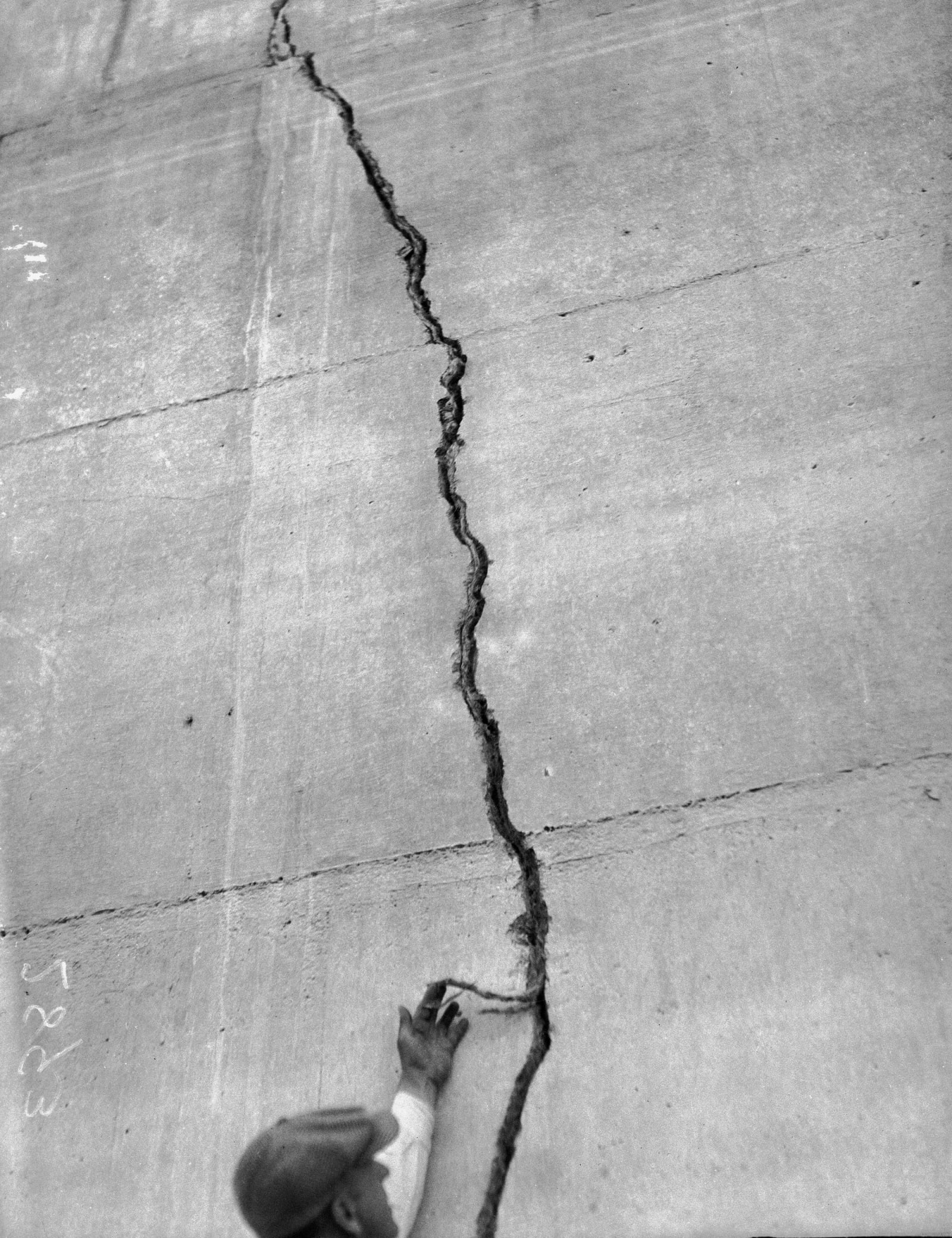
A man reaching up to a crack running down a concrete face of the St. Francis Dam, photographed after the March 1928 collapse.Los Angeles Daily News / CC BY 4.0 via Wikimedia Commons
πŸ›οΈHistorical

St. Francis Dam Disaster Site

Part ofSan Fernando & Santa Clarita Valleys

The dam failed just before midnight on March 12, 1928, and the flood ran fifty miles down the canyon to the sea.

⏱
Duration
Thirty minutes to an hour at the site.
πŸ“…
Best Season
Year round; the canyon road has been closed by fire and storm damage before, so check ahead.

The Story

William Mulholland put this dam in San Francisquito Canyon because the aqueduct feeding Los Angeles crossed the San Andreas Fault and he wanted a reserve the city could not lose. It was finished in 1926. On the morning of March 12, 1928 the dam keeper, Tony Harnischfeger, reported muddy water leaking near the western abutment. Mulholland drove out, spent two hours on it, and concluded the silt was coming from road work nearby. The dam went just before midnight.

Twelve billion gallons came down the canyon and did not stop until the Pacific at Oxnard, some five hours and better than fifty miles later. The official death toll settled around four hundred and fifty. The real figure is unknown, because bodies went out to sea and a great many of the dead were migrant farm workers nobody had counted to begin with; remains were still being found in the 1990s. It is the second deadliest dam failure in American history and the worst civil engineering failure this country had in the twentieth century. The coroner's jury brought no charges but said plainly that no one man, however eminent, should be left to judge a municipal dam alone. Mulholland's career ended on that sentence. Blocks of the dam weighing thousands of tons still lie in the canyon below the site.

Visitor Info

⏱
Time Needed
Thirty minutes to an hour at the site.
πŸ“…
Best Season
Year round; the canyon road has been closed by fire and storm damage before, so check ahead.
πŸ›£οΈ
Highway
San Francisquito Canyon Rd., off I-5

On the Map

Nearby

The closest stops worth working into your route

historical11 mi away
Oak of the Golden Dream
Gold was found in California here in 1842, six years before Sutter's Mill, and the oak it was found under is still standing.
industrial11 mi away
Pioneer Oil Refinery
The first commercially successful refinery in the West, built in 1876 to take the crude coming down the pipeline from Pico Canyon.
industrial12 mi away
Mentryville and Pico Canyon
A company town in a canyon, and a mile and a half further up the road, the well that started the California oil industry.
geological12 mi away
Vasquez Rocks
Sandstone beds stood on end by the fault underneath, on Tataviam ground, named for a man the county hanged.
industrial15 mi away
The Cascades
The concrete chute where the Los Angeles Aqueduct arrives, and where forty thousand people watched the Owens Valley come south in 1913.
historical18 mi away
Mission San Fernando Rey de EspaΓ±a
The seventeenth Alta California mission, founded at the Tataviam village of Achoicominga, with the largest adobe building in the state standing beside it.

Historical markers nearby

Roadside plaques and monuments within a short detour

Marker0 mi away
St. Francis Dam Disaster Site
Santa Clarita
Marker8 mi away
Rancho San Francisco
Valencia
Marker11 mi away
Lang
Santa Clarita
Marker11 mi away
Oak of the Golden Dream
Newhall
Marker11 mi away
Pioneer Oil Refinery
Santa Clarita
Marker12 mi away
Mentryville
Newhall