Home / Texas / Brownsville, McAllen & the Lower Rio Grande Valley / Santa Ana National Wildlife Refuge
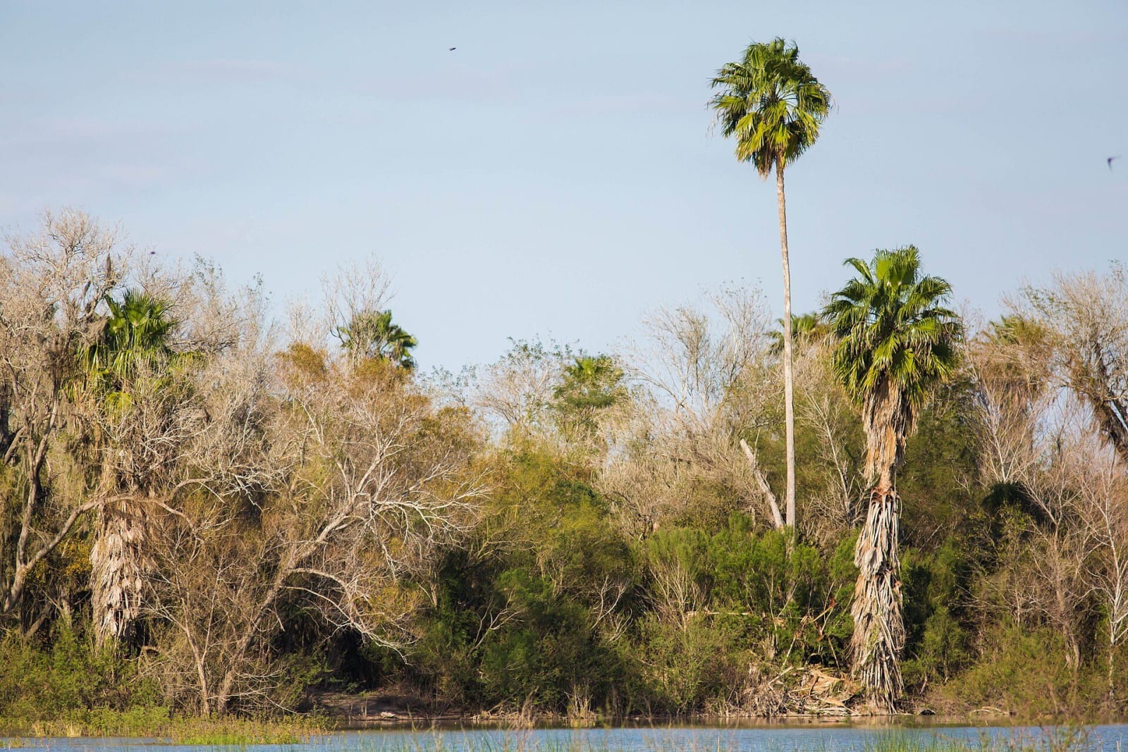
Tall Texas sabal palms and leafless brush rising above a lake edge in Santa Ana National Wildlife Refuge under a pale blue sky.cricketsblog (Melissa McMasters) / CC BY 2.0 via Wikimedia Commons
🌲Natural

Santa Ana National Wildlife Refuge

Part ofBrownsville, McAllen & the Lower Rio Grande Valley

About 2,000 acres of river forest on the Rio Grande's north bank, the surviving part of Benigno Leal's 1834 land grant, kept as a refuge since 1943 where two bird migration routes meet.

⏱
Duration
Two to four hours.
🎟
Admission
Per-vehicle fee, free on the first Sunday of each month; free for school groups.
📅
Best Season
Trails open sunrise to sunset daily; visitor center Tuesday to Saturday in winter. Mornings before 10 a.m. and late afternoons are best; summers are hot and humid.

The Story

In 1834 Mexico granted Benigno Leal about fifteen square miles on the north bank of the Rio Grande. He made his headquarters, Rancho de Adentro, and a cemetery here. The grant was later merged with neighbouring land as the Alamo Tract, and between 1910 and 1930 the Louisiana and Rio Grande Canal Company cleared the tract for farms. The southern end kept its river forest, and the United States bought it in 1943 as a sanctuary for migratory birds.

The refuge is 2,088 acres. It lies where two major migration routes meet and at the northern limit of many species that range south into Central and South America, so a morning here can turn up birds that cannot be seen elsewhere in the country. The Fish and Wildlife Service counts nearly 500 bird species and 300 butterflies. Congress left the refuge out of border barrier funding in 2018, and the 2019 spending bill again barred fencing at it and several other Valley landmarks.

The visitor center is at 3325 Green Jay Road in Alamo. Trails run from the 0.2-mile boardwalk of the Malachite Trail to the Owl Trail, which leads to the Cementerio Viejo, the old cemetery. A 40-foot tower on the Tower Trail looks over the canopy, and a seasonal winter tram runs on the paved auto-tour loop. Admission is charged per vehicle and is free on the first Sunday of each month. Pets are not allowed, and the heat is the main hazard from spring through fall.

Visitor Info

⏱
Time Needed
Two to four hours.
🎟
Admission
Per-vehicle fee, free on the first Sunday of each month; free for school groups.
📅
Best Season
Trails open sunrise to sunset daily; visitor center Tuesday to Saturday in winter. Mornings before 10 a.m. and late afternoons are best; summers are hot and humid.
🛣️
Highway
FM 907 / Old Military Highway

On the Map

Nearby

The closest stops worth working into your route

historical13 mi away
La Lomita Chapel
A small sandstone chapel on the Rio Grande levee, built by Oblate missionaries in 1865 and rebuilt at this site in 1899, the landmark that gave the city of Mission its name.
cultural15 mi away
Museum of South Texas History
Edinburg's regional museum, begun in 1967 in the 1910 Hidalgo County jail and now telling the Rio Grande's story from fossils and native peoples through steamboats to the 20th century.
natural17 mi away
Bentsen-Rio Grande Valley State Park
A 587-acre stand of Rio Grande woodland near Mission, once part of a Spanish porción, given to the state by the Bentsen family in 1944 and now headquarters of the World Birding Center.
historical41 mi away
Palo Alto Battlefield National Historical Park
A flat coastal prairie north of Brownsville where Taylor's army and Arista's Army of the North fought the first major battle of the Mexican War on May 8, 1846, now interpreted from both sides.
historical42 mi away
Stillman House Museum
The 1850 Greek Revival house of Charles Stillman, who laid out Brownsville in 1848 beside the army's Fort Brown, and for a century the home of the Treviño family.
natural50 mi away
Laguna Atascosa National Wildlife Refuge
A coastal refuge set up in 1946 for wintering redhead ducks, with 417 bird species recorded and, by the Fish and Wildlife Service's account, the largest ocelot population in the United States.

Historical markers nearby

Roadside plaques and monuments within a short detour

Marker3.1 mi away
Jackson Ranch Church
Pharr
Marker4.2 mi away
Louisiana-Rio Grande Canal Company
Pharr
Marker4.3 mi away
Run
Donna
Marker4.6 mi away
Donna Public Schools
Donna
Marker7.1 mi away
1940 Train-Truck Collision
Alamo
Marker7.1 mi away
Camp Ebenezer
Alamo