Home / Texas / Brownsville, McAllen & the Lower Rio Grande Valley / Laguna Atascosa National Wildlife Refuge
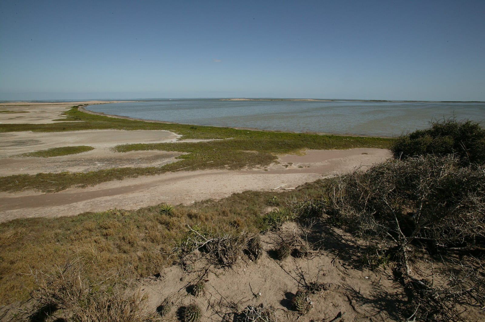
A wide view of the Bahia Grande shore at Laguna Atascosa, with a grassy sand flat curving along shallow water under a clear blue sky and thorny brush in the foreground.Steve Hillebrand / U.S. Fish and Wildlife Service / public domain via Wikimedia Commons
🌲Natural

Laguna Atascosa National Wildlife Refuge

Part ofBrownsville, McAllen & the Lower Rio Grande Valley

A coastal refuge set up in 1946 for wintering redhead ducks, with 417 bird species recorded and, by the Fish and Wildlife Service's account, the largest ocelot population in the United States.

⏱
Duration
Half a day.
🎟
Admission
Per-vehicle entrance fee, paid on Recreation.gov; free for school groups.
πŸ“…
Best Season
Open sunrise to sunset every day. Visitor center Tuesday through Friday, 8 a.m. to 3 p.m. Dawn to 9:30 a.m. and late afternoon are best; winter is the waterfowl season.

The Story

Laguna Atascosa was established in 1946 to give wintering waterfowl, mainly redhead ducks, a place to feed on the Texas coast. The refuge's own count of 417 recorded bird species is, by its account, more than any other national wildlife refuge. It also holds what the Fish and Wildlife Service calls the largest population of ocelots in the United States. The cats hunt in the brushlands, and aplomado falcons hunt over the grasslands.

The refuge grew by large purchases. In 2000 it took in the Bahia Grande Unit, 21,700 acres of which almost half is wetland, around a 6,500-acre basin. That year the Nature Conservancy bought 24,532 acres on South Padre Island, later transferred to the refuge, which now includes more than eight miles of beach. Managed archery hunts began in 1970 and firearm hunts in 1979.

The visitor center is at 22817 Ocelot Road in Los Fresnos, with feeding stations and short paved trails. The Steve Thompson Wildlife Drive is a 14.2-mile loop, mostly paved, that suits a bicycle; Lakeside Drive runs 1.5 miles of caliche to a 3,500-acre freshwater lake and Osprey Overlook, the only driving trail on the refuge. About twenty trails in all run from 0.3 mile to more than six miles. Trails stay open from sunrise to sunset every day of the year, and the refuge advises coming from dawn to 9:30 a.m. or after 4:30 p.m., when animals are active. Binoculars can be rented at the visitor center.

Visitor Info

⏱
Time Needed
Half a day.
🎟
Admission
Per-vehicle entrance fee, paid on Recreation.gov; free for school groups.
πŸ“…
Best Season
Open sunrise to sunset every day. Visitor center Tuesday through Friday, 8 a.m. to 3 p.m. Dawn to 9:30 a.m. and late afternoon are best; winter is the waterfowl season.
πŸ›£οΈ
Highway
FM 106

On the Map

Nearby

The closest stops worth working into your route

historical14 mi away
Port Isabel Lighthouse State Historic Site
A 72-foot brick tower finished in 1852 for the Brazos Santiago shipping lane, dark from 1905 until a reproduction lens was lit in 2022, and the only Texas lighthouse open to the public.
historical18 mi away
Palo Alto Battlefield National Historical Park
A flat coastal prairie north of Brownsville where Taylor's army and Arista's Army of the North fought the first major battle of the Mexican War on May 8, 1846, now interpreted from both sides.
historical24 mi away
Stillman House Museum
The 1850 Greek Revival house of Charles Stillman, who laid out Brownsville in 1848 beside the army's Fort Brown, and for a century the home of the TreviΓ±o family.
natural50 mi away
Santa Ana National Wildlife Refuge
About 2,000 acres of river forest on the Rio Grande's north bank, the surviving part of Benigno Leal's 1834 land grant, kept as a refuge since 1943 where two bird migration routes meet.
cultural51 mi away
Museum of South Texas History
Edinburg's regional museum, begun in 1967 in the 1910 Hidalgo County jail and now telling the Rio Grande's story from fossils and native peoples through steamboats to the 20th century.
historical61 mi away
La Lomita Chapel
A small sandstone chapel on the Rio Grande levee, built by Oblate missionaries in 1865 and rebuilt at this site in 1899, the landmark that gave the city of Mission its name.

Historical markers nearby

Roadside plaques and monuments within a short detour

Marker14 mi away
Port of Matamoros
Port Isabel
Marker14 mi away
Port Isabel (Old Point Isabel)
Port Isabel
Marker14 mi away
Point Isabel, C.S.A.
Port Isabel
Marker14 mi away
Charles Champion
Port Isabel
Marker14 mi away
Queen Isabel Inn
Port Isabel
Marker16 mi away
Stagecoach to the Rio Grande, C.S.A.
Rio Hondo