Home / Colorado / The San Juans & the Black Canyon / Red Mountain Mining District
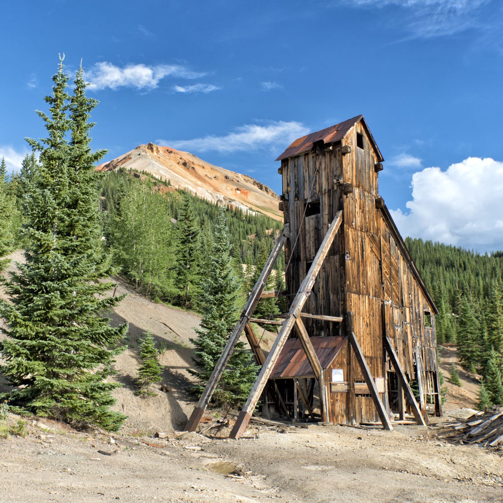
The wooden headframe of the Yankee Girl mine below a red-stained peak near Red Mountain PassJohn Fowler / CC BY 2.0 via Wikimedia Commons
🏛️Historical

Red Mountain Mining District

Part ofThe San Juans & the Black Canyon
On this driveUS-550: Durango to Ouray over the Million Dollar Highway

Three iron-red peaks above Red Mountain Pass, the 1882 Yankee Girl and its headframe, and a boom town that went up in five weeks in 1883.

Scenic DrivingPhotographyMining BoomGhost TownsFree
⏱
Duration
An hour at the overlooks.
🎟
Admission
Free.
📅
Best Season
Summer and fall; US 550 is open all year but avalanche-prone.

The Story

North of Red Mountain Pass, US 550 drops past three peaks named Red Mountain, their slopes stained orange, red and yellow by oxidized iron in rock altered long ago by hot mineral water. In 1882 the prospector John Robinson found a huge pipe of silver ore below them and staked the Yankee Girl claim; its shaft went nearly straight down about 1,200 feet, and for a time it ranked among the richest mines in the country. Its wooden headframe still stands beside the highway, the most photographed relic in the district.

Six camps crowded into less than eight square miles: Red Mountain Town, Ironton, Guston and others. In March 1883 the Ouray newspaper the Solid Muldoon reported that the site of Red Mountain Town had been spruce forest five weeks before and now had hotels, a printing office, stores, a telephone office, saloons and dance halls. The first train of the Silverton Railroad reached the town on September 17, 1888. The silver crash of 1893 broke the district, the Yankee Girl closed in 1898, and by 1913 Red Mountain Town had lost its post office.

The Idarado company worked the district's gold, lead and zinc into the twentieth century through a tunnel more than five miles long to Telluride, and its trestle and buildings stand at the overlook. In the late 1990s and 2000s, when the mining companies were selling and the land might have been subdivided, a local task force worked with the Trust for Public Land and the Forest Service to bring much of it into public hands. Ironton's cabins stand in a meadow a few miles north. Why the road is called the Million Dollar Highway, nobody can now say for certain.

Visitor Info

⏱
Time Needed
An hour at the overlooks.
🎟
Admission
Free.
📅
Best Season
Summer and fall; US 550 is open all year but avalanche-prone.
🛣️
Highway
US-550

On the Map

Nearby

The closest stops worth working into your route

historical7.2 mi away
Animas Forks
A silver camp at 11,200 feet where the Animas River's three forks meet, with the 1879 Duncan house and its bay window still standing on the Alpine Loop.
cultural37 mi away
Ute Indian Museum
On the farm of Ouray and Chipeta: a spring the DAR roofed with a concrete tipi in 1924, Chipeta's grave of 1925, and a museum rebuilt with the three Ute tribes in 2017.
historical46 mi away
Durango and Silverton Narrow Gauge Railroad
Steam to Silverton up the Animas since 1882, and the coal-fired locomotive cinder that federal investigators blamed for the 416 Fire of 2018.
natural46 mi away
Black Canyon of the Gunnison National Park
Two men on a rubber air mattress floated through in 1901 to prove a tunnel could be built, past a cliff that drops some 2,250 feet to the river.
cultural54 mi away
Southern Ute Cultural Center and Museum
A small tribal museum of 1971 rebuilt in 2011 as a $38 million building shaped like an eagle, facing east to the rising sun.
historical55 mi away
Canyons of the Ancients National Monument
The densest field of archaeological sites in the country, and a museum built on the three million objects dug up before a reservoir drowned the Dolores valley.