Home / North Carolina / Fayetteville, Pinehurst & the Sandhills / Raven Rock State Park
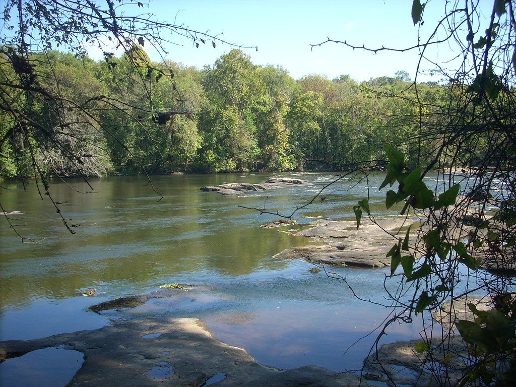
Low rock ledges called the fish traps breaking the surface of the wide Cape Fear River, with green woods on the far bank.Gerry Dincher / CC BY-SA 2.0 via Flickr
🏜️Geological

Raven Rock State Park

Part ofFayetteville, Pinehurst & the Sandhills

A crystalline bluff rising 150 feet over the Cape Fear River on the fall line, with the ruins of a lock and dam and trails through beech woods.

⏱
Duration
Two to four hours.
🎟
Admission
Free for day use; fees for camping (NC State Parks, 2026).
📅
Best Season
Spring and fall.

The Story

Raven Rock sits on the fall line, where the hard old rocks of the Piedmont give way to the soft sediments of the coastal plain, and the Cape Fear has cut along it a crystalline bluff 150 feet high that runs for more than a mile. The rock formed more than 400 million years ago under heat and pressure. Sissipahaw, Keyauwee, Eno, Shakori and Tuscarora people hunted this stretch of the river before Highland Scots and other settlers arrived in the mid-1700s.

Settlers first called the bluff Patterson's Rock, for a man who sheltered under it after his canoe overturned, and renamed it in 1854 for the ravens that roosted on its ledges. River pilots steered by it. The Raleigh-to-Fayetteville road crossed here at Northington's Ferry, and locks and dams were built to carry boats past the rapids until a hurricane wrecked them in 1859. The railroads took the trade and the river works were never rebuilt; the remains of the Northington lock and dam can still be seen.

Local people pressed for a park in the 1960s, the legislature created it in 1969, and Burlington Industries gave part of the land. The Raven Rock Loop, about two and a half miles, splits to reach the foot of the bluff at the water and a small stone overlook high above the river. Other trails lead to Lanier Falls, the fish traps and the old ferry site, and the American Beech Trail runs through hardwoods.

Visitor Info

⏱
Time Needed
Two to four hours.
🎟
Admission
Free for day use; fees for camping (NC State Parks, 2026).
📅
Best Season
Spring and fall.
🛣️
Highway
US 421

On the Map

Nearby

The closest stops worth working into your route

historical26 mi away
House in the Horseshoe State Historic Site
Philip Alston's house above a bend of the Deep River, shot full of holes in a 1781 Loyalist attack, later a cotton plantation where about fifty people were enslaved.
historical27 mi away
Shaw University
The Raleigh university founded for freed people in 1865, with Estey Hall of 1873, where Ella Baker gathered the student sit-in leaders who formed SNCC in April 1960.
historical27 mi away
Fayetteville State University
The historically Black university that grew from the 1867 Howard School, founded on land seven Black men bought, where Charles W. Chesnutt was principal.
natural27 mi away
William B. Umstead State Park
A 5,000-acre forest between Raleigh and Durham, built by the CCC on worn-out farms and split by race from 1950 until 1966, the Reedy Creek side for Black visitors.
historical28 mi away
Market House
The 1832 arcaded market and town hall in the traffic circle at the heart of Fayetteville, where enslaved people were sold, built on the site of the state house of 1789.
natural34 mi away
Weymouth Woods-Sandhills Nature Preserve
A remnant of the old longleaf pine forest at Southern Pines, saved by the novelist James Boyd's family, with trees centuries old and the scars of the turpentine trade.

Historical markers nearby

Roadside plaques and monuments within a short detour

Marker10 mi away
Campbell University
Buies Creek
Marker13 mi away
A. A. F. Seawell
Sanford
Marker14 mi away
Alton Stewart 1897-1929
Coats
Marker15 mi away
Ramsey's Mill
Moncure
Marker16 mi away
Rev. James Campbell
Linden
Marker16 mi away
Flora MacDonald
Johnsonville