Home / North Carolina / Raleigh, Durham & the Triangle / William B. Umstead State Park
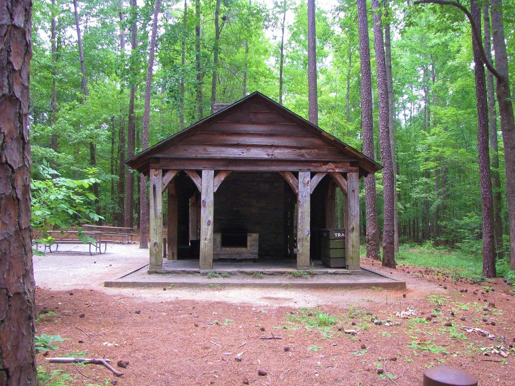
A timber picnic shelter with a stone fireplace in a clearing among tall pines and hardwoods.Gerry Dincher / CC BY-SA 2.0 via Flickr
🌲Natural

William B. Umstead State Park

Part ofRaleigh, Durham & the Triangle

A 5,000-acre forest between Raleigh and Durham, built by the CCC on worn-out farms and split by race from 1950 until 1966, the Reedy Creek side for Black visitors.

⏱
Duration
Two hours to a full day.
🎟
Admission
Free for day use; fees for camping and reservations (NC State Parks, 2026).
📅
Best Season
Spring and fall for trail weather; the park is open year round.

The Story

In 1934 the federal government began buying about four hundred worn-out farms on Crabtree Creek, their soil exhausted by one-crop cotton, to turn into a recreation area. Civilian Conservation Corps crews built it between 1936 and 1941: four group camps with cabins and dining halls, stone fountains and fireplaces, dams and lakes, trails, and bridges faced in stone. The camps were divided by race. White camps went to the Girl Scouts, the Boy Scouts and the Durham YMCA, while Black scout troops used Camp Whispering Pines near Reedy Creek Lake, leased through Durham's Merrick-Moore Memorial Park Association.

The state bought the whole tract from the federal government in 1943 for a dollar. In 1950 it carved off more than a thousand acres in the south and east as Reedy Creek State Park for Black visitors, with its own entrance and picnic area, and in 1955 the white side was renamed for the late governor William B. Umstead. The two halves were joined only in 1966, after the Civil Rights Act. The split still shows on the map: no public road crosses the park, so the Crabtree Creek entrance off US 70 and the Reedy Creek entrance in Cary are separate drives.

Start at the Reedy Creek entrance, the side Black families were allowed to use for sixteen years. Reedy Creek Road, closed to cars inside the park, is a wide multiuse path through the forest, and the Company Mill and Sycamore trails lead past old mill sites and the CCC lakes.

Visitor Info

⏱
Time Needed
Two hours to a full day.
🎟
Admission
Free for day use; fees for camping and reservations (NC State Parks, 2026).
📅
Best Season
Spring and fall for trail weather; the park is open year round.
🛣️
Highway
I-40

On the Map

Nearby

The closest stops worth working into your route

historical8 mi away
Shaw University
The Raleigh university founded for freed people in 1865, with Estey Hall of 1873, where Ella Baker gathered the student sit-in leaders who formed SNCC in April 1960.
cultural13 mi away
Hayti Heritage Center
The 1891 St. Joseph's AME Church in Durham, saved from demolition in 1975 as the cultural home of Hayti, the Black district the Durham Freeway cut in two.
historical14 mi away
Pauli Murray Center for History and Social Justice
The Durham house where Pauli Murray grew up, built by her grandparents in 1898 and opened in 2024 as a museum of the lawyer, poet and priest's life and work.
historical17 mi away
Duke Homestead State Historic Site
Washington Duke's 1852 farm and early tobacco factories north of Durham, where the family business that became the American Tobacco Company began.
historical18 mi away
Bennett Place State Historic Site
The rebuilt farmhouse west of Durham where Johnston surrendered 89,270 Confederate soldiers to Sherman on April 26, 1865, the largest surrender of the war.
historical20 mi away
Historic Stagville
A surviving piece of the Bennehan and Cameron plantations north of Durham, where more than nine hundred people were enslaved in 1860, with the two-story quarters of Horton Grove.

Historical markers nearby

Roadside plaques and monuments within a short detour

Marker3.4 mi away
Walter Hines Page
Cary
Marker3.4 mi away
North Carolina Museum of Art
Raleigh
Marker4 mi away
North Carolina State Fair
Raleigh
Marker4.7 mi away
Berry O'Kelly School
Raleigh
Marker5.9 mi away
N.C. Colored State Fair
Raleigh
Marker6.1 mi away
Holt Family
Raleigh