Home / Kentucky / Mammoth Cave & South-Central Kentucky / National Corvette Museum
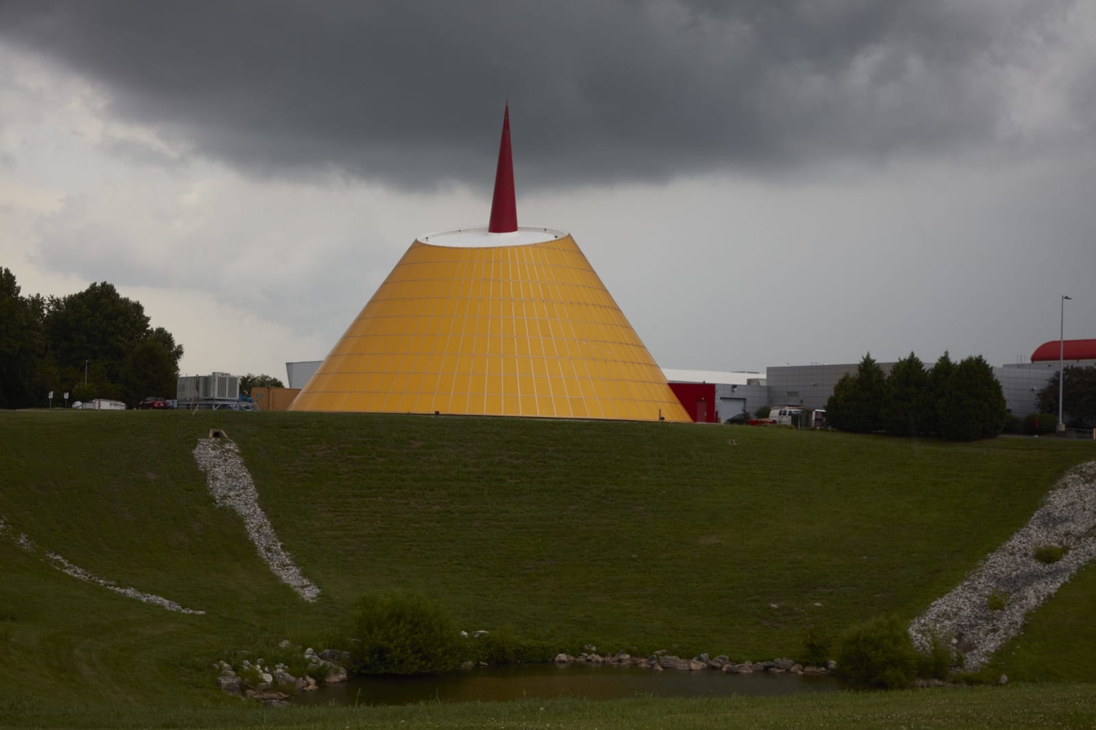
The yellow cone-shaped Skydome of the National Corvette Museum with its red spire, above a grassy slope under storm clouds.Carol M. Highsmith / public domain via Library of Congress
🎭Cultural

National Corvette Museum

Part ofMammoth Cave & South-Central Kentucky

The Corvette's museum beside the only plant that builds it, best known for the 2014 sinkhole that opened under its yellow Skydome and swallowed eight cars.

⏱
Duration
Two to three hours.
🎟
Admission
Admission charged.
📅
Best Season
Year round; indoor.

The Story

General Motors moved Corvette assembly from St. Louis to Bowling Green in 1981, and the car has been built here ever since, about a mile from the museum. The museum followed in 1994, a building by Kenneth Neumann and Joel Smith whose cone-shaped Skydome, clad in yellow panels with a red spire, can be seen from I-65. Inside are cars from every generation, race cars and prototypes, but the part people drive in to see is underfoot.

This is karst country, the same soluble limestone that made Mammoth Cave and Lost River, where water eats out voids until the ground over them gives way. Just after 5 a.m. on February 12, 2014, a sinkhole about 30 feet deep opened under the Skydome and took eight Corvettes down with it, among them a 1962 convertible, the 1992 one-millionth car and a 2009 ZR1 prototype called the Blue Devil. Security cameras caught the collapse, and the footage went around the world.

Three of the eight were restored, the Blue Devil by museum staff and the 1962 car and the one-millionth by GM; the rest were judged beyond repair and some are shown as they came out. Caissons driven deep into the rock now carry the floor, and a hatch lets you look down into the hole. It is the strangest exhibit in the building and the most honest one about the ground this whole region stands on.

Visitor Info

⏱
Time Needed
Two to three hours.
🎟
Admission
Admission charged.
📅
Best Season
Year round; indoor.
🛣️
Highway
I-65 exit 28

On the Map

Nearby

The closest stops worth working into your route

geological6.6 mi away
Lost River Cave
A karst valley and underground river inside Bowling Green, with 10,000 years of human use, an old mill site, a 1930s nightclub at the cave mouth and a boat tour.
historical17 mi away
Shaker Museum at South Union
The longest-lived western Shaker village, 1807 to 1922: pacifists and abolitionists between two armies, and a community burned for hiring freedmen.
geological20 mi away
Mammoth Cave National Park
The longest known cave system on earth, mapped first by Stephen Bishop and the enslaved guides who made its routes, with Archaic miners' traces 4,000 years older.
geological28 mi away
Hidden River Cave and the American Cave Museum
A cave under Main Street in Horse Cave that the town's sewage killed and a regional treatment plant brought back, now home to the American Cave Museum.
historical31 mi away
SEEK Museum
Two museum sites in Russellville, at Richard Bibb's house and in the Bottom, telling slavery, emancipation, lynching and civil rights in seven historic buildings.
historical31 mi away
Red River Meeting House
A rebuilt log church on the Red River near Adairville, where James McGready's four-day communion of June 1800 began the camp meetings of the Great Revival.

Historical markers nearby

Roadside plaques and monuments within a short detour

Marker1.4 mi away
Home/Office of Duncan Hines 1941-1959
Bowling Green
Marker2.8 mi away
Home of Thomas HInes
Bowling Green
Marker3.3 mi away
Shake Rag
Bowling Green
Marker3.3 mi away
Ora Porter (1880-1970)
Bowling Green
Marker3.4 mi away
Fort Webb
Bowling Green
Marker3.6 mi away
Ernest Hogan
Bowling Green