Home / Kentucky / Mammoth Cave & South-Central Kentucky / Lost River Cave
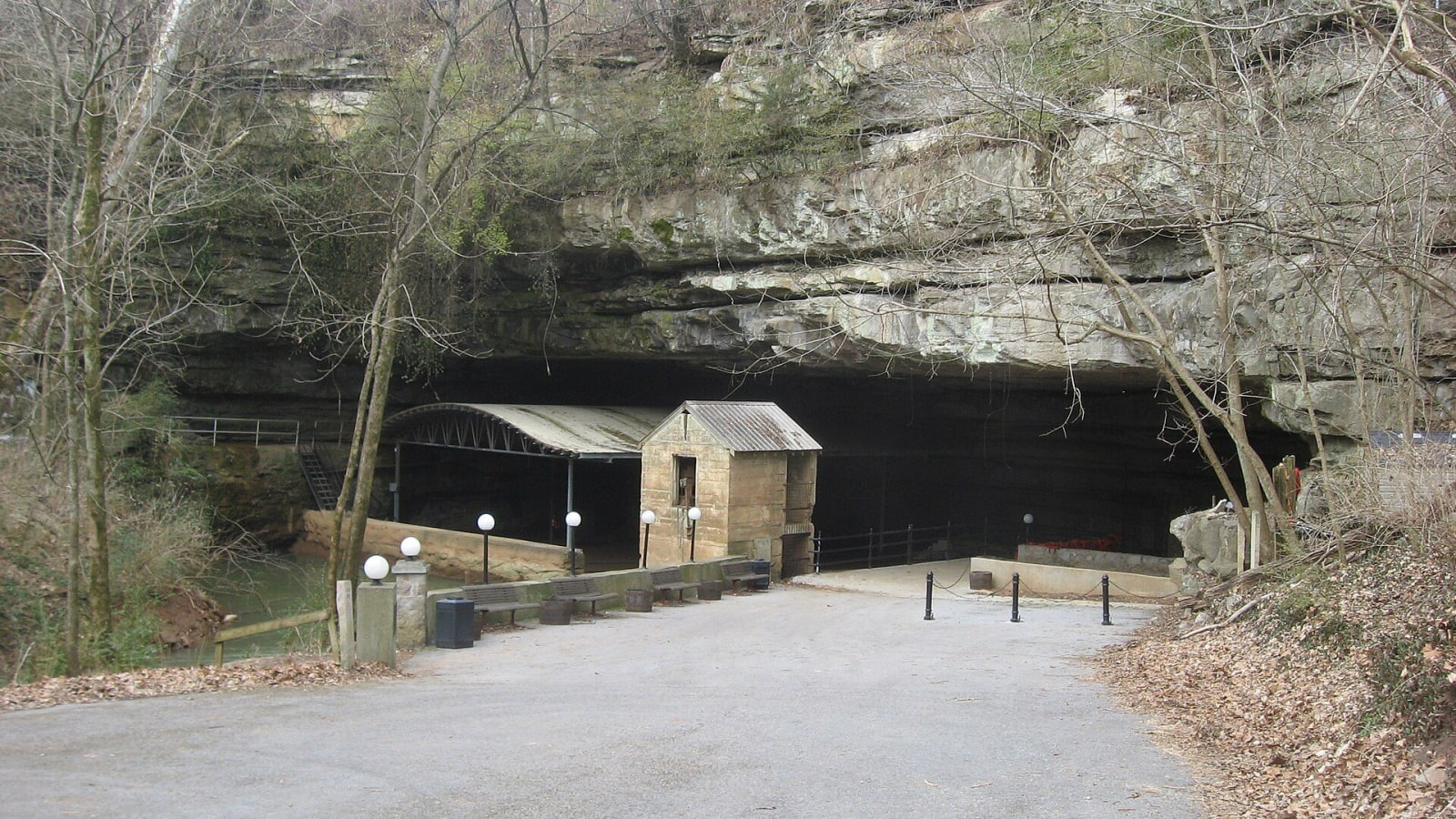
The wide mouth of Lost River Cave under a limestone bluff in winter, with a small stone building and boat shelter at the entrance.Nyttend / public domain via Wikimedia Commons
🏜️Geological

Lost River Cave

Part ofMammoth Cave & South-Central Kentucky

A karst valley and underground river inside Bowling Green, with 10,000 years of human use, an old mill site, a 1930s nightclub at the cave mouth and a boat tour.

⏱
Duration
About 45 minutes for the tour; another hour for the valley trails.
🎟
Admission
Admission charged for the boat tour.
📅
Best Season
Year round; the boat tour runs in all seasons except a few holidays.

The Story

The valley at the edge of Bowling Green has drawn people for its water for a very long time. Archaeologists from Western Kentucky University and the University of Kentucky have found traces of Paleo-Indian presence going back about 10,000 years, including a Dalton point, and Native groups used the cave mouth and valley for thousands of years after. The cave is wet, so little delicate survives, but the finds come from just where you walk in.

Later users wanted the current. A mill may have been turning here as early as 1792, among the first businesses in Warren County, and a dam and three-story mill went up in the 1870s; the last mill burned in 1915. During the Civil War, Confederate and then Union troops camped in the valley for the springs, and some left their names in candle smoke on the cave ceiling. A local story has Jesse James hiding here after the 1868 Russellville bank robbery; it has been told since the 1930s and stays a story.

The cave mouth is cool all summer, and in the 1930s it became the Cavern Nite Club, where dancers came off the Dixie Highway until the interstates drew traffic away and it closed in the early 1960s. From then until 1990 the valley was used as a dump. The Friends of Lost River formed that year to clean it up, and the cave reopened in 1997 with a boat tour following from 1999. The tour floats a short way into the underground river.

Visitor Info

⏱
Time Needed
About 45 minutes for the tour; another hour for the valley trails.
🎟
Admission
Admission charged for the boat tour.
📅
Best Season
Year round; the boat tour runs in all seasons except a few holidays.
🛣️
Highway
US 31W (Nashville Road)

On the Map

Nearby

The closest stops worth working into your route

cultural6.6 mi away
National Corvette Museum
The Corvette's museum beside the only plant that builds it, best known for the 2014 sinkhole that opened under its yellow Skydome and swallowed eight cars.
historical11 mi away
Shaker Museum at South Union
The longest-lived western Shaker village, 1807 to 1922: pacifists and abolitionists between two armies, and a community burned for hiring freedmen.
historical24 mi away
SEEK Museum
Two museum sites in Russellville, at Richard Bibb's house and in the Bottom, telling slavery, emancipation, lynching and civil rights in seven historic buildings.
historical25 mi away
Red River Meeting House
A rebuilt log church on the Red River near Adairville, where James McGready's four-day communion of June 1800 began the camp meetings of the Great Revival.
geological26 mi away
Mammoth Cave National Park
The longest known cave system on earth, mapped first by Stephen Bishop and the enslaved guides who made its routes, with Archaic miners' traces 4,000 years older.
historical30 mi away
John Prine Memorial Park at Rochester Dam
A Green River county park at Rochester Dam, renamed in 2022 for John Prine, whose song Paradise mourned the Muhlenberg town that coal and TVA took away.

Historical markers nearby

Roadside plaques and monuments within a short detour

Marker2.1 mi away
Jonesville
Bowling Green
Marker2.7 mi away
Eliza Calvert Hall, 1856-1935
Bowling Green
Marker3.2 mi away
James T. Morehead, 1797-1854
Bowling Green
Marker3.2 mi away
College Hill
Bowling Green
Marker3.2 mi away
Civil War Occupations
Bowling Green
Marker3.5 mi away
McFadin's Station
Bowling Green