Home / Wyoming / Jackson Hole & the Tetons / Mormon Row Historic District
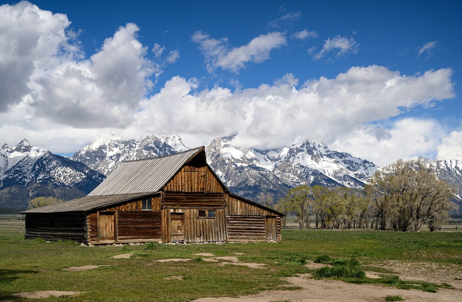
A weathered gambrel-roofed Moulton barn on Mormon Row, snowy Teton peaks half hidden in cloud behind itEric Kilby / CC BY-SA 4.0 via Wikimedia Commons
🏛️Historical

Mormon Row Historic District

Part ofJackson Hole & the Tetons

A Latter-day Saint farm village on Antelope Flats, its ditches still running and the Moulton barns still standing against the Tetons.

Pioneer HistoryPhotographyMormon Settlement
⏱
Duration
One hour.
📅
Best Season
Late spring through fall.

The Story

Most homesteaders in Jackson Hole took up land alone, a cabin and a claim miles from the next. The Latter-day Saint families who came over from Idaho in the 1890s settled the other way, in a line of farms close enough together to make a village, on the flat east of Blacktail Butte, where the soil was better and the butte broke the wind. The Post Office called the settlement Grovont, and it grew to twenty-seven homesteads. Water was the hard part, so they dug ditches to carry the Gros Ventre River to their fields. Some of those ditches still run.

What stands now comes mostly from the settlement's later decades. The brothers John and T. A. Moulton built barns on neighboring homesteads. T. A. took some thirty years to finish his, a gabled barn with sheds along its sides, and John, after nearly three decades on the land, replaced his log house and barn with a two-story gambrel barn and, in 1938, a pink stucco house. Andy Chambers's homestead is the most complete cluster left. Electric power did not reach the row until the 1950s.

The district was listed on the National Register in 1997, and the last privately held acre on the row passed to the park in 2018. Antelope Flats Road leaves US-191 just north of Moose Junction, and bison often graze the fields between the barns.

Visitor Info

⏱
Time Needed
One hour.
📅
Best Season
Late spring through fall.
🛣️
Highway
US-191

On the Map

Nearby

The closest stops worth working into your route

historical3 mi away
Murie Ranch
The porch where the Wilderness Act was argued into being; Olaus Murie died a year before it passed, and Mardy kept going for forty more.
geological6.4 mi away
Gros Ventre Slide
The north face of Sheep Mountain fell into the river in 1925; the dam it made held two years, then emptied onto the town of Kelly.
historical9.7 mi away
Cunningham Cabin
An 1888 dog-trot homestead cabin where a posse shot two men in 1893, and the valley decided not to talk about it.
natural13 mi away
National Elk Refuge
Stephen Leek's photographs of starving elk built this winter refuge in 1912; a century of hay feeding is now its hardest question.
historical18 mi away
Teton Pass
The trail the Astorians crossed in 1811, the six wagons of 1889, the highway of 1969, and the hairpin that slid off the mountain in 2024.
historical45 mi away
Warm River
Union Pacific built the Yellowstone Branch for tourists. At the bottom of this canyon it turned the engines that pushed them uphill.

Historical markers nearby

Roadside plaques and monuments within a short detour

Marker22 mi away
Pierre's Hole
Idaho
Marker24 mi away
Teton Range
Idaho
Marker24 mi away
John Colter
Idaho