Home / Missouri / The Missouri River: Rhineland to Boonslick / Meramec Caverns
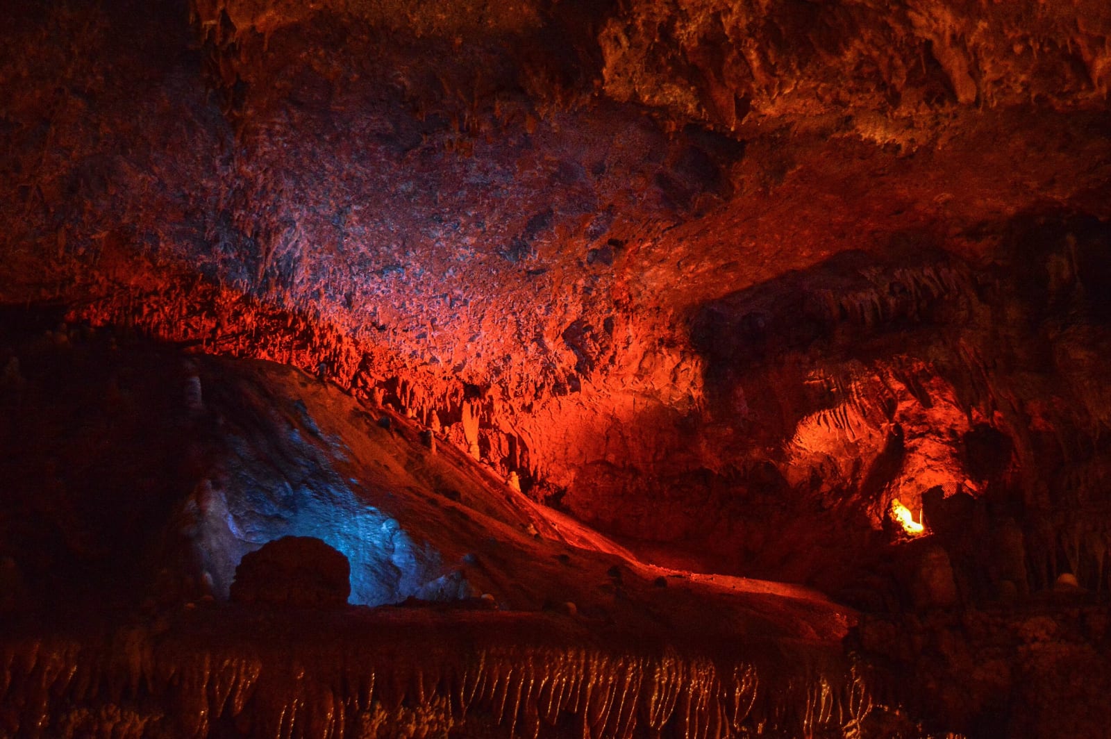
Cave formations in Meramec Caverns lit in red and blue along a tour passage.Lewis Hulbert / CC BY-SA 4.0 via Wikimedia Commons
⭐Attraction

Meramec Caverns

Part ofThe Missouri River: Rhineland to Boonslick

A saltpeter cave turned show cave by Lester Dill in 1933, who sold it to Route 66 with barns painted in 14 states, bumper signs and a Jesse James story.

⏱
Duration
One hour and 20 minutes for the tour.
🎟
Admission
Cavern tour $30.50 for ages 12 and up, $27.50 military, $16.50 for ages 5 to 11, under 5 free.
📅
Best Season
Spring through October, when tours leave every 20 to 30 minutes (9 a.m. to 4 p.m. daily in October); call ahead in November and December, closed from January 5 to February 27.

The Story

The cave in the bluffs above the Meramec River near Stanton was mined for saltpeter, the key ingredient of gunpowder, long before anyone paid to see it. The owners date the first mining to French explorers in 1720 and say it ended in 1864, when Confederate troops destroyed a Union gunpowder works inside. In the 1890s Stanton families held summer dances in a big room 300 feet in that they called the Ballroom, and in 1898 Charles Ruepple bought what was then known as Saltpeter Cave.

Lester B. Dill, who had been showing visitors Fisher's Cave in what is now Meramec State Park, bought it from Ruepple in 1933, renamed it Meramec Caverns and began tours. That year he broke through a crevice into upper levels and found the formation he called the Stage Curtain, nearly 70 feet tall, around which he built the Theatre Room. In the drought of 1941 the pool at the end of the main level dropped about six inches, Dill went under the wall, and found more passages, along with the items that let the owners call the cave a Jesse James hideout, a claim still told on the tour.

Dill's real gift was advertising. He had the cave's name painted on barns in 14 states and sent bumper sign boys to tie Meramec Caverns signs to visitors' cars while they were underground, before adhesive stickers existed. His descendants still run the cave. The guided tour covers 1.25 miles on lit walkways in air that stays at 58 degrees.

Visitor Info

⏱
Time Needed
One hour and 20 minutes for the tour.
🎟
Admission
Cavern tour $30.50 for ages 12 and up, $27.50 military, $16.50 for ages 5 to 11, under 5 free.
📅
Best Season
Spring through October, when tours leave every 20 to 30 minutes (9 a.m. to 4 p.m. daily in October); call ahead in November and December, closed from January 5 to February 27.
🛣️
Highway
I-44

On the Map

Nearby

The closest stops worth working into your route

geological14 mi away
Onondaga Cave State Park
A Meramec River show cave entered first by boat from a millpond, split by barbed wire in a property war, saved from a dam that would have drowned it, and held sacred by the Osage Nation.
historical25 mi away
Washington State Park
Big River hills with the largest group of petroglyphs found in Missouri and the stonework of Company 1743, an African American Civilian Conservation Corps company that named its camp for a carved thunderbird.
historical31 mi away
Maramec Spring Park and the Maramec Iron Works
Missouri's fifth-largest spring, which powered the first successful ironworks west of the Mississippi from 1826, kept whole and opened to the public by an ironmaster's granddaughter.
industrial37 mi away
Dillard Mill State Historic Site
A red gristmill on Huzzah Creek, built by Emil Mischke from 1904 to 1908 with steel roller mills and a turbine, the center of a guest lodge from 1930, and still run for visitors.
historical37 mi away
Deutschheim State Historic Site
Two Hermann houses of the 1840s, a violin maker's brick home and a printer's timber house with its own winery, kept as the German home the Missouri Rhineland settlers built.
geological40 mi away
Mastodon State Historic Site
The Kimmswick Bone Bed, misread and quarried for more than a century until a Clovis point found among mastodon bones in 1979 gave the first solid evidence that people and mastodons lived here together.

Historical markers nearby

Roadside plaques and monuments within a short detour

Marker15 mi away
Crawford County
Marker23 mi away
Washington
Marker27 mi away
Potosi
Marker29 mi away
Jefferson County