Home / Montana / The Southeastern Badlands / Makoshika State Park
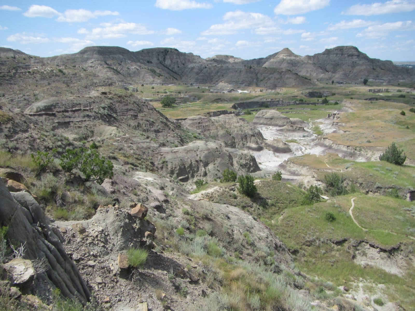
Eroded grey and buff badlands at Makoshika, a pale wash winding through green draws below a line of buttesTheTurducken / CC BY 2.0 via Wikimedia Commons
🌲Natural

Makoshika State Park

Part ofThe Southeastern Badlands

Montana's largest state park, a badland on the edge of Glendive where the rock shows the end of the age of dinosaurs.

Year-RoundPhotographyPaid EntryFossilsDinosaur SitesHiking
⏱
Duration
A few hours for the visitor center, the scenic road and a trail.
📅
Best Season
Spring and fall; summer heat in the breaks can be severe.

The Story

The Lakota name is usually written Mako sica, bad land, a plain warning about ground that was hard to cross. The park that keeps the name runs up from the southeast edge of Glendive into some eleven and a half thousand acres of clay and sandstone, carved into ridges, hoodoos and caprocks and dotted with ponderosa pine and juniper, the largest of Montana's state parks. Glendive people were asking for a park here as early as the 1890s; Dawson County gave the land in 1939 and again in 1953, and the park was established that November.

Most of what the weather has opened is the Hell Creek Formation, the last rock laid down in the age of dinosaurs, and in places the park points out the line where that age ends: the boundary between the Cretaceous and what geologists long called the Tertiary, about 65.5 million years old. Below it lie the dinosaurs; above it the big ones are gone. More than ten kinds have come out of the park, among them Tyrannosaurus, Edmontosaurus and a nearly complete Thescelosaurus, a small and rare plant-eater, and the visitor center at the entrance shows a complete Triceratops skull found inside the boundary.

The rest is a prairie badland that happens to sit at the edge of a town. About half the bird species recorded in Montana have been seen here, and nearly half the state's wildflowers. A scenic road climbs to viewpoints over the breaks, trails drop into the gullies, and there is a campground. Summer heat in the bottoms can be severe.

Visitor Info

⏱
Time Needed
A few hours for the visitor center, the scenic road and a trail.
📅
Best Season
Spring and fall; summer heat in the breaks can be severe.
🛣️
Highway
I-94

On the Map

Nearby

The closest stops worth working into your route

architectural24 mi away
Pierre Wibaux House
The town office of a French cattle baron who came through the Hard Winter and bought up the range, in the town renamed for him.
natural71 mi away
Medicine Rocks State Park
Sandstone towers worn full of holes, holy ground to the Lakota and Cheyenne and a stone register of everyone who came after.
cultural72 mi away
Miles City Bucking Horse Sale
A sale of bucking stock that began with thirty-five unwanted horses in 1950 and became eastern Montana's biggest weekend.
historical74 mi away
Fort Keogh
Nelson Miles's post at the mouth of the Tongue, built after the Little Bighorn, a remount depot by 1909 and a range lab since 1924.
cultural81 mi away
Carter County Museum
Montana's first county museum, built in 1936 by a ranch county to keep the dinosaurs its own ground kept giving up.
architectural106 mi away
Fort Peck Theatre
A movie house the Corps of Engineers threw up in nine months for the dam crews, meant to come down when the dam was done.