Home / Idaho / The Payette River Mountains / Kirkham Hot Springs
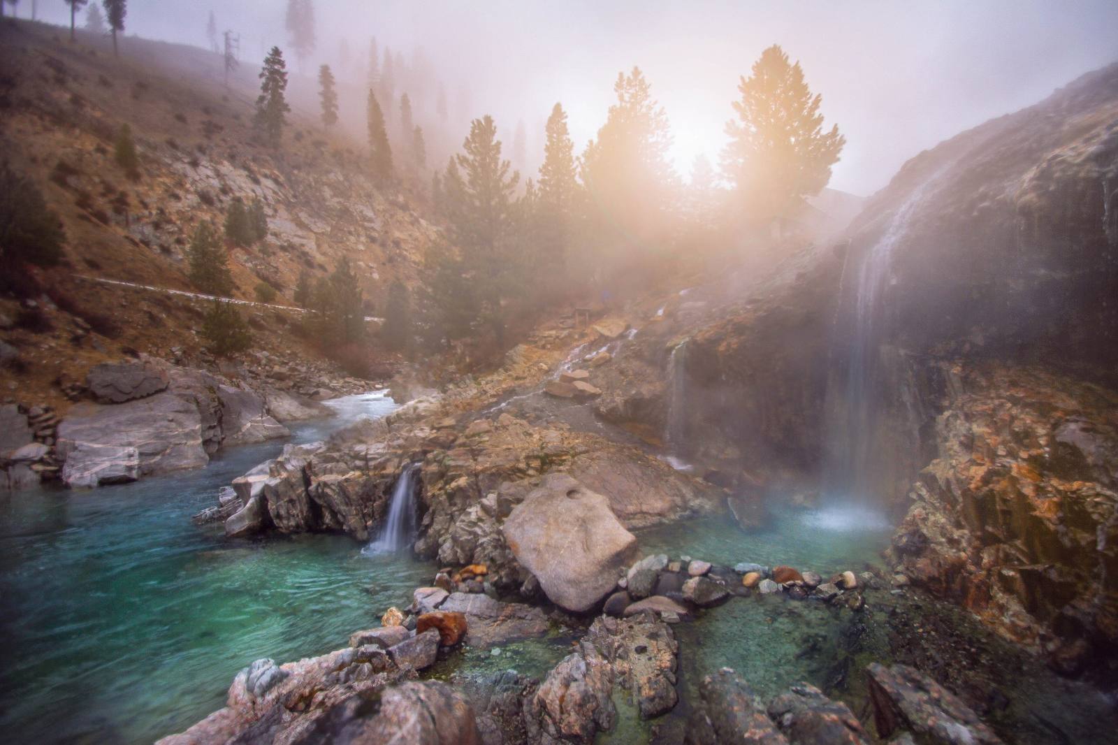
Hot water falling from a rock ledge into steaming pools beside the South Fork of the Payette at Kirkhamj.a.woodhouse / CC BY 2.0 via Wikimedia Commons
🌲Natural

Kirkham Hot Springs

Part ofThe Payette River Mountains

Hot water pours off a ledge into pools at the edge of the South Fork Payette, a staircase down from the highway.

Hot SpringsSwimming
⏱
Duration
An hour for a soak.
📅
Best Season
Year round, in daylight hours; winter visits need care on the highway.

The Story

Three miles east of Lowman, Highway 21 follows the South Fork of the Payette through a granite canyon, and at Kirkham the rock on the far bank steams. Hot water seeps and pours from a ledge above the river, falling in small hot waterfalls into a string of pools at the water's edge, with the cold river a step away. A bridge and a staircase lead down to them.

It is one of the most visited places in the Boise National Forest, and it very nearly loved itself to death. Through the pandemic years visitors left trash and human waste, broke glass in the pools, and rebuilt the rock walls until the upper pools flooded and the springs' natural flow was diverted. That damaged a small, specialized community of algae, bacteria and insects that lives only in hot water, and fish habitat downstream. The Forest Service closed the site in 2021, reopened it the next year for day use only, and has put money since into the bridge, parking and paths.

Treat it accordingly: come in daylight, carry out what you bring, and leave the pools and rock walls as you found them. The South Fork below runs good whitewater in early summer, and the Kirkham Ridge Trail, one of the district's long trails, starts a short walk away. Highway 21 continues east from here over the mountains to Stanley, and west down the South Fork to Banks.

Visitor Info

⏱
Time Needed
An hour for a soak.
📅
Best Season
Year round, in daylight hours; winter visits need care on the highway.
🛣️
Highway
SR-21 (Ponderosa Pine Scenic Byway)

On the Map

Nearby

The closest stops worth working into your route

historical22 mi away
Pon Yam House
The store of Idaho City's king merchant, where the Chinese of the Boise Basin bought cuttlefish, incense and firecrackers.
recreational29 mi away
Banks and the North Fork Payette
Where the Payette's two forks meet, below fifteen miles of continuous Class V whitewater beside the highway.
natural43 mi away
Galena Summit Overlook
The Salmon River's first miles, seen from an overlook named for the couple who helped keep a mine out of the view.
historical45 mi away
Old Idaho Penitentiary
A territorial prison that ran for 101 years on conditions that barely changed, and closed the year its prisoners burned it.
architectural45 mi away
Idaho State Capitol
Walls hauled from the prison quarry, heat pumped from 3,000 feet down, and its newest rooms built underground.
cultural46 mi away
Basque Block
A merchant's 1864 brick house became the boardinghouse where herders from the Basque Country found beds, meals and their own language.

Historical markers nearby

Roadside plaques and monuments within a short detour

Marker0.8 mi away
Emma Edwards
Marker3.3 mi away
Lowman
Marker16 mi away
Emile Grandjean
Marker23 mi away
Idaho City