Home / Idaho / The Sawtooths & the Salmon River / Galena Summit Overlook
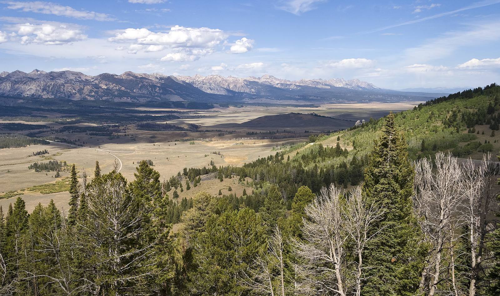
The Sawtooth Valley opening north from Galena Summit, with the Sawtooth Range along its western edgeAcroterion / CC BY-SA 4.0 via Wikimedia Commons
🌲Natural

Galena Summit Overlook

Part ofThe Sawtooths & the Salmon River
On this driveThe Sawtooths and the Salmon: Ketchum to Salmon

The Salmon River's first miles, seen from an overlook named for the couple who helped keep a mine out of the view.

Scenic DrivingPhotography
⏱
Duration
Fifteen minutes.
📅
Best Season
Year round; the view is best early and late in the day.

The Story

Highway 75 climbs out of the Wood River Valley to Galena Summit at 8,701 feet, the divide between the Big Wood and the Salmon, and a little more than a mile past the top, on the Salmon side, it reaches the overlook. Below lies the upper Sawtooth Valley: the Salmon beginning as a creek in the meadows, the jagged wall of the Sawtooths to the west, and the White Clouds off to the east. From here the river runs north past Stanley and Challis, north again to Salmon, and then west across the state to the Snake, some 425 miles in all.

The view nearly came with a mine in it. In 1968 the American Smelting and Refining Company proposed an open-pit molybdenum mine at the foot of Castle Peak in the White Clouds, with a tailings pond at Frog Lake. The governor at the time defended it by saying the company was not going to tear down the mountains, only dig a hole. Cecil Andrus ran against him in 1970 on stopping it and won, and afterward called Castle Peak the mountain that elected a governor. In 1972 Senator Frank Church carried the bill through Congress that created the Sawtooth National Recreation Area, taking in the Sawtooths, the White Clouds and this valley, and withdrawing the ground around Castle Peak from mining.

The overlook opened in 1964 and in 2006 was renamed the Bethine and Frank Church Overlook, for the senator and his wife, who spent decades working for Idaho's wild country. His name is also on the largest wilderness in the state, the River of No Return country north of here.

Visitor Info

⏱
Time Needed
Fifteen minutes.
📅
Best Season
Year round; the view is best early and late in the day.
🛣️
Highway
SR-75 (Sawtooth Scenic Byway)

On the Map

Nearby

The closest stops worth working into your route

industrial35 mi away
Yankee Fork Gold Dredge
A 988-ton floating gold dredge worked five miles of valley for twelve years, and spent more than it found.
natural43 mi away
Kirkham Hot Springs
Hot water pours off a ledge into pools at the edge of the South Fork Payette, a staircase down from the highway.
geological47 mi away
Borah Peak Earthquake Fault Scarp
In 1983 the valley floor dropped seven feet in a second, and a truckload of hunters dropped with it.
historical55 mi away
Pon Yam House
The store of Idaho City's king merchant, where the Chinese of the Boise Basin bought cuttlefish, incense and firecrackers.
geological66 mi away
Craters of the Moon National Monument
A geologist coined the name in 1923. A Boise taxidermist carried his dog across the lava and sold the place to a president.
recreational71 mi away
Banks and the North Fork Payette
Where the Payette's two forks meet, below fifteen miles of continuous Class V whitewater beside the highway.

Historical markers nearby

Roadside plaques and monuments within a short detour

Marker1.2 mi away
Salmon River
Marker1.7 mi away
Alexander Ross
Marker3 mi away
Vienna
Marker3.8 mi away
Galena
Marker5.4 mi away
Sawtooth City
Marker21 mi away
Ski Lifts