Home / Missouri / The Ozark Riverways & the St. Francois Mountains / Johnson's Shut-Ins State Park
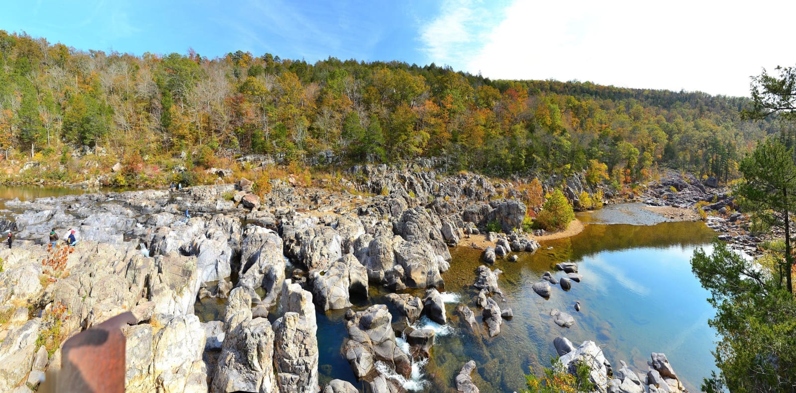
The East Fork of the Black River pouring through gray volcanic rock at Johnsons Shut-Ins in autumn.Kbh3rd / CC BY 3.0 via Wikimedia Commons
🏜️Geological

Johnson's Shut-Ins State Park

Part ofThe Ozark Riverways & the St. Francois Mountains

The East Fork of the Black River squeezed through chutes and potholes in ancient rhyolite, and a valley rebuilt after a mountaintop reservoir gave way before dawn on December 14, 2005.

⏱
Duration
Half a day.
🎟
Admission
The park's pages list no entrance fee; signed restricted areas carry fines of up to $500.
📅
Best Season
Summer for swimming: the valley gates open 8 a.m. to 8 p.m. from the Thursday before Memorial Day through Labor Day, to 6 p.m. in spring and fall and to 4 p.m. from November to February; the Black River Center is closed November to March.

The Story

A shut-in is a stretch where a river is confined to a narrow channel in hard rock. Here the East Fork of the Black River follows fractures and joints in erosion-resistant rhyolite porphyry and dark diabase dikes, and the sand and gravel it carries have cut potholes, chutes and small gorges. It is one of Missouri's best examples, the center of a 180-acre natural area, and a walkway leads to an overlook above the pothole chutes. The park holds 17 natural communities and more than 850 plant species, about 40 percent of the state's.

Osage hunters came into these mountains, but most settlers preferred the river valleys. The Johnston family, Scots-Irish from Appalachia, had a farm here by 1829, and three generations worked it. Joseph Desloge of St. Louis assembled most of the park over 17 years and gave it to the state in 1955.

At 5:12 a.m. on December 14, 2005, the Taum Sauk upper reservoir on Proffit Mountain, kept full by pumping, was overtopped and gave way. The park puts the release at 1.3 billion gallons. It came down the mountainside carrying trees and boulders, scoured the valley and wrecked the campground and day-use area. Missouri's Public Service Commission later called the utility's decision to keep operating with faulty gauges reckless. Swimming in the shut-ins resumed in 2009 in a rebuilt park. Food, drinks in disposable containers, coolers and alcohol are not allowed past the Shut-Ins Trail trailhead.

Visitor Info

⏱
Time Needed
Half a day.
🎟
Admission
The park's pages list no entrance fee; signed restricted areas carry fines of up to $500.
📅
Best Season
Summer for swimming: the valley gates open 8 a.m. to 8 p.m. from the Thursday before Memorial Day through Labor Day, to 6 p.m. in spring and fall and to 4 p.m. from November to February; the Black River Center is closed November to March.
🛣️
Highway
MO-N

On the Map

Nearby

The closest stops worth working into your route

geological6.7 mi away
Taum Sauk Mountain State Park
Missouri's highest point at 1,772 feet, an easy walk from the lot, and a rugged loop to the state's tallest waterfall in the worn roots of 1.5-billion-year-old volcanoes.
geological11 mi away
Elephant Rocks State Park
A train of rounded granite boulders 1.5 billion years old near Graniteville, weathered in place into a tor, beside the quarry that faced the Eads Bridge piers and paved the St. Louis levee.
historical12 mi away
Battle of Pilot Knob State Historic Site (Fort Davidson)
The hexagonal earthwork in the Arcadia Valley where some 1,500 Union defenders broke Sterling Price's assault in September 1864, then slipped out at night and blew the magazine behind them.
industrial23 mi away
Dillard Mill State Historic Site
A red gristmill on Huzzah Creek, built by Emil Mischke from 1904 to 1908 with steel roller mills and a turbine, the center of a guest lodge from 1930, and still run for visitors.
industrial27 mi away
Missouri Mines State Historic Site
Federal Mill No. 3 at Park Hills, the biggest lead mine and mill complex of the Old Lead Belt under St. Joseph Lead, with its 1906 powerhouse now a museum of mining machines and minerals.
historical38 mi away
Washington State Park
Big River hills with the largest group of petroglyphs found in Missouri and the stonework of Company 1743, an African American Civilian Conservation Corps company that named its camp for a carved thunderbird.

Historical markers nearby

Roadside plaques and monuments within a short detour

Marker12 mi away
Fort Davidson
Marker19 mi away
Reynolds County
Marker27 mi away
Potosi