Home / Missouri / The Ozark Riverways & the St. Francois Mountains / Battle of Pilot Knob State Historic Site (Fort Davidson)
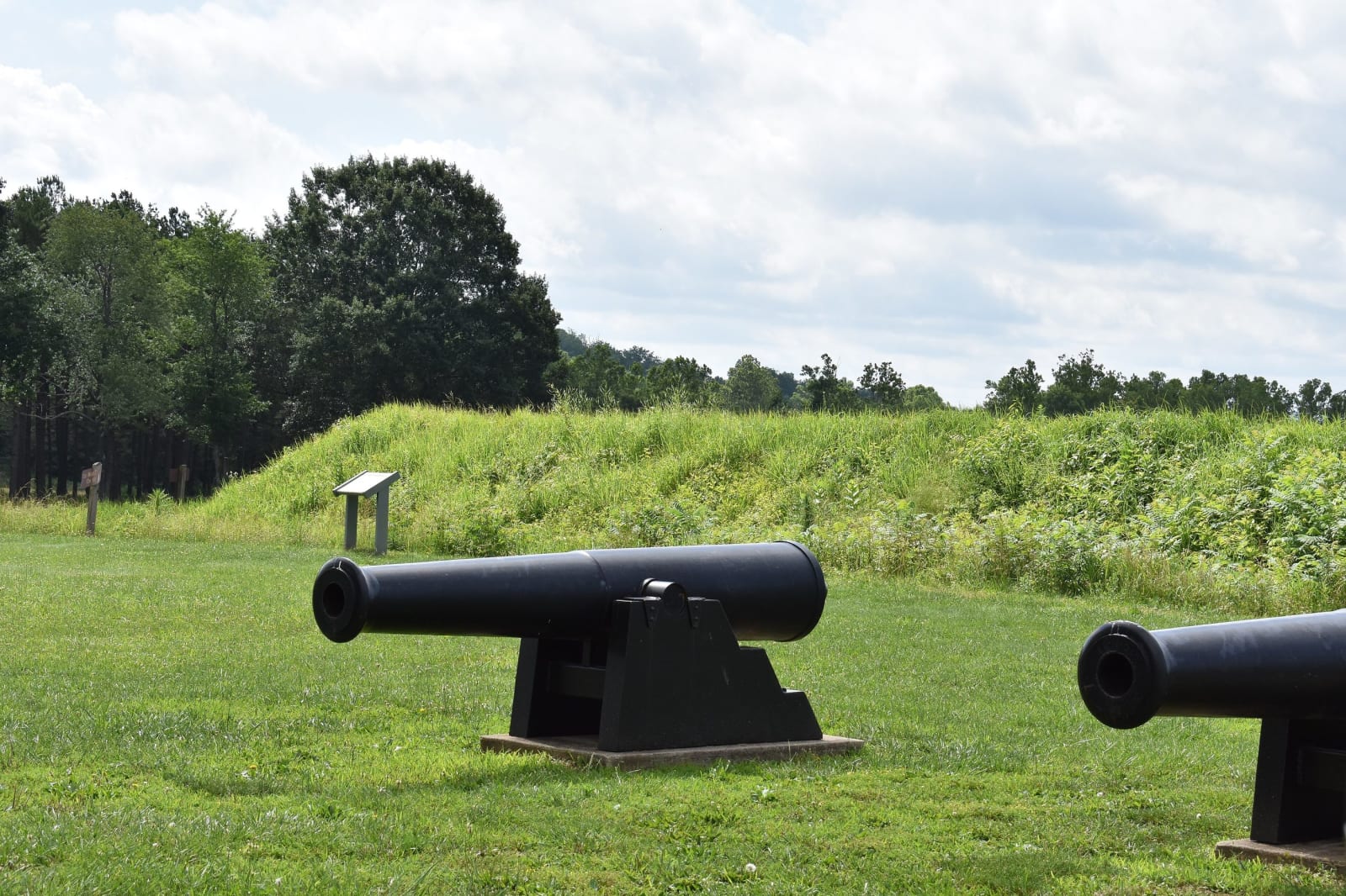
Two iron cannons on the grass below the grassy earthen walls of Fort Davidson at Pilot Knob.TCP04 / CC BY 4.0 via Wikimedia Commons
🏛️Historical

Battle of Pilot Knob State Historic Site (Fort Davidson)

Part ofThe Ozark Riverways & the St. Francois Mountains

The hexagonal earthwork in the Arcadia Valley where some 1,500 Union defenders broke Sterling Price's assault in September 1864, then slipped out at night and blew the magazine behind them.

⏱
Duration
One to two hours.
🎟
Admission
Free tours are offered during visitor center hours.
📅
Best Season
Grounds open sunrise to sunset year-round; the visitor center is open 10 a.m. to 4 p.m. daily from April 16 to October 31 and Thursday to Sunday from November 1 to April 15. The battle's anniversary falls in late September.

The Story

Pilot Knob was the end of the St. Louis and Iron Mountain Railroad in the iron-rich Arcadia Valley, and in the summer of 1863 Federal troops and a company of Black freemen built Fort Davidson on the valley floor. It was a hexagonal earthwork with sides about 150 feet long, packed-earth walls lined with planks inside, a dry moat, four heavy guns and a magazine at the center. It could stand an infantry assault, but Pilot Knob and Shepherd Mountain looked down into it.

In September 1864 Sterling Price led the largest Confederate cavalry raid of the war into Missouri, hoping, if he could, to take St. Louis or Jefferson City. Gen. Thomas Ewing reached the fort with reinforcements, bringing the garrison to about 1,500. On September 27 about 8,000 Confederates attacked after guns on Shepherd Mountain opened fire. The assaults came out of step, and only one brigade crossed the plain to the moat, where the defenders threw hand grenades down on it. In about 20 minutes the Confederates lost some 1,000 killed or wounded, the Union fewer than 100.

Ewing knew he could not hold another day. In the early morning hours the garrison marched out past Confederates who took them for their own, while a small party stayed behind to blow up the powder magazine. They fought their way to Leasburg and on to Rolla. The delay cost Price his chance at St. Louis. The site keeps the earthwork and battlefield, and the visitor center has a fiber-optic diorama of the battle.

Visitor Info

⏱
Time Needed
One to two hours.
🎟
Admission
Free tours are offered during visitor center hours.
📅
Best Season
Grounds open sunrise to sunset year-round; the visitor center is open 10 a.m. to 4 p.m. daily from April 16 to October 31 and Thursday to Sunday from November 1 to April 15. The battle's anniversary falls in late September.
🛣️
Highway
MO-21

On the Map

Nearby

The closest stops worth working into your route

geological3.6 mi away
Elephant Rocks State Park
A train of rounded granite boulders 1.5 billion years old near Graniteville, weathered in place into a tor, beside the quarry that faced the Eads Bridge piers and paved the St. Louis levee.
geological5.9 mi away
Taum Sauk Mountain State Park
Missouri's highest point at 1,772 feet, an easy walk from the lot, and a rugged loop to the state's tallest waterfall in the worn roots of 1.5-billion-year-old volcanoes.
geological12 mi away
Johnson's Shut-Ins State Park
The East Fork of the Black River squeezed through chutes and potholes in ancient rhyolite, and a valley rebuilt after a mountaintop reservoir gave way before dawn on December 14, 2005.
industrial17 mi away
Missouri Mines State Historic Site
Federal Mill No. 3 at Park Hills, the biggest lead mine and mill complex of the Old Lead Belt under St. Joseph Lead, with its 1906 powerhouse now a museum of mining machines and minerals.
natural27 mi away
Hawn State Park
A schoolteacher's bequest of sandstone canyons, shortleaf pine and clear sandy creeks west of Ste. Genevieve, with one of the state's best backpacking trails.
industrial32 mi away
Dillard Mill State Historic Site
A red gristmill on Huzzah Creek, built by Emil Mischke from 1904 to 1908 with steel roller mills and a turbine, the center of a guest lodge from 1930, and still run for visitors.

Historical markers nearby

Roadside plaques and monuments within a short detour

Marker0.1 mi away
Fort Davidson
Marker19 mi away
Fredericktown
Marker21 mi away
Bonne Terre
Marker23 mi away
Potosi
Marker29 mi away
Reynolds County