Home / Arkansas / Texarkana, El Dorado & the Timberlands / Historic Washington State Park
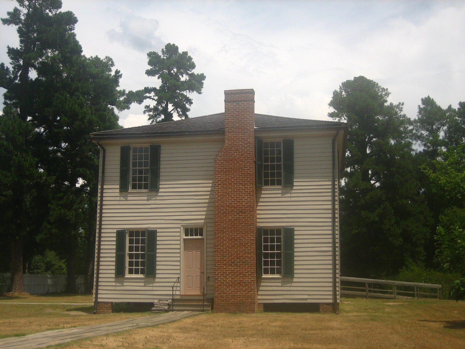
The two-story 1836 Hempstead County Courthouse at Historic Washington State Park, a white frame building with a central brick chimney and green shutters among pine trees.Billy Hathorn / CC BY-SA 3.0 via Wikimedia Commons
🏛️Historical

Historic Washington State Park

Part ofTexarkana, El Dorado & the Timberlands

A Southwest Trail town that was Arkansas's Confederate capital from 1863 to 1865, then lost the railroad and kept its buildings, with a blacksmith shop and the 1836 courthouse.

⏱
Duration
Two hours to a day.
🎟
Admission
Guided tours are paid; the park lists surrey rides at $8 adults and $4 children (state parks page, November 2026). Call for current rates.
📅
Best Season
Year round. Visitor center open daily 8 a.m. to 5 p.m., closed New Year's Day, Thanksgiving, Christmas Eve and Christmas (state parks page, November 2026). Guided tours run 9 a.m. to 3:30 p.m.

The Story

Washington grew on the Southwest Trail, the road that linked St. Louis to Texas, and Hempstead County made Elijah Stuart's tavern its first seat of government in 1824. Choctaw, Chickasaw and Cherokee people passed through on the removal to Indian Territory, and the Encyclopedia of Arkansas places the town on the Trail of Tears route from 1832 to 1838. Its blacksmith James Black reportedly made the first bowie knife for Jim Bowie in 1831, and a Washington newspaper attributed the knife to him in 1841.

The town's wealth came from cotton, and the Encyclopedia says many enslaved people worked here as household servants and in the fields around it. After the Civil War a Freedmen's Bureau office opened in Washington, and Archer Shepperson, who had been held in slavery, served in the Arkansas General Assembly in 1873 and 1874. In the fall of 1863 the Confederate state government fled Little Rock and met in the 1836 courthouse until 1865. Then the Cairo and Fulton Railroad bypassed the town in the 1870s and put its depot nine miles away, where Hope grew. Fires in 1875 and 1883 finished the business district, and the county seat moved to Hope in 1939.

That decline is why the buildings survived. The park opened in 1973 and holds fifty-four buildings on 101 acres, thirty of them historically significant. Start at the 1874 courthouse, which serves as the visitor center, then walk to the blacksmith shop, the weapons and print museums and the cemeteries. Williams Tavern serves lunch Tuesday to Sunday.

Visitor Info

⏱
Time Needed
Two hours to a day.
🎟
Admission
Guided tours are paid; the park lists surrey rides at $8 adults and $4 children (state parks page, November 2026). Call for current rates.
📅
Best Season
Year round. Visitor center open daily 8 a.m. to 5 p.m., closed New Year's Day, Thanksgiving, Christmas Eve and Christmas (state parks page, November 2026). Guided tours run 9 a.m. to 3:30 p.m.
🛣️
Highway
AR 278

On the Map

Nearby

The closest stops worth working into your route

historical8.9 mi away
President William Jefferson Clinton Birthplace Home National Historic Site
The two-story Hervey Street house in Hope where Bill Clinton lived his first four years with his widowed mother and her parents, now a National Park Service site with a ranger-led tour.
geological18 mi away
Crater of Diamonds State Park
A volcanic crater where anyone can dig for diamonds and keep what they find.
recreational19 mi away
Millwood State Park
A park at the foot of the 3.3-mile Millwood Dam, built in 1966 on the Little River, where flooded timber makes serious bass fishing and the lake counts as a bird-conservation area.
cultural32 mi away
Museum of Regional History
Texarkana's oldest museum, in an 1879 brick building on State Line Avenue, with Caddo pottery, one of Scott Joplin's pianos and a research library of city directories and photographs.
recreational34 mi away
White Oak Lake State Park
A 725-acre park on the lower of two 1961 lakes, where white sand marks an ancient shoreline and the visitor center carries a Poison Spring display eight miles from the battlefield.
historical40 mi away
Poison Spring Battleground State Park
An 85-acre roadside battlefield west of Camden, where Confederates routed a Union foraging column on April 18, 1864, and many Black soldiers of the 1st Kansas Colored Infantry were killed after surrendering.

Historical markers nearby

Roadside plaques and monuments within a short detour

Marker28 mi away
Hatchel/Barkman Caddo Indian Village
Texarkana vicinity, Texas