Home / Arkansas / Texarkana, El Dorado & the Timberlands / Millwood State Park
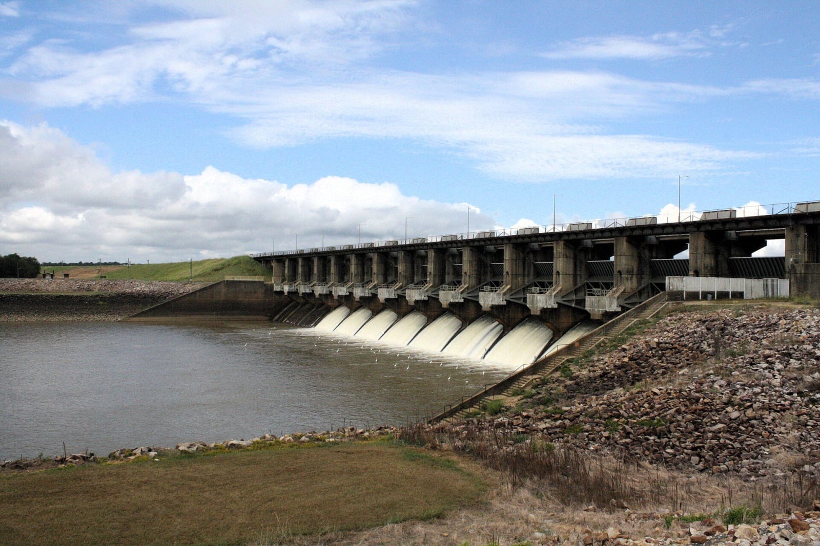
Water pouring through the open gates of Millwood Dam under a blue sky with large clouds, with white egrets on the water below.Brandonrush / CC0 via Wikimedia Commons
🏕️Recreational

Millwood State Park

Part ofTexarkana, El Dorado & the Timberlands

A park at the foot of the 3.3-mile Millwood Dam, built in 1966 on the Little River, where flooded timber makes serious bass fishing and the lake counts as a bird-conservation area.

⏱
Duration
Two hours to a weekend.
🎟
Admission
No day-use fee listed by the state parks page; camping and boat rentals are charged.
📅
Best Season
Year round. Visitor center open daily 8 a.m. to 5 p.m. March to November, shorter weekend hours December to February; the marina is closed November to February (state parks page, November 2026). Bass fishing and birding are best spring and fall.

The Story

Millwood Lake is a federal reservoir, and the park sits at its dam. The Army Corps of Engineers built the lake on the Little River in 1966, about sixteen miles above the river's meeting with the Red River, and the Cossatot and Saline rivers also feed it. A 3.3-mile earthen dam holds the water, the longest of its type in Arkansas according to the Encyclopedia of Arkansas. The Encyclopedia says the lakes of the Little River basin play an important role in controlling floods on the Red River. The name comes from a frontier river landing used between 1845 and 1875.

The Corps developed several recreation areas along the shore, among them Cypress Slough at the dam's southwestern end. On April 1, 1976, it signed a lease with the state parks division, and Cypress Slough became Millwood State Park. The lake covers roughly 29,000 acres, and its trademark standing timber, marshes and oxbow cutoffs give fish cover and keep them in shallow water, which is why anglers come for largemouth bass, catfish and crappie.

The state parks page also calls the lake an Audubon-designated Important Bird Area, with sightings of over 300 of the state's 400 recorded species. The park has 45 campsites, picnic sites, a pavilion, a self-guided walking trail and a bicycle trail. The marina sells groceries, bait and gas and rents fishing boats, canoes and kayaks. The park is just outside Ashdown, north of Texarkana, and hosts fishing events, bird walks and lake tours.

Visitor Info

⏱
Time Needed
Two hours to a weekend.
🎟
Admission
No day-use fee listed by the state parks page; camping and boat rentals are charged.
📅
Best Season
Year round. Visitor center open daily 8 a.m. to 5 p.m. March to November, shorter weekend hours December to February; the marina is closed November to February (state parks page, November 2026). Bass fishing and birding are best spring and fall.
🛣️
Highway
AR 32

On the Map

Nearby

The closest stops worth working into your route

cultural18 mi away
Museum of Regional History
Texarkana's oldest museum, in an 1879 brick building on State Line Avenue, with Caddo pottery, one of Scott Joplin's pianos and a research library of city directories and photographs.
historical19 mi away
Historic Washington State Park
A Southwest Trail town that was Arkansas's Confederate capital from 1863 to 1865, then lost the railroad and kept its buildings, with a blacksmith shop and the 1836 courthouse.
historical22 mi away
President William Jefferson Clinton Birthplace Home National Historic Site
The two-story Hervey Street house in Hope where Bill Clinton lived his first four years with his widowed mother and her parents, now a National Park Service site with a ranger-led tour.
geological31 mi away
Crater of Diamonds State Park
A volcanic crater where anyone can dig for diamonds and keep what they find.
recreational34 mi away
Atlanta State Park
A shoreline park on Wright Patman Lake, leased from the Army in 1954, where Caddo ancestors farmed the Sulphur River and wagon traces such as the Bobo Ferry trace still cross the woods.
natural51 mi away
Beavers Bend State Park
Pine and hardwood Ouachita hills where the Mountain Fork leaves Broken Bow Lake, a 1930s CCC park named for a Choctaw citizen, with trout water, a 26-mile ridge trail and the Forest Heritage Center.

Historical markers nearby

Roadside plaques and monuments within a short detour

Marker13 mi away
Hatchel/Barkman Caddo Indian Village
Texarkana vicinity, Texas
Marker17 mi away
Scott Joplin
Texarkana, Texas
Marker17 mi away
Texarkana
Texarkana, Texas
Marker18 mi away
First Disciples of Christ in Texas
Texarkana, Texas
Marker18 mi away
World War I Memorial
Texarkana, Texas
Marker18 mi away
The French in Texas
Texarkana, Texas