Home / Arkansas / Texarkana, El Dorado & the Timberlands / White Oak Lake State Park
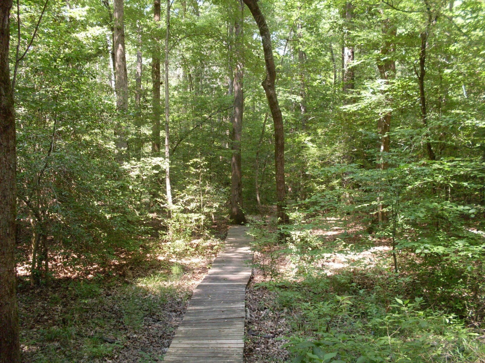
A wooden boardwalk trail running into leafy hardwood forest at White Oak Lake State Park.Robert Nunnally / CC BY 2.0 via Wikimedia Commons
🏕️Recreational

White Oak Lake State Park

Part ofTexarkana, El Dorado & the Timberlands

A 725-acre park on the lower of two 1961 lakes, where white sand marks an ancient shoreline and the visitor center carries a Poison Spring display eight miles from the battlefield.

⏱
Duration
Two hours to a weekend.
🎟
Admission
No day-use fee listed by the state parks page; camping and boat rentals are charged.
📅
Best Season
Year round. Visitor center open daily 8 a.m. to 5 p.m. March to November, shorter weekend hours December to February (state parks page, November 2026). Fishing and birding are best spring and fall.

The Story

White Oak Lake is two lakes, built in 1961 by the Arkansas Game and Fish Commission with the state parks division: a 1,031-acre upper lake south of Highway 387 and a 1,735-acre lower lake north of it. The land came to the federal government in the 1930s under the Bankhead-Jones Farm Tenant Act, which was meant to help tenant farmers become owners, and the state acquired it in 1957 for recreation and conservation. The commission leased a shoreline strip on the lower lake in November 1964, and the park opened on April 1, 1967. Act 192 made it an official state park in 1969.

The woods give the park its character. Along its three trails the forest shifts from bottomland hardwoods to loblolly pine, and in places white sand shows on the forest floor, left from the time when the Gulf of Mexico covered much of the southern United States, retreating sometime between forty and sixty million years ago. The lake holds bass, crappie, catfish and bream, and herons, egrets, ospreys and bald eagles use it.

The state parks page lists 45 campsites, a marina with rental fishing boats and canoes, a pavilion, a playground and bicycles to rent at the visitor center. The center has an interactive video exhibit and information on the Red River Campaign, and it holds the interpretive display for Poison Spring Battleground State Park, eight miles away. Summer programs run through the season.

Visitor Info

⏱
Time Needed
Two hours to a weekend.
🎟
Admission
No day-use fee listed by the state parks page; camping and boat rentals are charged.
📅
Best Season
Year round. Visitor center open daily 8 a.m. to 5 p.m. March to November, shorter weekend hours December to February (state parks page, November 2026). Fishing and birding are best spring and fall.
🛣️
Highway
AR 387

On the Map

Nearby

The closest stops worth working into your route

historical6.6 mi away
Poison Spring Battleground State Park
An 85-acre roadside battlefield west of Camden, where Confederates routed a Union foraging column on April 18, 1864, and many Black soldiers of the 1st Kansas Colored Infantry were killed after surrendering.
historical16 mi away
McCollum-Chidester House Museum
An 1847 Greek Revival house in Camden that served as a stagecoach headquarters and, in April 1864, as General Steele's headquarters, with bullet holes still visible upstairs.
natural25 mi away
Logoly State Park
Arkansas's first environmental education state park, built on the Magnesia Springs resort and a Boy Scout camp, with about 200 acres of mature forest kept as a natural area.
historical29 mi away
President William Jefferson Clinton Birthplace Home National Historic Site
The two-story Hervey Street house in Hope where Bill Clinton lived his first four years with his widowed mother and her parents, now a National Park Service site with a ranger-led tour.
architectural31 mi away
Magnolia Square and the Columbia County Courthouse
The 1906 courthouse and square at the center of a town founded in 1853, where oil came in 1922, Southern Arkansas University grew from a farm school, and Jordan Jameson was burned to death in 1919.
industrial33 mi away
Arkansas Museum of Natural Resources
A free state museum on the Smackover field, where a 112-foot derrick, a rebuilt 1920s boomtown street and working pumps tell how oil and bromine remade south Arkansas.