Home / California / The Redwood Coast / Gold Bluffs Beach and Fern Canyon
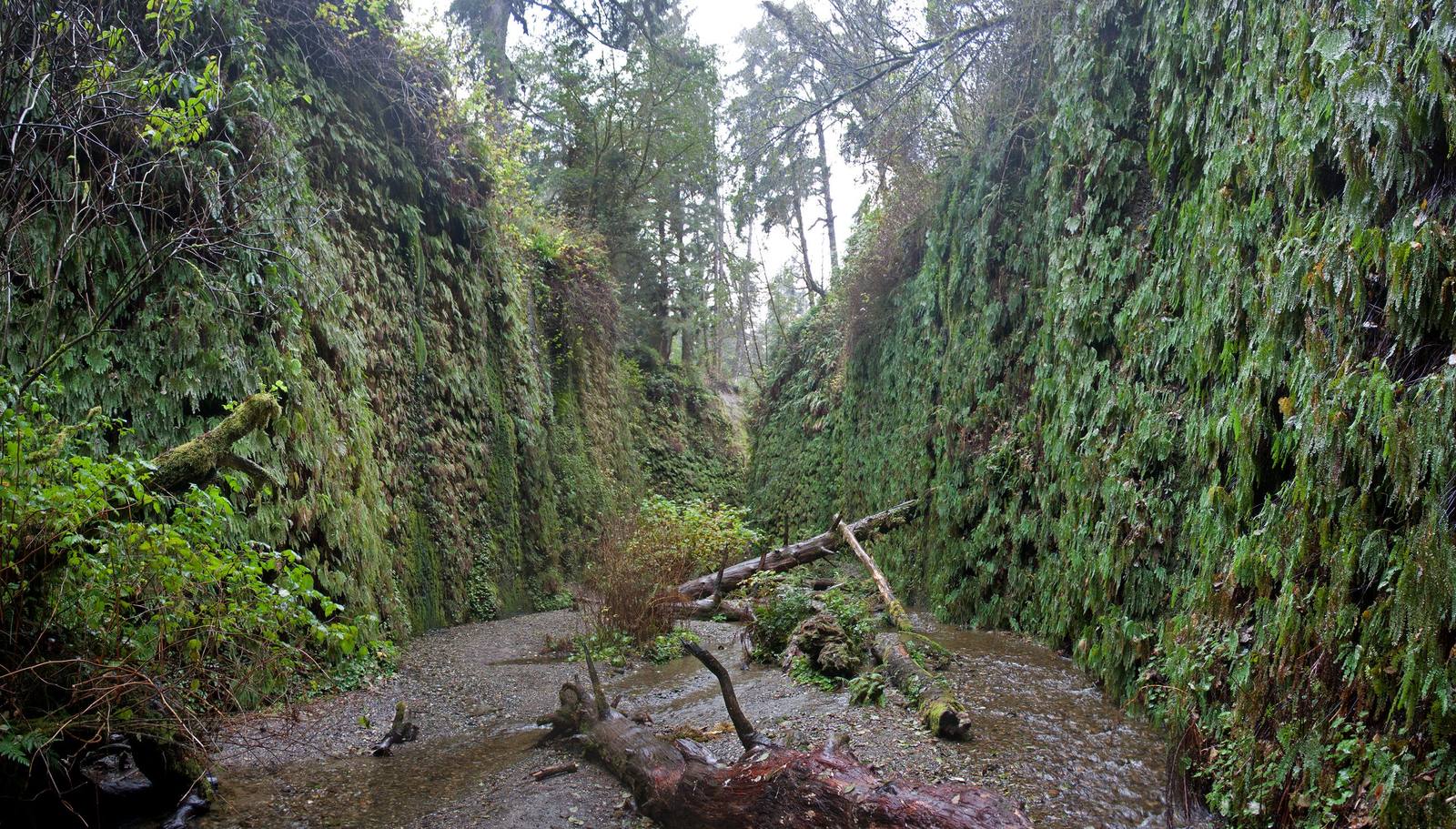
Fern Canyon in Prairie Creek Redwoods State Park: sheer walls covered in five-finger and sword ferns on either side of a flat gravel creek bed, a fallen log lying across it.WolfmanSF / CC BY-SA 3.0 via Wikimedia Commons
🌲Natural

Gold Bluffs Beach and Fern Canyon

Part ofThe Redwood Coast
On this driveUS-101: The Redwood Coast

A beach that set off a gold stampede in 1850, and the fern-walled slot a creek has cut through the same bluffs.

Mining BoomHiking
⏱
Duration
Two to three hours with the drive.
🎟
Admission
Day-use fee; a reservation permit is required in summer.
📅
Best Season
Late spring through early fall, when the footbridges are in.

The Story

In the spring of 1850 a party of prospectors walking north along the beach from Trinidad saw glittering specks in the black sand beneath these bluffs. The gold was real. The trouble was that it was dust, so fine and so mixed with heavy black sand that the men could save only a fraction of it. Word reached San Francisco anyway and grew as it travelled: investors heard of sand worth up to ten dollars a pound, and that December a ship sailed north crowded with fortune-seekers. Most went home with little. Companies kept at it, off and on, with sluices, tunnels and schemes to dredge the offshore sand, until mining at the bluffs finally stopped by about 1920.

The bluffs are soft sedimentary rock, and Home Creek has cut a narrow slot through them about half a mile long. Its walls rise fifty feet and more, and they are hung top to bottom with five-finger and sword ferns, kept wet by seeps that run all year.

Roosevelt elk graze the meadows behind the beach, often close to the road.

The road in is miles of gravel and closed to trailers. In summer the creek gets footbridges and the area needs a day-use permit; in the wet months expect to wade.

Visitor Info

⏱
Time Needed
Two to three hours with the drive.
🎟
Admission
Day-use fee; a reservation permit is required in summer.
📅
Best Season
Late spring through early fall, when the footbridges are in.
🛣️
Highway
Davison Road, off US-101 north of Orick

On the Map

Nearby

The closest stops worth working into your route

natural14 mi away
Tall Trees Grove
Where a 1963 measurement found the world's tallest known tree on timber company land, and helped decide where a national park would go.
historical19 mi away
Sue-meg State Park
A Yurok place that carried a settler's name for ninety years and took its own back in 2021.
historical24 mi away
Crescent City Harbor
The harbor the Pacific aims its tsunamis at, rebuilt after 2011 to ride the next one out.
natural27 mi away
Stout Memorial Grove
A lumberman's memorial made of the kind of forest his company cut, kept open underneath by the river's floods.
natural38 mi away
Arcata Marsh and Wildlife Sanctuary
A wildlife sanctuary that is also the town's sewage works, because Arcata turned down the state's plan.
historical42 mi away
Carson Mansion
The house Eureka's biggest lumberman began in 1884 on the bluff above his own mill, and the story told about why.

Historical markers nearby

Roadside plaques and monuments within a short detour

Marker8.3 mi away
Fort Ter-Wer
Klamath
Marker24 mi away
Old Indian Village of Tsurai
Trinidad
Marker24 mi away
Town of Trinidad
Trinidad
Marker25 mi away
Battery Point Lighthouse
Crescent City
Marker25 mi away
Trinidad Head
Trinidad
Marker25 mi away
S.S. Emidio
Crescent City