Home / California / The Redwood Coast / Stout Memorial Grove
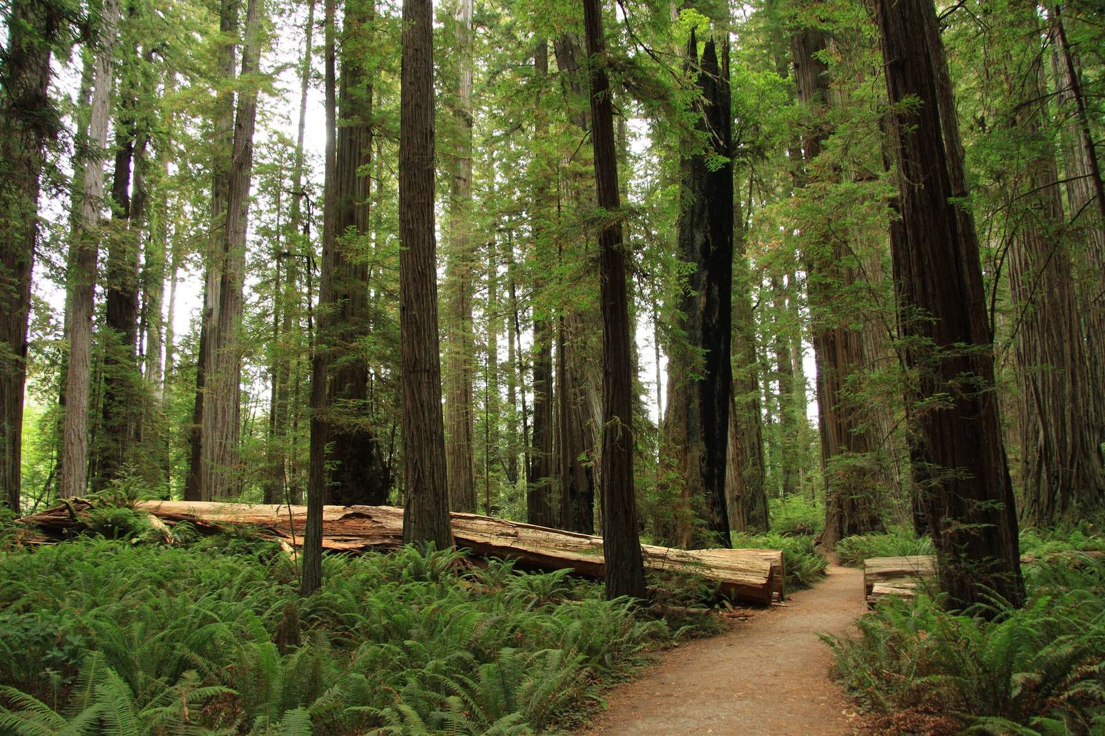
A trail through Stout Memorial Grove on the Smith River flat, straight redwood trunks rising from an open floor of sword ferns, a fallen log lying beyond the path.Chmee2 / CC BY-SA 3.0 via Wikimedia Commons
🌲Natural

Stout Memorial Grove

Part ofThe Redwood Coast
On this driveUS-101: The Redwood Coast

A lumberman's memorial made of the kind of forest his company cut, kept open underneath by the river's floods.

Hiking
⏱
Duration
An hour.
🎟
Admission
Free from Howland Hill Road; day-use fee at the campground in summer.
📅
Best Season
Any season; the footbridge is in only in summer.

The Story

Frank D. Stout made his money in timber, from Chicago, and among his holdings was the Del Norte Company, which logged along the Smith River. He died in 1927. Two years later, on September 11, 1929, his family gave the state forty-four acres of old-growth redwood where Mill Creek meets the Smith, bought for $80,000 with gifts that Save the Redwoods League gathered from donors across the country. It was the first grove in what became Jedediah Smith Redwoods State Park.

There is a plain irony in a timber fortune's memorial taking the form of the trees the trade was cutting. It is also the reason the grove is still standing.

What makes Stout Grove look unlike most redwood forests is the river. The Smith floods over the flat in big winters, laying down silt and scouring out the young trees and shrubs that would crowd a drier stand. The result is a forest almost entirely of redwoods, columns over three hundred feet tall rising from a floor of sword fern with long sight lines between them.

The loop is half a mile and nearly level. In summer a seasonal footbridge crosses the Smith from the state park campground; the rest of the year, come in by Howland Hill Road.

Visitor Info

⏱
Time Needed
An hour.
🎟
Admission
Free from Howland Hill Road; day-use fee at the campground in summer.
📅
Best Season
Any season; the footbridge is in only in summer.
🛣️
Highway
Howland Hill Road, off US-199 east of Crescent City

On the Map

Nearby

The closest stops worth working into your route

historical5.9 mi away
Crescent City Harbor
The harbor the Pacific aims its tsunamis at, rebuilt after 2011 to ride the next one out.
natural27 mi away
Gold Bluffs Beach and Fern Canyon
A beach that set off a gold stampede in 1850, and the fern-walled slot a creek has cut through the same bluffs.
natural40 mi away
Tall Trees Grove
Where a 1963 measurement found the world's tallest known tree on timber company land, and helped decide where a national park would go.
geological41 mi away
Oregon Caves
A cave of marble rather than limestone, found in 1874 by a hunter who followed his dog in by matchlight and found his way out by the sound of a stream.
historical45 mi away
Sue-meg State Park
A Yurok place that carried a settler's name for ninety years and took its own back in 2021.
natural64 mi away
Arcata Marsh and Wildlife Sanctuary
A wildlife sanctuary that is also the town's sewage works, because Arcata turned down the state's plan.

Historical markers nearby

Roadside plaques and monuments within a short detour

Marker3 mi away
Crescent City Plank and Turnpike Road
Crescent City
Marker3.3 mi away
Camp Lincoln
Crescent City
Marker6.3 mi away
S.S. Emidio
Crescent City
Marker6.8 mi away
Battery Point Lighthouse
Crescent City
Marker7 mi away
Brother Jonathan Cemetery
Crescent City
Marker7.3 mi away
Site of Old Indian Village at Pebble Beach, Crescent City
Crescent City