Home / Idaho / The Sawtooths & the Salmon River / Yankee Fork Gold Dredge
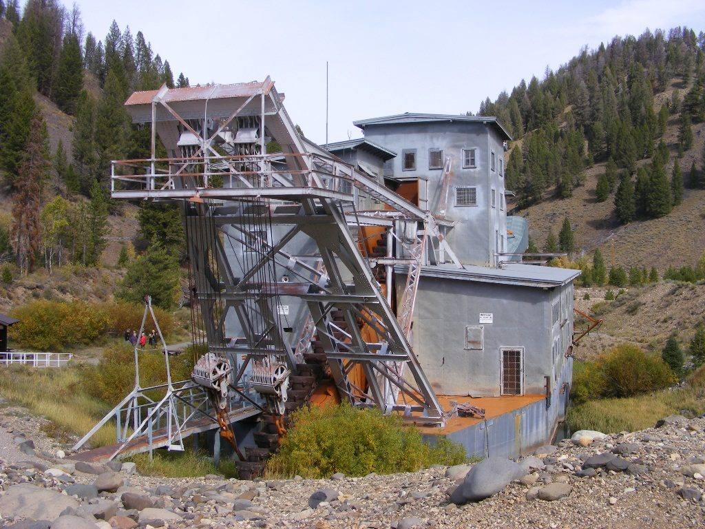
The steel-clad Yankee Fork gold dredge and its bucket ladder sitting on its tailings among pinesJerry Willis / CC BY-SA 2.0 via Wikimedia Commons
🏭Industrial

Yankee Fork Gold Dredge

Part ofThe Sawtooths & the Salmon River
On this driveThe Sawtooths and the Salmon: Ketchum to Salmon

A 988-ton floating gold dredge worked five miles of valley for twelve years, and spent more than it found.

Off the Beaten PathMining BoomGhost Towns
⏱
Duration
An hour for the dredge; half a day with Custer and Bonanza.
📅
Best Season
Memorial Day through Labor Day for tours; the road is snowbound in winter.

The Story

Gold was found on the Yankee Fork of the Salmon in the 1870s, and by the 1880s the camps of Bonanza and Custer were booming on the lode mines above them. By 1911 both were ghost towns. The gold left behind lay scattered through the gravels of the valley floor, too thin to pan and too deep to shovel, and in 1939 the Silas Mason Company decided to go after it with a dredge.

It came in pieces and was assembled on the spot: a barge 112 feet long, 54 feet wide and 64 feet high, weighing 988 tons, driven by two diesel engines. Crews flooded a pond, floated it, and set it digging. A chain of buckets on the bow scooped up the stream bed, the machine washed the gold out inside, and the stern dropped the stripped rock behind it, so that the dredge moved forward in its own pond. It ran around the clock, and people in the valley said they noticed its pounding only when it stopped. Between 1940 and 1952, with a pause for the war, it worked five and a half miles up the valley, handled 6.3 million cubic yards of gravel, and recovered about $1.04 million in gold and silver, at a cost of about $1.08 million.

What it left is plain from the road: long ridges of washed cobbles where a stream and its meadows used to be. Its last owner, J. R. Simplot, gave the dredge to the Forest Service, and an association founded by former crew members and their families restored it. It sits in its final pond between Bonanza and Custer, and volunteers lead tours through it in summer. It is part of Land of the Yankee Fork State Park, whose interpretive center is at Challis.

Visitor Info

⏱
Time Needed
An hour for the dredge; half a day with Custer and Bonanza.
📅
Best Season
Memorial Day through Labor Day for tours; the road is snowbound in winter.
🛣️
Highway
SR-75; Yankee Fork Road

On the Map

Nearby

The closest stops worth working into your route

natural35 mi away
Galena Summit Overlook
The Salmon River's first miles, seen from an overlook named for the couple who helped keep a mine out of the view.
geological45 mi away
Borah Peak Earthquake Fault Scarp
In 1983 the valley floor dropped seven feet in a second, and a truckload of hunters dropped with it.
natural46 mi away
Kirkham Hot Springs
Hot water pours off a ledge into pools at the edge of the South Fork Payette, a staircase down from the highway.
historical67 mi away
Pon Yam House
The store of Idaho City's king merchant, where the Chinese of the Boise Basin bought cuttlefish, incense and firecrackers.
cultural69 mi away
Sacajawea Interpretive, Cultural and Educational Center
In the valley where she was born, a center that spells her name the way many of her people say it.
recreational72 mi away
Banks and the North Fork Payette
Where the Payette's two forks meet, below fifteen miles of continuous Class V whitewater beside the highway.

Historical markers nearby

Roadside plaques and monuments within a short detour

Marker7.3 mi away
Yankee Fork Mines
Marker15 mi away
Stanley Ranger Station
Marker15 mi away
Bear's "Ploughed Field"
Marker18 mi away
Clayton Smelter
Marker26 mi away
Bison Jump
Marker26 mi away
Michel Bourdon