Home / Kentucky / Lexington, Frankfort & the Bluegrass / Fort Boonesborough State Park
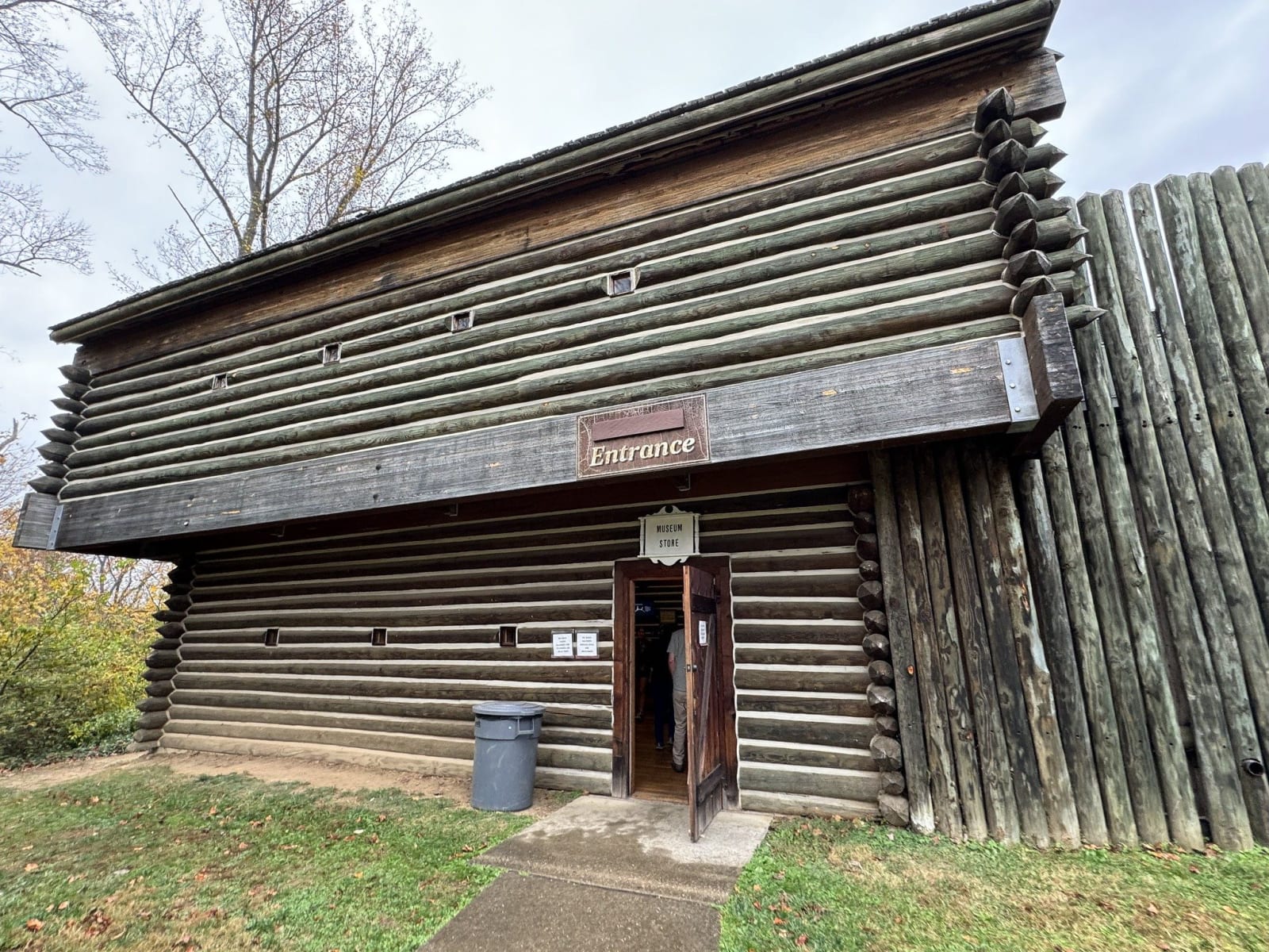
The log blockhouse entrance of the reconstructed fort at Fort Boonesborough, joined to a tall wooden stockade.Sarah Stierch / CC BY 2.0 via Flickr
🏛️Historical

Fort Boonesborough State Park

Part ofLexington, Frankfort & the Bluegrass

The Transylvania Company's 1775 fort on the Kentucky River, built on country the Shawnee hunted, and the site of the Shawnee siege of September 1778.

⏱
Duration
One to two hours.
🎟
Admission
Fort admission $8 adults, $5 children 6-12, free under 6; the park grounds are free (Kentucky State Parks, 2026).
📅
Best Season
April through October, when the reconstructed fort is open Wednesday to Sunday; the park and riverside campground are open year round (Kentucky State Parks, 2026).

The Story

Long before Daniel Boone, a small Fort Ancient village stood near this bend of the Kentucky River around 1400, and archaeologists found its traces in the 1980s. The Shawnee hunted the country south of the Ohio, and many of their leaders did not accept the 1774 treaty ending Dunmore's War that had given up those hunting grounds. In March 1775 Richard Henderson's private Transylvania Company bought some 20 million acres from Cherokee leaders at Sycamore Shoals, a sale Dragging Canoe refused to sign and Virginia and North Carolina later voided. Boone's party cut a road north and reached this site on April 1, 1775.

In February 1778 Shawnee warriors under Blackfish captured Boone and about 27 salt makers at the Licking River salt springs. Boone was adopted into a Shawnee family at Chillicothe and named Sheltowee, Big Turtle, then escaped and covered about 160 miles in five days to warn of an attack. It came on September 7: by Boone's count 444 warriors, mostly Shawnee, with a dozen French-Canadian militia from Detroit, against about 40 riflemen. Blackfish asked by what right the settlers held the country, and Boone answered that it had been bought from the Cherokee. Talks failed, a tunnel toward the walls collapsed in heavy rain, and the siege lifted after eleven days. London, an enslaved man, and David Bondurant were killed inside the fort.

The park's fort is a working reconstruction of cabins and blockhouses, with artisans in season. The original site has new interpretive signs drawn from the archaeology, and the Kentucky River Museum fills the old lock keeper's house.

Visitor Info

⏱
Time Needed
One to two hours.
🎟
Admission
Fort admission $8 adults, $5 children 6-12, free under 6; the park grounds are free (Kentucky State Parks, 2026).
📅
Best Season
April through October, when the reconstructed fort is open Wednesday to Sunday; the park and riverside campground are open year round (Kentucky State Parks, 2026).
🛣️
Highway
KY 627 / KY 388

On the Map

Nearby

The closest stops worth working into your route

natural7 mi away
Raven Run Nature Sanctuary
Lexington's largest park, more than 700 acres of woods, meadow and stone fences where Raven Run Creek drops through the Kentucky River Palisades.
historical15 mi away
Ashland, the Henry Clay Estate
Henry Clay's Lexington estate, rebuilt by his son in the 1850s, where the guided tours now tell the lives of the more than 140 people Clay enslaved.
historical16 mi away
Cheapside and Henry A. Tandy Centennial Park
Lexington's old courthouse square, for decades the center of Kentucky's slave trade, renamed in 2020 for Henry A. Tandy, a formerly enslaved builder.
historical18 mi away
Pilot Knob State Nature Preserve
The sandstone knob west of Stanton where tradition puts Daniel Boone's first look at the Bluegrass on June 7, 1769, with an old millstone quarry below.
historical19 mi away
Camp Nelson National Monument
The 1863 Union depot above the Kentucky River where more than 10,000 enslaved men enlisted in the U.S. Colored Troops and their families fought for a place to live.
industrial22 mi away
Cottage Furnace
A cut-stone charcoal iron furnace of the 1850s in the Daniel Boone National Forest, from the years when Kentucky was a leading iron state.

Historical markers nearby

Roadside plaques and monuments within a short detour

Marker1.7 mi away
Salt Spring Trace
Winchester
Marker1.7 mi away
Colonel John Holder
Winchester
Marker3.5 mi away
Old Providence Church
Winchester
Marker3.6 mi away
Jones Nursery/Nursery Place
Winchester
Marker3.8 mi away
Caveland
Winchester
Marker4.8 mi away
Lion of White Hall
Richmond