Home / Kentucky / Red River Gorge & the Eastern Hills / Pilot Knob State Nature Preserve
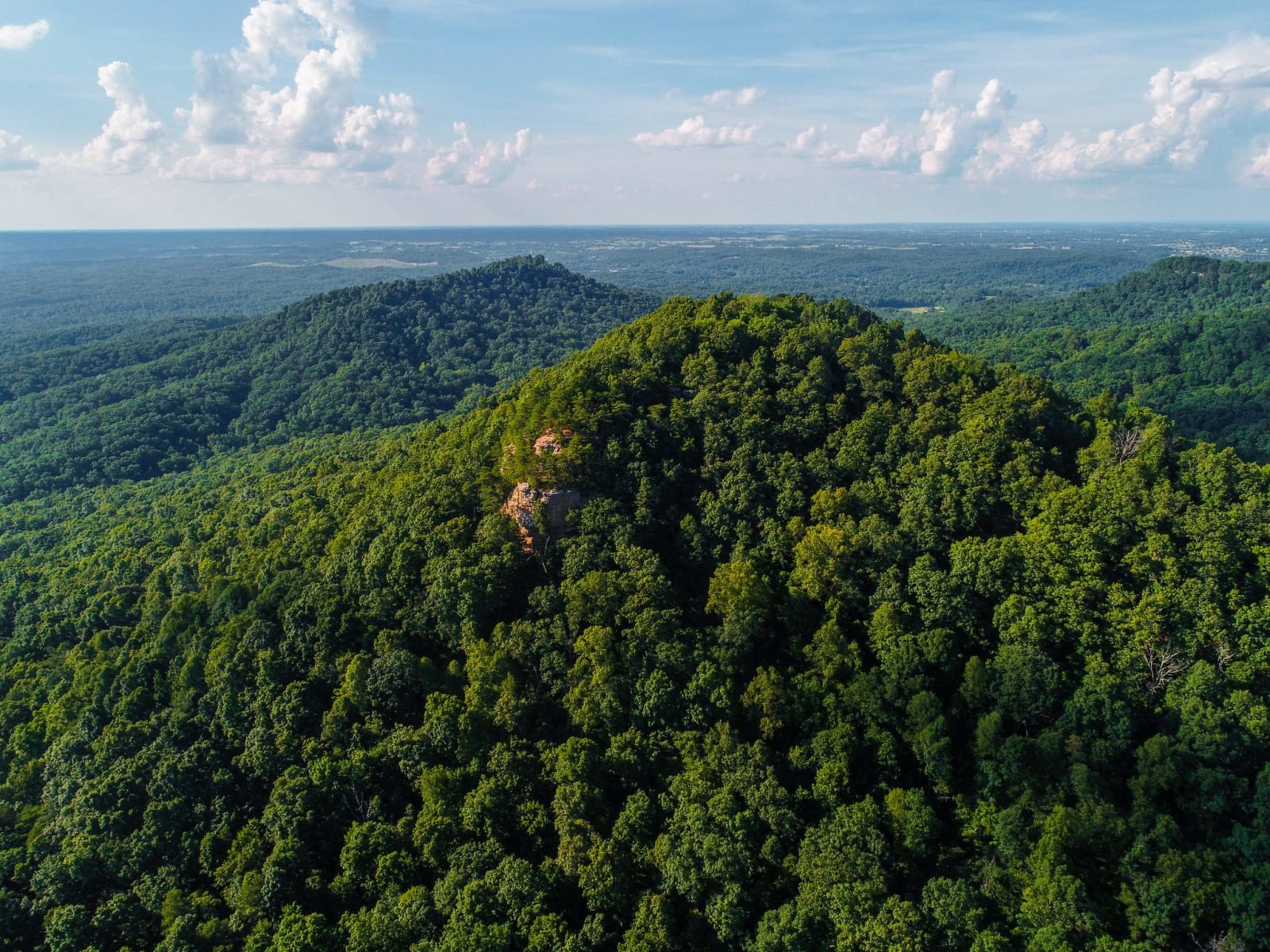
Aerial view of the forested summit of Pilot Knob with a sandstone ledge showing through the trees and the Bluegrass lowlands beyond.Ben Childers, USDA Forest Service / public domain via Flickr
🏛️Historical

Pilot Knob State Nature Preserve

Part ofRed River Gorge & the Eastern Hills

The sandstone knob west of Stanton where tradition puts Daniel Boone's first look at the Bluegrass on June 7, 1769, with an old millstone quarry below.

⏱
Duration
Two to three hours for the climb and the quarry.
🎟
Admission
Free; open sunrise to sundown.
📅
Best Season
Late fall through early spring, when bare trees open the view.

The Story

Pilot Knob stands on the western edge of the mountains, and from the sandstone outcrop at its southeast end you can see the Cumberland Plateau behind you, the knobs around you and the level Bluegrass ahead. The rock is Pennsylvanian conglomerate, full of pebbles an ancient stream laid down, and people once quarried it for millstones. A mile-long round trip from the lot visits the old quarry; the summit trail climbs through oak and hickory to stunted blackjack oak and Virginia pine at the top.

This is held to be where Daniel Boone and John Finley first looked out over the Bluegrass, on June 7, 1769. Finley called it the beautiful level of Kentucky, and the narrative John Filson later wrote in Boone's voice has him gaining "the summit of a commanding ridge" and seeing the plains below. The Kentucky Historical Society keeps June 7 as Boone Day. The land Boone was looking at was hunting ground of the Shawnee, the Cherokee and other nations. Six years later the Transylvania Company bought much of it from Cherokee leaders at Sycamore Shoals, a sale that Dragging Canoe and many other Cherokee opposed.

The preserve was dedicated on September 26, 1985, with 308 acres, and state land-fund purchases have since added many more; the Office of Kentucky Nature Preserves owns it with the Powell County Fiscal Court. The gravel lot on Brush Creek Road, off KY 15 north of Clay City, holds only seven or eight cars. Camping, climbing, bikes and pets are not allowed.

Visitor Info

⏱
Time Needed
Two to three hours for the climb and the quarry.
🎟
Admission
Free; open sunrise to sundown.
📅
Best Season
Late fall through early spring, when bare trees open the view.
🛣️
Highway
KY 15

On the Map

Nearby

The closest stops worth working into your route

industrial11 mi away
Cottage Furnace
A cut-stone charcoal iron furnace of the 1850s in the Daniel Boone National Forest, from the years when Kentucky was a leading iron state.
geological17 mi away
Natural Bridge State Resort Park
A 78-foot sandstone arch that a railroad opened to tourists in 1895, one of Kentucky's four original state parks, with Hemlock Lodge below it.
historical18 mi away
Fort Boonesborough State Park
The Transylvania Company's 1775 fort on the Kentucky River, built on country the Shawnee hunted, and the site of the Shawnee siege of September 1778.
geological19 mi away
Red River Gorge Geological Area
The Daniel Boone National Forest's canyon country: sandstone cliffs, rock shelters and more than 100 arches, with the Gladie Visitor Center on KY 715.
natural22 mi away
Red Wild and Scenic River
The stretch of the Red River that a 1960s Corps of Engineers dam would have flooded, saved by a 1967 protest hike, a book and a 1993 act of Congress.
natural25 mi away
Raven Run Nature Sanctuary
Lexington's largest park, more than 700 acres of woods, meadow and stone fences where Raven Run Creek drops through the Kentucky River Palisades.

Historical markers nearby

Roadside plaques and monuments within a short detour

Marker3.4 mi away
Indian Old Fields
Winchester
Marker3.8 mi away
Early Iron Works
Clay City
Marker6.2 mi away
County Named, 1852
Stanton
Marker7.4 mi away
Daniel Boone's Settlement/Scholl's Station Schollsville
Winchester
Marker9.4 mi away
Battle--June 8, 1864
Mt. Sterling
Marker9.8 mi away
Battle--June 9, 1864
Mt. Sterling