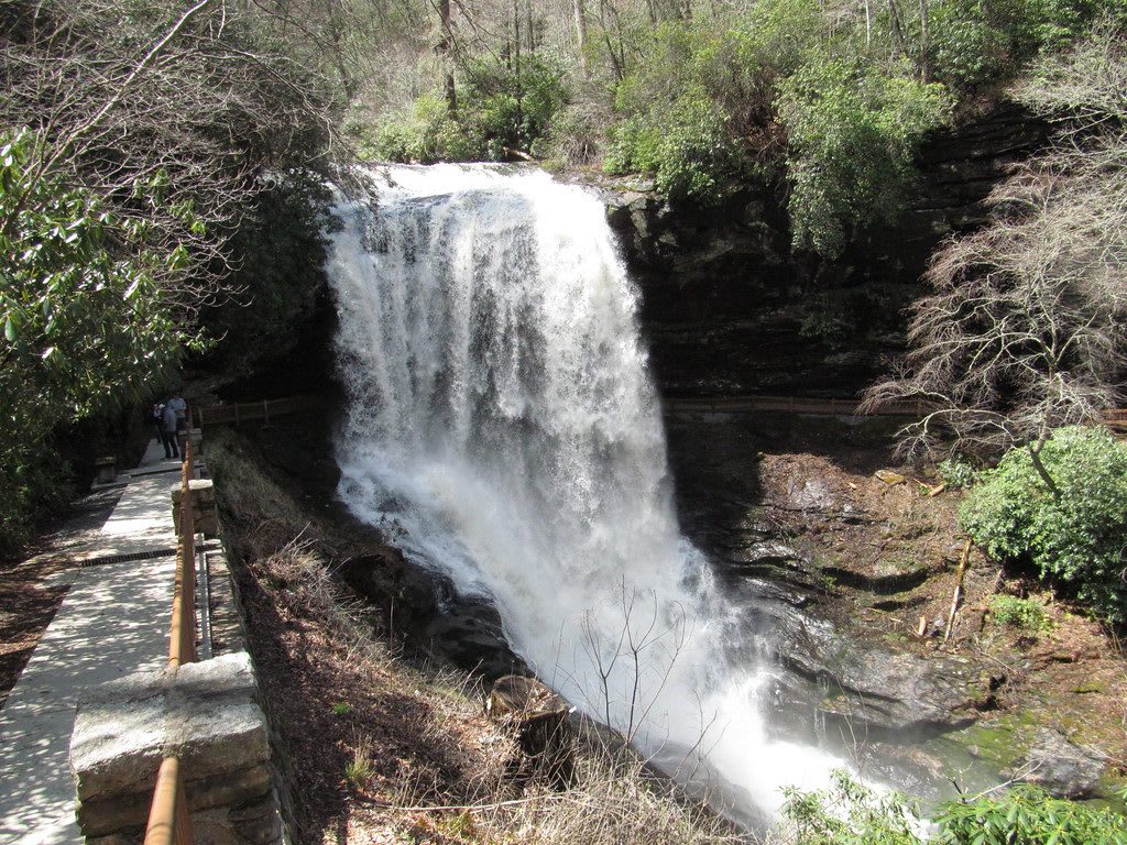
 Dougtone / CC BY-SA 2.0 via Flickr
The Story
The Cullasaja takes its name from Kulsetsi, short for Kulsetsiyi, a name several Cherokee towns carried, one of them on this river near Ellijay Creek. The word is often translated "honey locust place," and the English name Sugar Fork comes from it. Downstream, where the Cullasaja meets the Little Tennessee, stood Nikwasi, one of the largest and most important Cherokee towns; Franklin grew on its ground after the land was ceded.
Between Franklin and Highlands, US 64 and NC 28 run together for seven and a half miles through the Cullasaja Gorge on the Mountain Waters Scenic Byway, a narrow, winding road that follows the river through the Nantahala National Forest. The river falls over a string of waterfalls on the way. Bridal Veil Falls drops 120 feet a little over a mile west of Highlands; then come Dry Falls and Quarry Falls, and last Cullasaja Falls, a long cascade best seen in passing, since it sits on blind curves between sheer cliffs with only one small pull-off.
Dry Falls is the one to stop for. The river pours 75 feet over an overhanging bluff, and the rock shelter behind it stays dry when the flow is low, which is how it got its name; it has also been called High Falls and Pitcher Falls. From the parking area an accessible walkway gives a view from above, and a short trail leads right behind the falling water. Wet or icy rock is slick. On busy days the lot fills; come back later rather than block the highway.
Visitor Info
On the Map
Nearby
The closest stops worth working into your route
Historical markers nearby
Roadside plaques and monuments within a short detour