 Chris Ballance / CC BY 2.0 via Flickr
The Story
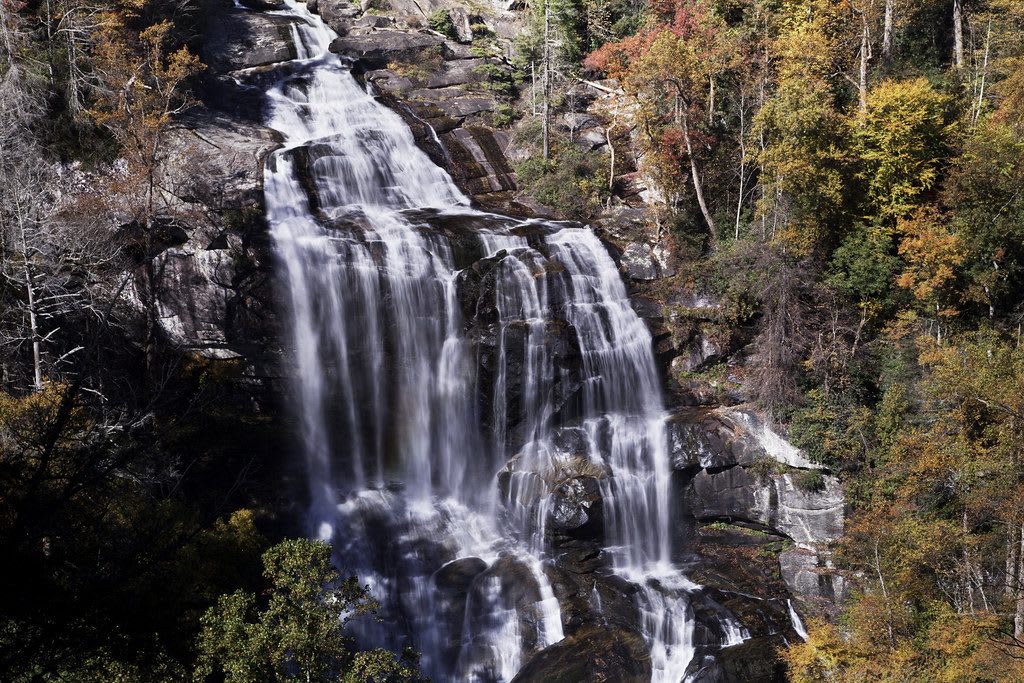
Whitewater Falls exists because of the Blue Ridge Escarpment, the abrupt edge where the mountains break down to the Piedmont. In about three and a half miles the Whitewater River drops some 1,500 feet and crosses from North Carolina into South Carolina, and the upper falls, here in Jackson County, take much of that drop in one plunge. The Forest Service gives it 411 feet and calls it the highest waterfall east of the Rockies; others measure it shorter, and falls in Virginia and Georgia have rival claims that depend on how a waterfall is defined. Lower Whitewater Falls stands about two miles downstream in South Carolina.
The escarpment's steep, broken ground kept roads and settlement away, and much of this country has stayed wild. In the cool, wet shade under the cliffs grow wildflowers, ferns, mosses and fungi, and salamanders live in the seeps. The Foothills Trail, a 76-mile National Recreation Trail running from Table Rock State Park to Oconee State Park in South Carolina, passes the base of the falls; Duke Power built its middle section along with its Bad Creek pumped-storage project.
Several viewing platforms at different heights below the parking area give different views of the falls. The ground beyond them is treacherous, and rangers strongly discourage going off-trail. The site lies in the Nantahala National Forest south of Cashiers near the state line, open dawn to dusk, with no restrooms or drinking water. Midday and holiday crowds are heavy; morning or evening is better.
Visitor Info
On the Map
Nearby
The closest stops worth working into your route
Historical markers nearby
Roadside plaques and monuments within a short detour