Home / South Carolina / Greenville & the Upstate Mountains / Stumphouse Tunnel Park
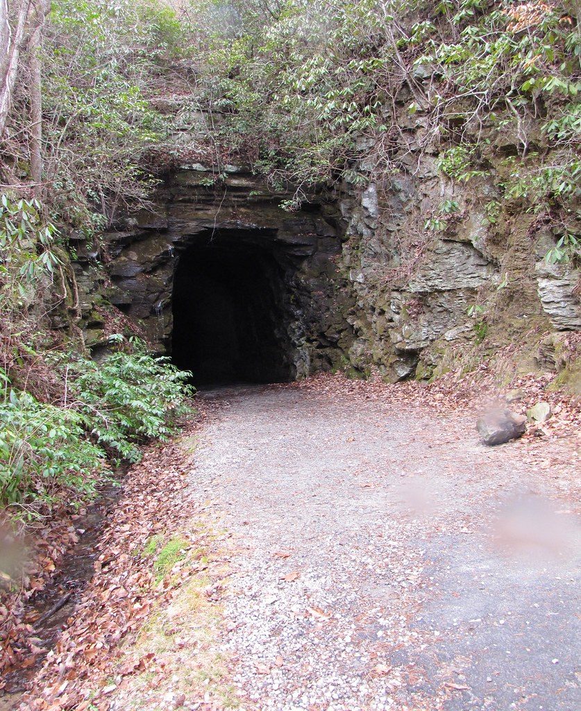
A dark arched tunnel mouth cut into a layered rock face, with a gravel path leading in between rhododendron and fallen leaves.The_Gut / CC BY 2.0 via Flickr
🏭Industrial

Stumphouse Tunnel Park

Part ofGreenville & the Upstate Mountains
On this driveThe Cherokee Foothills Scenic Highway: Cowpens, Caesars Head, Table Rock, Walhalla and the Chattooga

The unfinished 1850s railroad tunnel Irish laborers drove into Stumphouse Mountain to link Charleston with the Midwest, beside Issaqueena Falls.

⏱
Duration
One to two hours.
🎟
Admission
$5 per vehicle; annual passes sold at Walhalla City Hall (2026).
📅
Best Season
Year round; the tunnel holds near 50 degrees in every season.

The Story

In the 1850s South Carolina tried to tunnel through the Blue Ridge. The Blue Ridge Railroad was to run from Charleston to Knoxville and on toward the Midwest, and the line had to pass through the heart of Stumphouse Mountain. Work on the tunnel began in 1856. A London contractor brought Irish laborers, who lived in a camp on the mountain called Tunnel Hill and drilled and blasted the rock by hand; ten workers died. By 1859 the state had spent more than a million dollars and would spend no more. The bore stopped well short of the far side of the mountain.

The project was revived in 1876 and again in 1900 and talked about as late as 1940, but no train ever came. Clemson College bought the tunnel in 1951 and cured blue cheese in its cool, wet dark for years. The tunnel was listed on the National Register in 1971, closed after a rock slide in the mid-1990s and reopened as a park in 2000. The name, by an old story, comes from a Cherokee woman and her white husband who lived on the mountain in a log house set on stumps.

The City of Walhalla runs the park. You can walk about a quarter mile into the tunnel, where water drips from the ceiling. Issaqueena Falls is a short walk from the second lot to an overlook deck; the scramble to its base is dangerous. The Palmetto Trail, which runs across the state, begins here, and the Blue Ridge Railroad trail follows the old grade from the falls lot.

Visitor Info

⏱
Time Needed
One to two hours.
🎟
Admission
$5 per vehicle; annual passes sold at Walhalla City Hall (2026).
📅
Best Season
Year round; the tunnel holds near 50 degrees in every season.
🛣️
Highway
SC 28

On the Map

Nearby

The closest stops worth working into your route

historical3.9 mi away
Oconee Station State Historic Site
A 1792 militia blockhouse and William Richards's 1805 trading-post house on what was South Carolina's western edge, with a trail to Station Cove Falls.
cultural4.4 mi away
Museum of the Cherokee in South Carolina
A small Walhalla museum of the Cherokee Lower Towns, Keowee, Seneca, Jocassee, Tamassee and the rest, built from what came out of this county's ground.
natural10 mi away
Chattooga Wild and Scenic River
The free-flowing river on the Georgia line, designated Wild and Scenic in 1974, with a river-access lot at the US 76 bridge.
natural14 mi away
Devils Fork State Park
The only public way onto Lake Jocassee, a clear, cold reservoir over the Jocassee valley, where Oconee bells bloom along the trail each March.
historical15 mi away
Traveler's Rest State Historic Site
A stagecoach inn of about 1815 on the Unicoi Turnpike near the Tugaloo River, later the center of Devereaux Jarrett's slave-labor plantation, and a National Historic Landmark since 1964.
historical16 mi away
Keowee-Toxaway State Park
A foothills park on Lake Keowee, whose water covers the Cherokee town of Keowee and the site of Fort Prince George.

Historical markers nearby

Roadside plaques and monuments within a short detour

Marker4.3 mi away
St. John's Lutheran Church
Walhalla
Marker4.4 mi away
The English School
Walhalla
Marker4.5 mi away
The Lynching of Allen Green
Walhalla
Marker8 mi away
Tamassee DAR School
Tamassee
Marker9.4 mi away
The Cherokee Path
Salem vicinity
Marker12 mi away
Retreat Rosenwald School
Westminster vicinity