Home / Missouri / The Lake of the Ozarks & the Osage River / Devils Elbow Bridge (Route 66)
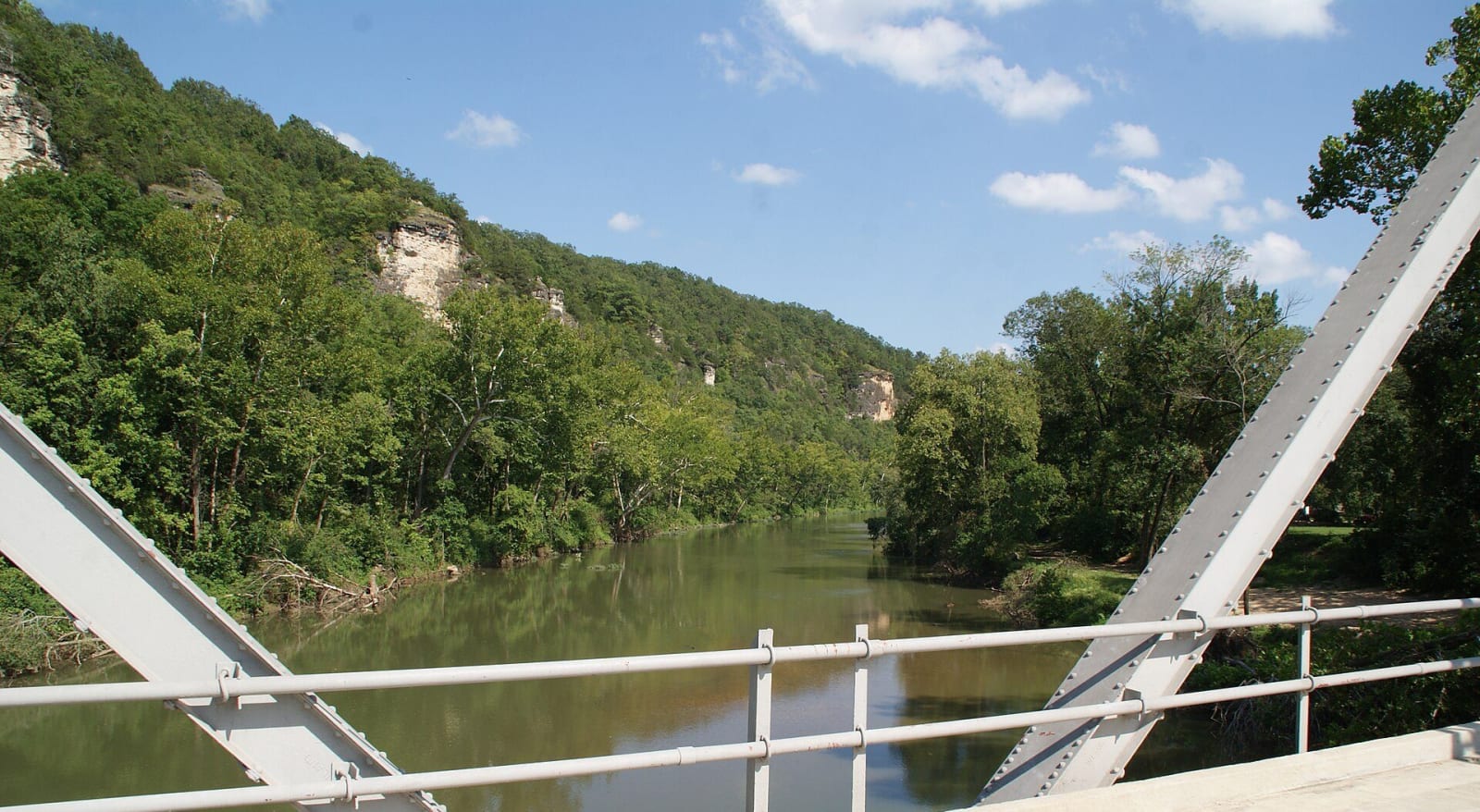
The Big Piney River and its wooded bluffs seen between the steel trusses of the Devils Elbow Bridge.RSherard / CC BY-SA 4.0 via Wikimedia Commons
🛣️Roadside

Devils Elbow Bridge (Route 66)

Part ofThe Lake of the Ozarks & the Osage River
On this driveRoute 66 Across Missouri: St. Louis to Joplin

A 1923 steel truss with a dogleg over the Big Piney, on the original 1926 line of Route 66 at a bend the tie rafters named, still carrying cars after its 2014 rehabilitation.

⏱
Duration
Thirty minutes to an hour.
🎟
Admission
Free; the bridge is a public road.
📅
Best Season
Year-round.

The Story

Devils Elbow is named for the river, not the road. Lumbermen up the Big Piney cut shortleaf pine and hacked railroad ties from the hardwoods, and rafters floated them down to the railroad yard at Arlington on the Gasconade. At this tight bend the rafts sometimes broke apart and ties were lost, and the rafters called it the Devil's Elbow. St. Louis sportsmen came for the fishing and hunting from the late 1800s, by train to Dixon and wagon from there.

The steel truss went up in 1923, when State Highway 14 between St. Louis and Springfield was improved, and in 1926 Highway 14 became US 66. Walter Graham opened a post office in his resort store in 1927, Nelle Munger and Howard Moss built a sandwich shop at the north end of the bridge, and Dwight Rench put up the native rock Devil's Elbow Cafe at the south end. In the 1930s the State Planning Commission listed the bluffs among the seven beauty spots of Missouri. Fort Leonard Wood brought a wartime boom, and then, late in 1945, a divided four-lane bypassed the village to the north through the Hooker Cut.

The 588-foot bridge is one of two on Route 66 with a dogleg curve, and the only one still open to traffic. Pulaski County inherited it, rehabilitated it for about $1.3 million and reopened it on May 22, 2014. In 2017 the bridge, the old roadbed and five other structures were listed as the Devil's Elbow Historic District.

Visitor Info

⏱
Time Needed
Thirty minutes to an hour.
🎟
Admission
Free; the bridge is a public road.
📅
Best Season
Year-round.
🛣️
Highway
Teardrop Road (old US-66), off I-44

On the Map

Nearby

The closest stops worth working into your route

historical30 mi away
Maramec Spring Park and the Maramec Iron Works
Missouri's fifth-largest spring, which powered the first successful ironworks west of the Mississippi from 1826, kept whole and opened to the public by an ironmaster's granddaughter.
geological32 mi away
Ozark Caverns (Lake of the Ozarks State Park)
A guided half-mile walk through a drained Ozark conduit in Lake of the Ozarks State Park, with a shower that falls from solid rock, old claw marks and blind grotto salamanders.
geological40 mi away
Ha Ha Tonka State Park
Collapsed caverns laid open above the Niangua arm of the Lake of the Ozarks: a natural bridge, a sinkhole amphitheater, a spring in a gorge and the burned stone shell of a Kansas City businessman's castle.
natural44 mi away
Bennett Spring State Park
More than 100 million gallons a day out of a Niangua valley spring, a branch stocked with rainbow trout every day of the season, and the mill valley and CCC lodge that came first.
industrial48 mi away
Dillard Mill State Historic Site
A red gristmill on Huzzah Creek, built by Emil Mischke from 1904 to 1908 with steel roller mills and a turbine, the center of a guest lodge from 1930, and still run for visitors.
geological48 mi away
Onondaga Cave State Park
A Meramec River show cave entered first by boat from a millpond, split by barbed wire in a property war, saved from a dam that would have drowned it, and held sacred by the Osage Nation.

Historical markers nearby

Roadside plaques and monuments within a short detour

Marker7.7 mi away
Pulaski County
Marker24 mi away
Maries County